·

Enable Location

We need your location to show you interesting places around you

Discover nearby places

Find interesting locations and hidden gems around you

Precise directions

Get accurate directions and distances to places

Your location is never shared with other users. It's only used when you tap the location button.

Playland Park

Log in to your account

Start exploring — it's free

Trusted by 62,691 travelers worldwide

Continue with Google
Continue with Apple
or

We will send you a code to connect

By continuing, you accept our Terms and Conditions and our Privacy Policy

Check your inbox

We've sent a pincode in your inbox. Please enter the code below.

Playland Park

Playland Park, Former amusement park in South Bend, Indiana.

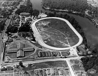
Playland Park was an amusement park situated next to the St. Joseph River with a roller coaster, casino, exhibition hall, and baseball field. The location combined multiple types of entertainment and sporting activities in one venue.

The park began as Springbrook Park in 1880 and was renamed Playland Park in 1924 when Pete Redden took over management. This transition marked its shift into a modern entertainment destination.

The dance hall drew thousands of visitors on weekends for performances by renowned musicians like Duke Ellington and Cab Calloway. It served as a major gathering spot for music and social life in the area.

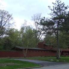
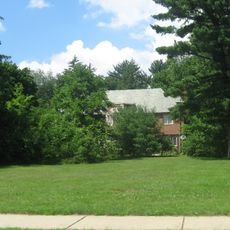
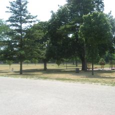
The former grounds have been converted into student housing for Indiana University South Bend, leaving only concrete structures visible. Visitors can explore the site to locate remnants of the park's former attractions.

A NASCAR race was held on the park's track on July 20, 1952, with Tim Flock winning and Lee Petty finishing second. This motorsport event was a rare sporting moment in the park's history.

The community of curious travelers

AroundUs brings together thousands of curated places, local tips, and hidden gems, enriched daily by 60,000 contributors worldwide.

Start exploring
Location
Address
1903 Lincolnway E, South Bend, IN 46613, USA
GPS coordinates
41.65900,-86.21800
Latest update
December 12, 2025 09:03
Around this place
Stanley Coveleski Regional Stadium
United States of America

Stanley Coveleski Regional Stadium

3.4 km
Potawatomi Zoo
United States of America

Potawatomi Zoo

1.1 km
Herman T. Mossberg Residence
United States of America

Herman T. Mossberg Residence

1.9 km
St. Matthew's Cathedral
United States of America

St. Matthew's Cathedral

1.4 km
Beiger Mansion
United States of America

Beiger Mansion

3.4 km
United States of America

Potawatomi Conservatories

784 m
Old Mishawaka Carnegie Library
United States of America

Old Mishawaka Carnegie Library

2.8 km
Ellis-Schindler House
United States of America

Ellis-Schindler House

2.2 km
Knights of Pythias Lodge
United States of America

Knights of Pythias Lodge

3.4 km
Battell Park Historic District
United States of America

Battell Park Historic District

2.7 km
Robert A. Grant Federal Building and U.S. Courthouse
United States of America

Robert A. Grant Federal Building and U.S. Courthouse

3.3 km
State Theatre
United States of America

State Theatre

3.2 km
Second St. Joseph County Courthouse
United States of America

Second St. Joseph County Courthouse

2.9 km
St. Joseph School
United States of America

St. Joseph School

2.9 km
Citizens Bank
United States of America

Citizens Bank

3.2 km
James A. Judie House
United States of America

James A. Judie House

1.9 km
Martin Wenger House
United States of America

Martin Wenger House

1.9 km
All American Bank Building
United States of America

All American Bank Building

3.3 km
South Michigan Street Historic District
United States of America

South Michigan Street Historic District

3 km
East Washington Street Historic District
United States of America

East Washington Street Historic District

2.6 km
Farmers Security Bank
United States of America

Farmers Security Bank

3.4 km
Howard Park Historic District
United States of America

Howard Park Historic District

2.6 km
Colonial Gardens Commercial Historic District
United States of America

Colonial Gardens Commercial Historic District

1.3 km
Dille-Probst House
United States of America

Dille-Probst House

2.9 km
Sommerer House
United States of America

Sommerer House

2.1 km
W. N. Bergan–J. C. Lauber Company Building
United States of America

W. N. Bergan–J. C. Lauber Company Building

3.1 km
Stephenson Underwear Mill
United States of America

Stephenson Underwear Mill

3.3 km
I and M Electric Co. Building-Transformer House and Garage
United States of America

I and M Electric Co. Building-Transformer House and Garage

3.2 km
Show the full map
« Playland Park - Former amusement park in South Bend, Indiana » is provided by Around Us (aroundus.com). Images and texts are derived from Wikimedia project under a Creative Commons license. You are allowed to copy, distribute, and modify copies of this page, under the conditions set by the license, as long as this note is clearly visible.

Discover hidden gems everywhere you go!

From secret cafés to breathtaking viewpoints, skip the crowded tourist spots and find places that match your style. Our app makes it easy with voice search, smart filtering, route optimization, and insider tips from travelers worldwide. Download now for the complete mobile experience.

Around Us App Screenshot

A unique approach to discovering new places

Le Figaro

All the places worth exploring

France Info

A tailor-made excursion in just a few clicks

20 Minutes

Around Us
Travel Guide & Maps
Download

Send to your phone

QR Code
1

Open the camera app on your mobile.

2

Point at the QR code with your camera. A notification will appear.

3

Tap the notification to open the link.