Rabbit Hash Historic District

Log in to your account

AroundUs is a community-driven map of interesting places, built by curious explorers like you. It grows with every review, story, and photo you share.
Connect to save your favorite spots, contribute locations, and create personalized routes.
Continue with Google
Continue with Apple
Continue with X
Continue with Facebook
Continue with email
By continuing, you accept our Terms and Conditions and our Privacy Policy
Create an account
Add to collection
Map
Suggest a change
Share

Rabbit Hash Historic District, Historic district on Ohio River bank in Kentucky, United States.

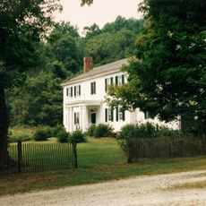
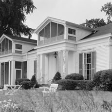
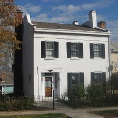
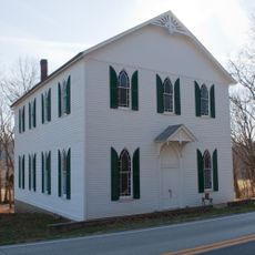
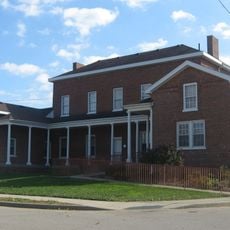
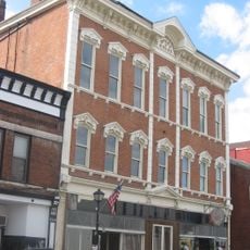
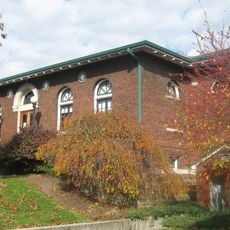
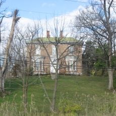
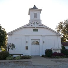
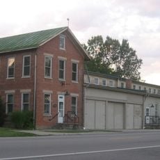
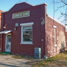
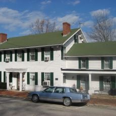
Rabbit Hash Historic District is a preserved settlement with a dozen historic buildings and structures spread along a river road in rural Kentucky. The buildings include a General Store and residences that maintain their 19th-century appearance and layout.

The settlement developed along the Ohio River as an early community, with buildings dating back to the 1800s reflecting its original role as a river-based settlement. The district gained official protection as a historic site in the early 2000s, recognizing its value to regional heritage.

The community celebrates its bond with animals through the tradition of electing dogs as mayors via popular fundraising votes. Visitors can see how this quirky custom remains central to local identity and gatherings.

The site is accessible by car via a rural road that winds through the area, allowing visitors to drive and walk at their own pace. The grounds are open and spread out, so wearing comfortable shoes is recommended when exploring the various buildings and structures.

The community's name comes from a resourceful origin story involving flooding that drove rabbits from riverbank burrows, providing food for early settlers during difficult times. This animal connection has shaped the place's character and continues to influence local traditions even now.

Location: Kentucky

GPS coordinates: 38.94222,-84.84583

Latest update: December 14, 2025 15:00

Photos
Around this place
Big Bone Lick State Park
United States of America

Big Bone Lick State Park

10.5 km
National Dirt Late Model Hall of Fame
United States of America

National Dirt Late Model Hall of Fame

14.9 km
Hillforest
United States of America

Hillforest

13.3 km
Dinsmore Homestead
United States of America

Dinsmore Homestead

7.1 km
Laughery Creek Bridge
United States of America

Laughery Creek Bridge

9.8 km
Veraestau
United States of America

Veraestau

12 km
George Street Bridge
United States of America

George Street Bridge

13.7 km
Levi Stevens House
United States of America

Levi Stevens House

13.2 km
River View Cemetery
United States of America

River View Cemetery

10.1 km
Prospect Farm
United States of America

Prospect Farm

13.5 km
First Presbyterian Church
United States of America

First Presbyterian Church

13.2 km
First Evangelical United Church of Christ
United States of America

First Evangelical United Church of Christ

13.2 km
Downtown Aurora Historic District
United States of America

Downtown Aurora Historic District

13.3 km
Big Bone Methodist Church
United States of America

Big Bone Methodist Church

10.1 km
Vance-Tousey House
United States of America

Vance-Tousey House

16.5 km
Leive, Parks and Stapp Opera House
United States of America

Leive, Parks and Stapp Opera House

13.6 km
First Methodist Church
United States of America

First Methodist Church

13.5 km
Aurora Public Library
United States of America

Aurora Public Library

13.6 km
Daniel S. Major House
United States of America

Daniel S. Major House

16.6 km
James Rogers House
United States of America

James Rogers House

5.1 km
Christian Meeting House
United States of America

Christian Meeting House

14.2 km
Boone County Distillery Superintendent's House and Guest House
United States of America

Boone County Distillery Superintendent's House and Guest House

14.3 km
United States of America

Belleview Post Office

5.1 km
Clore Plow Works-J.W. Whitlock and Company
United States of America

Clore Plow Works-J.W. Whitlock and Company

1 km
Farmers Bank of Petersburg
United States of America

Farmers Bank of Petersburg

14.3 km
Donald Barger House
United States of America

Donald Barger House

14.4 km
Lewis Hurlbert, Sr. House
United States of America

Lewis Hurlbert, Sr. House

13.5 km
Merit-Tandy Farmstead
United States of America

Merit-Tandy Farmstead

9.4 km
Show the full map
Reviews

Visited this place? Tap the stars to rate it and share your experience / photos with the community! Try now! You can cancel it anytime.

« Rabbit Hash Historic District - Historic district on Ohio River bank in Kentucky, United States » is provided by Around Us (aroundus.com). Images and texts are derived from Wikimedia project under a Creative Commons license. You are allowed to copy, distribute, and modify copies of this page, under the conditions set by the license, as long as this note is clearly visible.

Discover hidden gems everywhere you go!

From secret cafés to breathtaking viewpoints, skip the crowded tourist spots and find places that match your style. Our app makes it easy with voice search, smart filtering, route optimization, and insider tips from travelers worldwide. Download now for the complete mobile experience.

Around Us App Screenshot

A unique approach to discovering new places

Le Figaro

All the places worth exploring

France Info

A tailor-made excursion in just a few clicks

20 Minutes