Enable Location

We need your location to show you interesting places around you

Discover nearby places

Find interesting locations and hidden gems around you

Precise directions

Get accurate directions and distances to places

Your location is never shared with other users. It's only used when you tap the location button.

Rocheport

Log in to your account

Start exploring — it's free

Trusted by 61,341 travelers worldwide

Continue with Google
Continue with Apple
or

We will send you a code to connect

By continuing, you accept our Terms and Conditions and our Privacy Policy

Check your inbox

We've sent a pincode in your inbox. Please enter the code below.

Rocheport, Historic district in Rocheport, Missouri, United States

Description

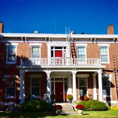
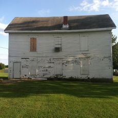
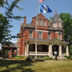
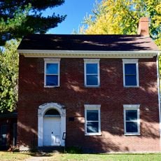
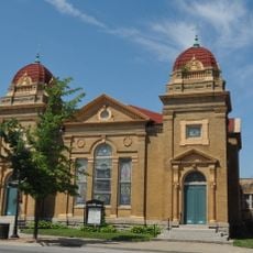
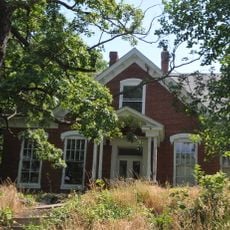
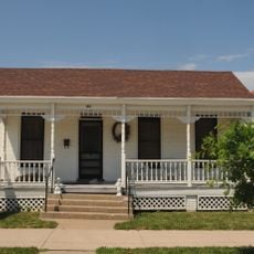
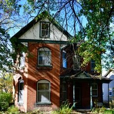
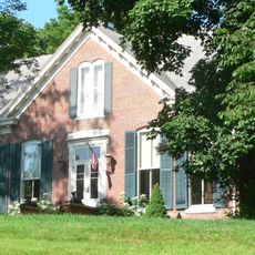
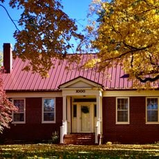
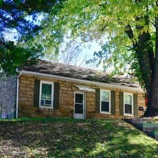
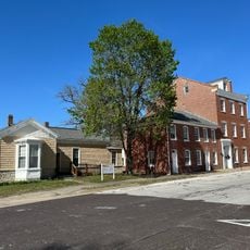
This historic district stretches along the Missouri River and contains many buildings from the 1800s made from local limestone and stone. The structures display architectural styles with Greek and Italian influences visible in their windows, doors, and decorative details on the facades.

History

The Lewis and Clark Expedition passed through this area in 1804, with William Clark recording Native American rock carvings and natural features along the creek. Over time the settlement grew into a major trading center where goods from surrounding farms were gathered and shipped downstream.

Culture

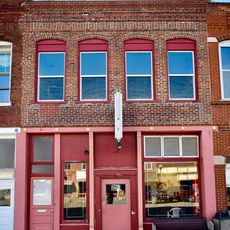
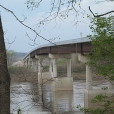
This place served as a vital shipping hub in the 1800s where farmers brought their harvest to boats headed downstream. The old warehouses and dock areas still reflect this commercial past and the role people played in moving goods across the region.

Practical

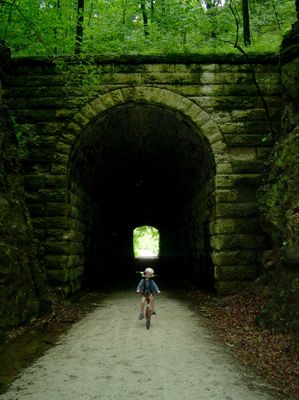
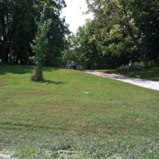
The area offers direct access to the Katy Trail State Park, a popular bicycle path built on an old railroad line that connects to other towns. Visitors should plan time to explore both the old buildings and the riverside landscape at a comfortable walking pace.

Did you know?

The name was changed from Rockport to Rocheport in 1825 based on a suggestion from a French missionary, with the new name meaning rocky port. This French naming is unusual for an American settlement and reflects the cultural connections that existed along the river at that time.

Location
GPS coordinates
38.97861,-92.56361
Latest update
December 14, 2025 16:45

AroundUs brings together thousands of curated places, local tips, and hidden gems, enriched daily by 60,000 contributors worldwide. Discover all places nearby (Missouri).

Around this place
Welch Hall
United States of America

Welch Hall

19.9 km
Sigma Alpha Epsilon Fraternity House
United States of America

Sigma Alpha Epsilon Fraternity House

20 km
Greenwood
United States of America

Greenwood

18.8 km
Columbia Agriculture Park
United States of America

Columbia Agriculture Park

17.4 km
William B. Hunt House
United States of America

William B. Hunt House

10.2 km
John N. and Elizabeth Taylor House
United States of America

John N. and Elizabeth Taylor House

18.8 km
Thomas Nelson House
United States of America

Thomas Nelson House

14.8 km
West Broadway Historic District
United States of America

West Broadway Historic District

18.9 km
Lyric Theater
United States of America

Lyric Theater

15.5 km
Harrisburg School
United States of America

Harrisburg School

20.1 km
Wilbur T. and Rhoda Stephens Johnson House
United States of America

Wilbur T. and Rhoda Stephens Johnson House

14.5 km
St. Matthew's Chapel A.M.E. Church
United States of America

St. Matthew's Chapel A.M.E. Church

15.7 km
Roeschel-Toennes-Oswald Property
United States of America

Roeschel-Toennes-Oswald Property

16.6 km
Harris-Chilton-Ruble House
United States of America

Harris-Chilton-Ruble House

16 km
Historic District D
United States of America

Historic District D

15.6 km
Juliet Trigg Johnson House
United States of America

Juliet Trigg Johnson House

15.4 km
Albert Gallatin Blakey House
United States of America

Albert Gallatin Blakey House

16.4 km
Meierhoffer Sand Company Office Building
United States of America

Meierhoffer Sand Company Office Building

16.2 km
Andrews-Wing House
United States of America

Andrews-Wing House

15.5 km
William S. and Mary Beckett House
United States of America

William S. and Mary Beckett House

15.8 km
Sumner Public School
United States of America

Sumner Public School

15.6 km
New Franklin Commercial Historic District
United States of America

New Franklin Commercial Historic District

15.6 km
Josephine Trigg Pigott House
United States of America

Josephine Trigg Pigott House

15.3 km
Morton-Myer House
United States of America

Morton-Myer House

14.5 km
Andrew Gantner House
United States of America

Andrew Gantner House

15.2 km
Historic District C
United States of America

Historic District C

15.8 km
Boonslick Bridge
United States of America

Boonslick Bridge

15.8 km
Moses U. Payne House
United States of America

Moses U. Payne House

3.3 km
Show the full map
« Rocheport - Historic district in Rocheport, Missouri, United States » is provided by Around Us (aroundus.com). Images and texts are derived from Wikimedia project under a Creative Commons license. You are allowed to copy, distribute, and modify copies of this page, under the conditions set by the license, as long as this note is clearly visible.

Discover hidden gems everywhere you go!

From secret cafés to breathtaking viewpoints, skip the crowded tourist spots and find places that match your style. Our app makes it easy with voice search, smart filtering, route optimization, and insider tips from travelers worldwide. Download now for the complete mobile experience.

Around Us App Screenshot

A unique approach to discovering new places

Le Figaro

All the places worth exploring

France Info

A tailor-made excursion in just a few clicks

20 Minutes

Around Us
Travel Guide & Maps
Download

Send to your phone

QR Code
1

Open the camera app on your mobile.

2

Point at the QR code with your camera. A notification will appear.

3

Tap the notification to open the link.