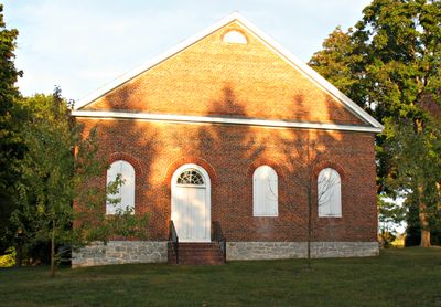
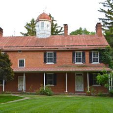
Rocky Spring Presbyterian Church, Presbyterian church in Letterkenny Township, Pennsylvania.
Rocky Spring Presbyterian Church is a brick structure with a rectangular footprint and pitched gable roof set apart from surrounding buildings. The interior holds two heating stoves and narrow wooden pews with tall straight backs, creating a simple and orderly worship space.
Built in 1794, the church operated on a fee-per-pew system where members signed financial agreements with trustees for annual seating rights. This arrangement reflected how congregations funded their operations through direct member investments in their worship space.
The pews contain carved names of past attendees displaying their military ranks from the Revolutionary War era, connecting the building to the people who worshipped here and shaped the nation. These inscriptions make the congregation's role in that period tangible to anyone walking through.
The circular pulpit with its oval canopy allows clear sight lines to the preacher from every seat and improves sound distribution throughout the space. Visitors should allow time to appreciate how the tight spacing and high pew backs create distinct viewing angles from different positions.
The cemetery surrounding the building holds gravestones dating to the 1780s, documenting the long history of burials at this site. The oldest known grave belongs to John Burns from 1760, predating the church building itself by more than 30 years.
The community of curious travelers
AroundUs brings together thousands of curated places, local tips, and hidden gems, enriched daily by 60,000 contributors worldwide.