Enable Location

We need your location to show you interesting places around you

Discover nearby places

Find interesting locations and hidden gems around you

Precise directions

Get accurate directions and distances to places

Your location is never shared with other users. It's only used when you tap the location button.

Tamarac National Wildlife Refuge

Log in to your account

Start exploring — it's free

Trusted by 62,938 travelers worldwide

Continue with Google
Continue with Apple
or

We will send you a code to connect

By continuing, you accept our Terms and Conditions and our Privacy Policy

Check your inbox

We've sent a pincode in your inbox. Please enter the code below.

Tamarac National Wildlife Refuge
Discussion Reviews 1 Photos
2.4k Popularity

Tamarac National Wildlife Refuge, National wildlife refuge in Becker County, Minnesota, US

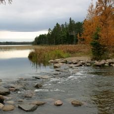
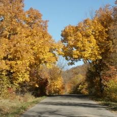
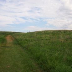
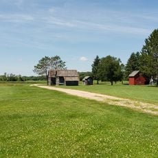
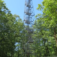
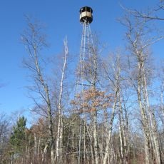
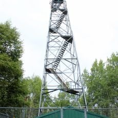
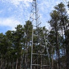
Tamarac National Wildlife Refuge is a protected area containing wetlands, forests, and grasslands where three distinct ecosystems meet. Eastern deciduous hardwoods, northern coniferous forests, and western tallgrass prairie overlap, creating diverse habitats for wildlife.

The refuge was established in 1938 through a presidential order as a sanctuary for migratory birds. This creation reflected a broader federal effort to protect habitats for bird species on their seasonal journeys.

The name comes from an Anishinaabe word meaning larch tree, reflecting the land's indigenous roots. Visitors today come to experience wild spaces where traditional harvesting rights are still exercised by local tribal communities.

The visitor center operates seasonally with different hours for weekdays and weekends, while trails remain accessible throughout the year. Plan your visit during spring and fall when bird activity is highest and the land is most active.

Trumpeter swans returned to nest in this refuge after vanishing from the region more than a century ago and completely disappearing from Minnesota. Their comeback demonstrates how protection efforts can restore a species on the brink of extinction.

The community of curious travelers

AroundUs brings together thousands of curated places, local tips, and hidden gems, enriched daily by 60,000 contributors worldwide.

Start exploring
Location
Inception
1938
GPS coordinates
47.04080,-95.59250
Latest update
December 13, 2025 11:45
Around this place
Itasca State Park
United States of America

Itasca State Park

36.6 km
Maplewood State Park
United States of America

Maplewood State Park

62.7 km
Buffalo River State Park
United States of America

Buffalo River State Park

68.8 km
Pelican Pete
United States of America

Pelican Pete

64.3 km
Paul Bunyan State Forest
United States of America

Paul Bunyan State Forest

46.2 km
Hamden Slough National Wildlife Refuge
United States of America

Hamden Slough National Wildlife Refuge

36.2 km
Badoura State Forest
United States of America

Badoura State Forest

70.6 km
Finn Creek Museum
United States of America

Finn Creek Museum

68.2 km
Nevis Tiger Muskie
United States of America

Nevis Tiger Muskie

57.6 km
O.A.E. Blyberg House
United States of America

O.A.E. Blyberg House

65 km
Mahnomen County Courthouse
United States of America

Mahnomen County Courthouse

42 km
Gran Evangelical Lutheran Church
United States of America

Gran Evangelical Lutheran Church

56.5 km
Hubbard County Courthouse
United States of America

Hubbard County Courthouse

42.3 km
People's Union Church
United States of America

People's Union Church

55.1 km
White Earth State Forest
United States of America

White Earth State Forest

45.1 km
Smoky Hills State Forest
United States of America

Smoky Hills State Forest

18.8 km
Buffalo River State Park WPA/Rustic Style Historic Resources
United States of America

Buffalo River State Park WPA/Rustic Style Historic Resources

69.5 km
Nimrod Fire Tower
United States of America

Nimrod Fire Tower

70 km
Height of Land Lookout Tower
United States of America

Height of Land Lookout Tower

22.3 km
Aiton Heights Fire Tower
United States of America

Aiton Heights Fire Tower

34.6 km
Schoolcraft Fire Tower
United States of America

Schoolcraft Fire Tower

57.7 km
Detroit Lakes City Park
United States of America

Detroit Lakes City Park

20.4 km
Badoura Lookout Tower
United States of America

Badoura Lookout Tower

68.9 km
Smoky Hills Lookout Tower
United States of America

Smoky Hills Lookout Tower

21.8 km
Kabekona Lookout Tower
United States of America

Kabekona Lookout Tower

57.5 km
Tulaby Lookout Tower
United States of America

Tulaby Lookout Tower

14.6 km
Recreation Building
United States of America

Recreation Building

32.2 km
LaSalle Lookout Tower
United States of America

LaSalle Lookout Tower

43.2 km
Show the full map
Reviews
Share your experience

No review yet

Discussions
Start a discussion...

No discussion yet

« Tamarac National Wildlife Refuge - National wildlife refuge in Becker County, Minnesota, US » is provided by Around Us (aroundus.com). Images and texts are derived from Wikimedia project under a Creative Commons license. You are allowed to copy, distribute, and modify copies of this page, under the conditions set by the license, as long as this note is clearly visible.

Discover hidden gems everywhere you go!

From secret cafés to breathtaking viewpoints, skip the crowded tourist spots and find places that match your style. Our app makes it easy with voice search, smart filtering, route optimization, and insider tips from travelers worldwide. Download now for the complete mobile experience.

Around Us App Screenshot

A unique approach to discovering new places

Le Figaro

All the places worth exploring

France Info

A tailor-made excursion in just a few clicks

20 Minutes

Around Us
Travel Guide & Maps
Download

Send to your phone

QR Code
1

Open the camera app on your mobile.

2

Point at the QR code with your camera. A notification will appear.

3

Tap the notification to open the link.