Enable Location

We need your location to show you interesting places around you

Discover nearby places

Find interesting locations and hidden gems around you

Precise directions

Get accurate directions and distances to places

Your location is never shared with other users. It's only used when you tap the location button.

Texarkana metropolitan area

Log in to your account

Start exploring — it's free

Trusted by 68,727 travelers worldwide

Continue with Google
Continue with Apple
or

We will send you a code to connect

By continuing, you accept our Terms and Conditions and our Privacy Policy

Check your inbox

We've sent a pincode in your inbox. Please enter the code below.

Texarkana metropolitan area
Discussion Reviews 3 Photos
34.9k Popularity

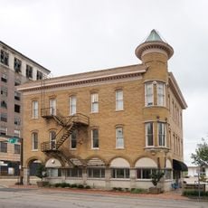
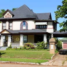
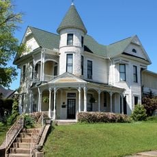
Texarkana metropolitan area, Metropolitan statistical area at Texas-Arkansas border, United States

The Texarkana metropolitan area spans two counties across the Texas-Arkansas border and encompasses a region with roughly 146,000 residents. The area features the Red River Army Depot, Christus St. Michael Health System, and a commercial airport with two runways.

The region grew from the junction of two railroad lines that met in 1873, establishing a settlement at the state boundary. It gained official recognition as a metropolitan statistical area in 1960.

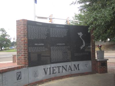
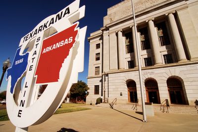
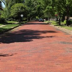
State Line Avenue marks the border between Texas and Arkansas, shaping how residents live and work across both states as part of a single community. People here have developed a shared identity that transcends official boundaries.

The region is straightforward to navigate, with State Line Avenue serving as the main orientation reference between the two states. Visitors should note that some services and businesses may be concentrated on one or both sides of the border.

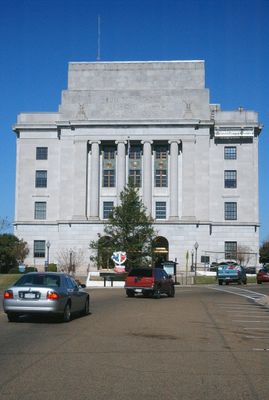
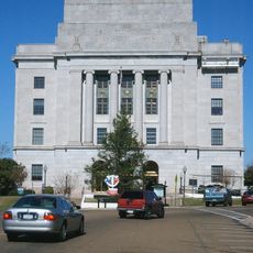
The Texarkana Post Office was literally built straddling the state border, allowing postal operations to function in both states at the same time. This building demonstrates the unusual relationship between the two sides of this boundary region.

The community of curious travelers

AroundUs brings together thousands of curated places, local tips, and hidden gems, enriched daily by 60,000 contributors worldwide.

Start exploring
Location
Location
Inception
1960
Elevation above the sea
91 m
GPS coordinates
33.43722,-94.06750
Latest update
March 5, 2026 16:38
Around this place
Ace of Clubs House
United States of America

Ace of Clubs House

2.6 km
United States Post Office and Courthouse
United States of America

United States Post Office and Courthouse

2.7 km
Confederate Mothers Monument
United States of America

Confederate Mothers Monument

2.6 km
Four States Auto Museum
United States of America

Four States Auto Museum

3.1 km
Beech Street Brick Street
United States of America

Beech Street Brick Street

2.7 km
Museum of Regional History
United States of America

Museum of Regional History

2.8 km
Buhrman-Pharr Hardware Company Historic District
United States of America

Buhrman-Pharr Hardware Company Historic District

3 km
East Broad Street Historic District
United States of America

East Broad Street Historic District

2.8 km
Beech Street Historic District
United States of America

Beech Street Historic District

2.7 km
Miller County Courthouse
United States of America

Miller County Courthouse

3.9 km
Bottoms House
United States of America

Bottoms House

3.2 km
Canaan Baptist Church
United States of America

Canaan Baptist Church

2.5 km
Claude Foulke House
United States of America

Claude Foulke House

3.1 km
Orr School
United States of America

Orr School

2.5 km
John Clifton House
United States of America

John Clifton House

2.8 km
Dean House
United States of America

Dean House

2.7 km
J.K. Wadley House
United States of America

J.K. Wadley House

3 km
Cotton Belt Railroad Office Building
United States of America

Cotton Belt Railroad Office Building

2.9 km
Alvah Horace Whitmarsh House
United States of America

Alvah Horace Whitmarsh House

2.6 km
Augustus M. Garrison House
United States of America

Augustus M. Garrison House

3 km
Wallace Adams Service Station
United States of America

Wallace Adams Service Station

3 km
Patrick J. Ahern House
United States of America

Patrick J. Ahern House

2.9 km
Ritchie Grocery Building
United States of America

Ritchie Grocery Building

3 km
Little River County Training School Historic District
United States of America

Little River County Training School Historic District

26.5 km
Kittrell House
United States of America

Kittrell House

2.9 km
Swift Building
United States of America

Swift Building

3 km
Averitt House
United States of America

Averitt House

13.9 km
Perot Theatre
United States of America

Perot Theatre

2.8 km
Show the full map
Reviews
Share your experience

No review yet

Discussions
Start a discussion...

No discussion yet

Administrative divisions
« Texarkana metropolitan area - Metropolitan statistical area at Texas-Arkansas border, United States » is provided by Around Us (aroundus.com). Images and texts are derived from Wikimedia project under a Creative Commons license. You are allowed to copy, distribute, and modify copies of this page, under the conditions set by the license, as long as this note is clearly visible.

Discover hidden gems everywhere you go!

From secret cafés to breathtaking viewpoints, skip the crowded tourist spots and find places that match your style. Our app makes it easy with voice search, smart filtering, route optimization, and insider tips from travelers worldwide. Download now for the complete mobile experience.

Around Us App Screenshot

A unique approach to discovering new places

Le Figaro

All the places worth exploring

France Info

A tailor-made excursion in just a few clicks

20 Minutes

Around Us
Travel Guide & Maps
Download

Send to your phone

QR Code
1

Open the camera app on your mobile.

2

Point at the QR code with your camera. A notification will appear.

3

Tap the notification to open the link.