Enable Location

We need your location to show you interesting places around you

Discover nearby places

Find interesting locations and hidden gems around you

Precise directions

Get accurate directions and distances to places

Your location is never shared with other users. It's only used when you tap the location button.

Texarkana

Log in to your account

Start exploring — it's free

Trusted by 62,532 travelers worldwide

Continue with Google
Continue with Apple
or

We will send you a code to connect

By continuing, you accept our Terms and Conditions and our Privacy Policy

Check your inbox

We've sent a pincode in your inbox. Please enter the code below.

Texarkana, Railroad city in Texas, United States

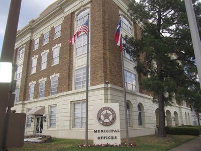
Texarkana is a railroad city in Bowie County that sits directly on the Texas and Arkansas state border, with State Line Avenue marking the division through its downtown core. The municipality operates under two separate governments, yet functions as one community with neighborhoods, shops, and public spaces spread across both sides of the border.

The town formed in 1873 when two railroad lines met at this location, creating a transportation hub that drew settlers and commerce from both Texas and Arkansas. The railroad junction led to rapid growth as a trade center, and the dual state arrangement became permanent when officials decided to maintain separate administrations rather than merge under one state.

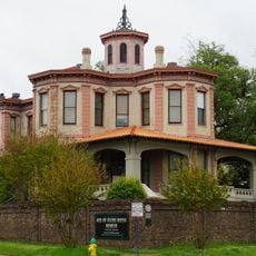
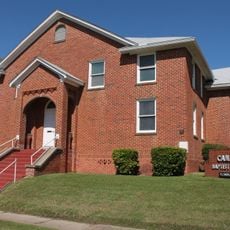
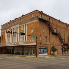
The Museum of Regional History, housed in the oldest building in Texarkana, presents exhibits about local development and regional artifacts from past centuries.

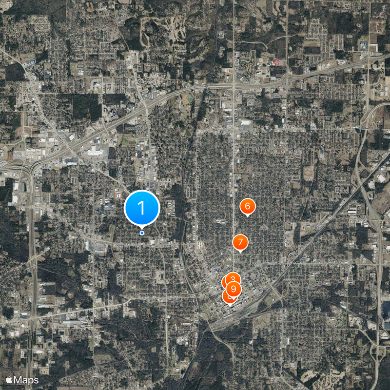
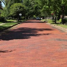
Visitors can walk along State Line Avenue to see the border markers and observe how the street divides the downtown area into two states. The regional airport offers connections to larger cities, while several major highways converge here, making it accessible by car from surrounding regions.

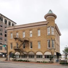
The post office building sits precisely on the state line, allowing mail to be processed under both Texas and Arkansas jurisdictions from the same counter. The Museum of Regional History occupies the oldest standing structure in town and displays artifacts that trace the development of this border community over more than a century.

The community of curious travelers

AroundUs brings together thousands of curated places, local tips, and hidden gems, enriched daily by 60,000 contributors worldwide.

Start exploring
Location
Inception
December 8, 1873
Elevation above the sea
91 m
Part of
Texarkana
Shares border with
Texarkana
GPS coordinates
33.43720,-94.06750
Latest update
December 15, 2025 08:05
Around this place
Ace of Clubs House
United States of America

Ace of Clubs House

2.6 km
Confederate Mothers Monument
United States of America

Confederate Mothers Monument

2.6 km
Beech Street Brick Street
United States of America

Beech Street Brick Street

2.7 km
Museum of Regional History
United States of America

Museum of Regional History

2.8 km
Beech Street Historic District
United States of America

Beech Street Historic District

2.7 km
Canaan Baptist Church
United States of America

Canaan Baptist Church

2.5 km
Perot Theatre
United States of America

Perot Theatre

2.8 km
United States of America

Hotel Grim

2.8 km
United States of America

Texas High School Baseball Field

1.8 km
United States of America

Saenger Theater

2.7 km
United States of America

Whitaker House

1.9 km
United States of America

Howell W. Runnels Home

1.6 km
United States of America

Earl-Rochelle House

2.2 km
United States of America

Rialto Building

2.7 km
United States of America

Old Rialto Building

2.7 km
United States of America

Moores-Burke-Ragland Home

2.2 km
United States of America

Cervini House

2.3 km
United States of America

The Jamison Building

2.6 km
United States of America

Central Christian Church

2.3 km
United States of America

St. James Episcopal Church

2.6 km
United States of America

United States Post Office and Courthouse

2.6 km
United States of America

Dr. A. H. A. and Ruby Jones House

3.1 km
Splash pad
United States of America

Splash pad

3.1 km
United States of America

Texarkana Golf Ranch

7.8 km
United States of America

Perot Theater

2.7 km
United States of America

Sullivan Performing Arts Center

2 km
United States of America

Sculpture, Work of art

3.9 km
United States of America

Work of art, sculpture

2.8 km
Show the full map
« Texarkana - Railroad city in Texas, United States » is provided by Around Us (aroundus.com). Images and texts are derived from Wikimedia project under a Creative Commons license. You are allowed to copy, distribute, and modify copies of this page, under the conditions set by the license, as long as this note is clearly visible.

Discover hidden gems everywhere you go!

From secret cafés to breathtaking viewpoints, skip the crowded tourist spots and find places that match your style. Our app makes it easy with voice search, smart filtering, route optimization, and insider tips from travelers worldwide. Download now for the complete mobile experience.

Around Us App Screenshot

A unique approach to discovering new places

Le Figaro

All the places worth exploring

France Info

A tailor-made excursion in just a few clicks

20 Minutes

Around Us
Travel Guide & Maps
Download

Send to your phone

QR Code
1

Open the camera app on your mobile.

2

Point at the QR code with your camera. A notification will appear.

3

Tap the notification to open the link.