Enable Location

We need your location to show you interesting places around you

Discover nearby places

Find interesting locations and hidden gems around you

Precise directions

Get accurate directions and distances to places

Your location is never shared with other users. It's only used when you tap the location button.

Winchester Square Historic District

Log in to your account

Start exploring — it's free

Trusted by 61,897 travelers worldwide

Continue with Google
Continue with Apple
or

We will send you a code to connect

By continuing, you accept our Terms and Conditions and our Privacy Policy

Check your inbox

We've sent a pincode in your inbox. Please enter the code below.

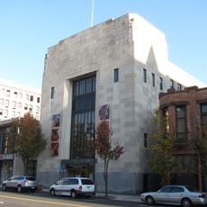
Winchester Square Historic District, Historic district near State Street and Wilbraham Road in Springfield, Massachusetts.

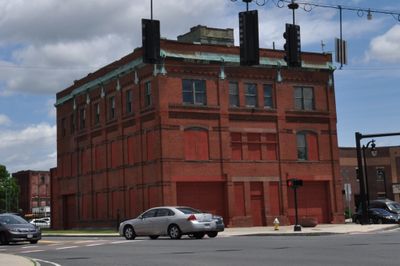
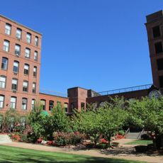
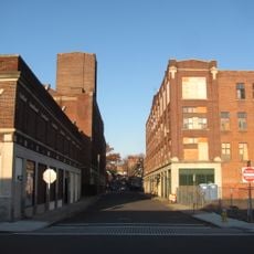
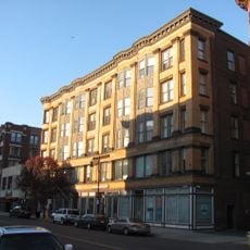
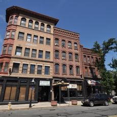
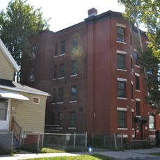
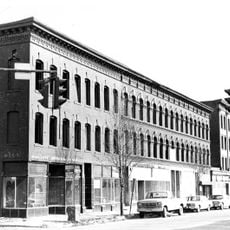
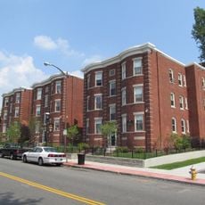
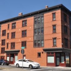
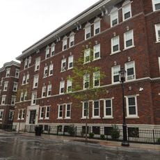
Winchester Square Historic District is an industrial neighborhood in Springfield filled with brick buildings constructed from 1875 to 1913. The area includes manufacturing plants and transportation facilities that reflect the economic growth of that period.

The area developed after the Springfield and New London Railroad was completed in 1870, which triggered extensive industrial expansion. The district's formation was driven by rail access and the region's growing manufacturing economy.

The Springfield Industrial Institute, founded in 1895, trained workers for the local factories and became central to how residents understood their community. This institution reflected the neighborhood's commitment to developing skilled labor for manufacturing work.

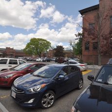
The district is accessible by car and located near State Street and Wilbraham Road. Walking through the area systematically helps you see all the historic buildings and understand how they are arranged.

The Indian Motorcycle Company operated here and grew to become the world's largest motorcycle maker by 1914. This factory demonstrates how a single manufacturer could define a region's reputation as a production hub.

The community of curious travelers

AroundUs brings together thousands of curated places, local tips, and hidden gems, enriched daily by 60,000 contributors worldwide.

Start exploring
Location
GPS coordinates
42.11056,-72.56250
Latest update
December 14, 2025 17:42
Around this place
MassMutual Center
United States of America

MassMutual Center

2.2 km
Springfield Museums
United States of America

Springfield Museums

2 km
United States of America

Mulberry Street

1.6 km
Springfield Museums
United States of America

Springfield Museums

2.1 km
Milton-Bradley Company
United States of America

Milton-Bradley Company

2.1 km
Masonic Temple
United States of America

Masonic Temple

1.6 km
Christ Church Cathedral
United States of America

Christ Church Cathedral

2.1 km
United States of America

High School of Commerce

1.4 km
North Congregational Church
United States of America

North Congregational Church

2.1 km
St. John's Congregational Church & Parsonage-Parish for Working Girls
United States of America

St. John's Congregational Church & Parsonage-Parish for Working Girls

576 m
Springfield Fire & Marine Insurance Co.
United States of America

Springfield Fire & Marine Insurance Co.

2.2 km
Smith Carriage Company District
United States of America

Smith Carriage Company District

2.2 km
Evans Court Apartment Building
United States of America

Evans Court Apartment Building

2.1 km
Colonial Block
United States of America

Colonial Block

2.3 km
Burbach Block
United States of America

Burbach Block

2.3 km
Springfield Safe Deposit and Trust Company
United States of America

Springfield Safe Deposit and Trust Company

2.2 km
Adams Apartment Building
United States of America

Adams Apartment Building

2.1 km
Mills-Hale-Owen Blocks
United States of America

Mills-Hale-Owen Blocks

2.3 km
Upper Worthington Historic District
United States of America

Upper Worthington Historic District

1.6 km
Ivernia Apartment Building
United States of America

Ivernia Apartment Building

1.3 km
Hancock Apartment Building
United States of America

Hancock Apartment Building

665 m
Federal Square Historic District
United States of America

Federal Square Historic District

1.3 km
Outing Park Historic District
United States of America

Outing Park Historic District

2.2 km
United States of America

Wigglesworth Building

965 m
Michele & Donald D'Amour Museum of Fine Arts
United States of America

Michele & Donald D'Amour Museum of Fine Arts

2 km
McKnight District
United States of America

McKnight District

892 m
Maple-Union Corners
United States of America

Maple-Union Corners

1.9 km
Springfield City Library
United States of America

Springfield City Library

2 km
Show the full map
« Winchester Square Historic District - Historic district near State Street and Wilbraham Road in Springfield, Massachusetts » is provided by Around Us (aroundus.com). Images and texts are derived from Wikimedia project under a Creative Commons license. You are allowed to copy, distribute, and modify copies of this page, under the conditions set by the license, as long as this note is clearly visible.

Discover hidden gems everywhere you go!

From secret cafés to breathtaking viewpoints, skip the crowded tourist spots and find places that match your style. Our app makes it easy with voice search, smart filtering, route optimization, and insider tips from travelers worldwide. Download now for the complete mobile experience.

Around Us App Screenshot

A unique approach to discovering new places

Le Figaro

All the places worth exploring

France Info

A tailor-made excursion in just a few clicks

20 Minutes

Around Us
Travel Guide & Maps
Download

Send to your phone

QR Code
1

Open the camera app on your mobile.

2

Point at the QR code with your camera. A notification will appear.

3

Tap the notification to open the link.