Enable Location

We need your location to show you interesting places around you

Discover nearby places

Find interesting locations and hidden gems around you

Precise directions

Get accurate directions and distances to places

Your location is never shared with other users. It's only used when you tap the location button.

Wilder Ranch State Park

Log in to your account

Start exploring — it's free

Trusted by 62,922 travelers worldwide

Continue with Google
Continue with Apple
or

We will send you a code to connect

By continuing, you accept our Terms and Conditions and our Privacy Policy

Check your inbox

We've sent a pincode in your inbox. Please enter the code below.

Wilder Ranch State Park
Discussion Reviews 1 Photos
13.2k Popularity

Wilder Ranch State Park, State park in Santa Cruz County, California, US.

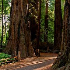
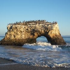
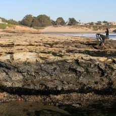
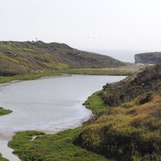
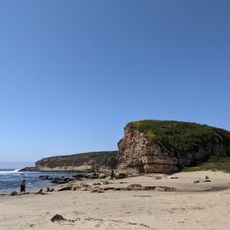
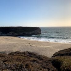
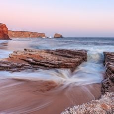
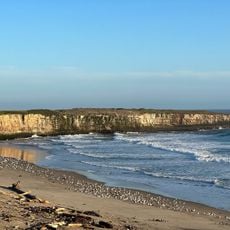
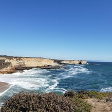
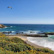
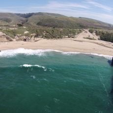
Wilder Ranch State Park is a coastal reserve spanning about 7,000 acres with rolling valleys, open grasslands, and ocean cliffs overlooking the Pacific. A network of about 34 miles of trails connects these landscapes, taking hikers through different terrain and along the bluffs.

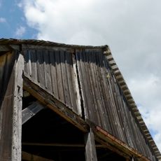
The land was granted to settlers by the Mexican government in 1839, then became a working dairy ranch when Delos D. Wilder bought it in 1871. The family operated the farm for nearly a century before it opened to the public as a state park.

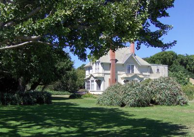
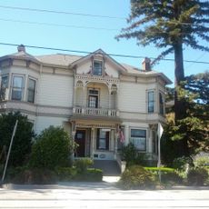
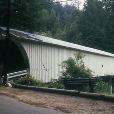
The restored Victorian house from the 1890s and adobe buildings show how people lived and farmed along the California coast. Visitors can walk through these homes and see the daily life of the families who worked the land.

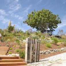
The park is open daily from sunrise to sunset and is reached from Highway 1 via Coast Road, making it easy to find from the main highway. Trails vary in difficulty, so visitors should wear sturdy shoes and bring water, especially on warmer days.

The adjoining Gray Whale Ranch holds limestone caves, with one called Hell Hole known for its depth and the search-and-rescue missions it has required. These caves remain off-limits to casual visitors and appeal only to people with serious caving experience.

The community of curious travelers

AroundUs brings together thousands of curated places, local tips, and hidden gems, enriched daily by 60,000 contributors worldwide.

Start exploring
Inception
1974
Operator
California Department of Parks and Recreation
GPS coordinates
36.98330,-122.10000
Latest update
December 7, 2025 20:41
Around this place
Mission Santa Cruz
United States of America

Mission Santa Cruz

6.3 km
Henry Cowell Redwoods State Park
United States of America

Henry Cowell Redwoods State Park

5.8 km
Natural Bridges State Beach
United States of America

Natural Bridges State Beach

5.1 km
Roaring Camp and Big Trees Narrow Gauge Railroad
United States of America

Roaring Camp and Big Trees Narrow Gauge Railroad

7.2 km
Natural Bridges State Marine Reserve
United States of America

Natural Bridges State Marine Reserve

4.4 km
College Eight
United States of America

College Eight

3.2 km
Felton Covered Bridge
United States of America

Felton Covered Bridge

8 km
McHenry Library
United States of America

McHenry Library

3.9 km
Younger Lagoon Reserve
United States of America

Younger Lagoon Reserve

4.7 km
Cowell Lime Works
United States of America

Cowell Lime Works

4.3 km
Arboretum at the University of California, Santa Cruz
United States of America

Arboretum at the University of California, Santa Cruz

3.5 km
Hinds House
United States of America

Hinds House

6.3 km
California Powder Works Bridge
United States of America

California Powder Works Bridge

5.8 km
Bigfoot Discovery Museum
United States of America

Bigfoot Discovery Museum

6.9 km
Shark Fin Cove Beach
United States of America

Shark Fin Cove Beach

8 km
Felton Presbyterian Church
United States of America

Felton Presbyterian Church

8.1 km
Visitor Center | Henry Cowell Redwoods State Park
United States of America

Visitor Center | Henry Cowell Redwoods State Park

7 km
Felton Presbyterian Church
United States of America

Felton Presbyterian Church

8.1 km
Yellowbank Beach
United States of America

Yellowbank Beach

6.4 km
Four Mile Beach
United States of America

Four Mile Beach

2.8 km
Shark Fin Cove (California)
United States of America

Shark Fin Cove (California)

8 km
Holy Cross Church
United States of America

Holy Cross Church

6.3 km
Laguna Creek Beach
United States of America

Laguna Creek Beach

5 km
Panther Beach
United States of America

Panther Beach

6.4 km
Wilder Beach
United States of America

Wilder Beach

3.8 km
Three Mile Beach
United States of America

Three Mile Beach

2.7 km
Red, White and Blue Beach
United States of America

Red, White and Blue Beach

3.8 km
Bonny Doon Beach
United States of America

Bonny Doon Beach

7.5 km
Show the full map
Reviews
Share your experience

No review yet

Discussions
Start a discussion...

No discussion yet

« Wilder Ranch State Park - State park in Santa Cruz County, California, US » is provided by Around Us (aroundus.com). Images and texts are derived from Wikimedia project under a Creative Commons license. You are allowed to copy, distribute, and modify copies of this page, under the conditions set by the license, as long as this note is clearly visible.

Discover hidden gems everywhere you go!

From secret cafés to breathtaking viewpoints, skip the crowded tourist spots and find places that match your style. Our app makes it easy with voice search, smart filtering, route optimization, and insider tips from travelers worldwide. Download now for the complete mobile experience.

Around Us App Screenshot

A unique approach to discovering new places

Le Figaro

All the places worth exploring

France Info

A tailor-made excursion in just a few clicks

20 Minutes

Around Us
Travel Guide & Maps
Download

Send to your phone

QR Code
1

Open the camera app on your mobile.

2

Point at the QR code with your camera. A notification will appear.

3

Tap the notification to open the link.