Enable Location

We need your location to show you interesting places around you

Discover nearby places

Find interesting locations and hidden gems around you

Precise directions

Get accurate directions and distances to places

Your location is never shared with other users. It's only used when you tap the location button.

Log in to your account

Start exploring — it's free

Trusted by 62,558 travelers worldwide

Continue with Google
Continue with Apple
or

We will send you a code to connect

By continuing, you accept our Terms and Conditions and our Privacy Policy

Check your inbox

We've sent a pincode in your inbox. Please enter the code below.

Hulah Lake

Hulah Lake, Man-made reservoir in Oklahoma, United States

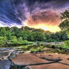
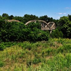
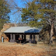
Hulah Lake is a large reservoir in northeastern Oklahoma with expansive water surrounded by gentle rolling hills and tree-lined shores. The calm waters vary in depth, and the lake offers multiple boat ramps, fishing areas, and camping facilities managed by the U.S. Army Corps of Engineers.

The lake was created in the late 1960s by dam construction to control flooding and supply water to surrounding communities. Since then it has become an integral part of regional life, serving both recreation and water management purposes.

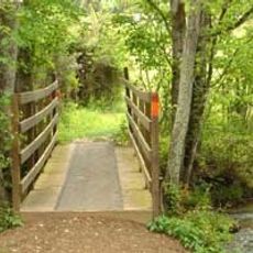
The name Hulah comes from the Osage language and reflects the historical roots of the region. Today visitors can see how the lake serves as a gathering place where families and anglers practice traditional activities like fishing and camping throughout the seasons.

The water is usually calm, making it suitable for boating, fishing, and swimming in designated areas. Visitors should know that certain fishing methods like bowfishing and spearing are prohibited, and local bait and tackle shops are available in nearby towns such as Copan and Claremore.

Researchers and wildlife workers regularly visit the lake to study local animals such as skunks and birds and monitor the surrounding environment. These research activities show that the reservoir ecosystem remains active and continues to attract scientific interest.

The community of curious travelers

AroundUs brings together thousands of curated places, local tips, and hidden gems, enriched daily by 60,000 contributors worldwide.

Start exploring
Location
GPS coordinates
36.93500,-96.09170
Latest update
February 9, 2026 08:23
Around this place
Price Tower
United States of America

Price Tower

23.3 km
Tallgrass Prairie Preserve
United States of America

Tallgrass Prairie Preserve

30.9 km
Woolaroc
United States of America

Woolaroc

30.3 km
Fred and Adeline Drummond House
United States of America

Fred and Adeline Drummond House

63.6 km
Osage Hills State Park
United States of America

Osage Hills State Park

22.9 km
Elk City State Park
United States of America

Elk City State Park

45.7 km
LaQuinta
United States of America

LaQuinta

27 km
Bank of Bigheart
United States of America

Bank of Bigheart

42 km
Independence Public Library
United States of America

Independence Public Library

47 km
Diamond Point School
United States of America

Diamond Point School

44.9 km
Booth Theater
United States of America

Booth Theater

47.1 km
Onion Creek Bridge (Coffeyville, Kansas)
United States of America

Onion Creek Bridge (Coffeyville, Kansas)

40 km
Old Washington County Courthouse
United States of America

Old Washington County Courthouse

23.2 km
Booth Hotel
United States of America

Booth Hotel

46.8 km
Hominy Armory
United States of America

Hominy Armory

63.7 km
Bethel African Methodist Episcopal Church
United States of America

Bethel African Methodist Episcopal Church

43.6 km
City Hall
United States of America

City Hall

37.5 km
Niotaze Methodist Episcopal Church
United States of America

Niotaze Methodist Episcopal Church

16.5 km
Coffeyville Carnegie Public Library Building
United States of America

Coffeyville Carnegie Public Library Building

43.2 km
Little House On The Prairie Museum
United States of America

Little House On The Prairie Museum

31 km
Cedar Creek Bridge
United States of America

Cedar Creek Bridge

16.8 km
Elk Falls Pratt Truss Bridge
United States of America

Elk Falls Pratt Truss Bridge

49.6 km
Osage Casino Hotel - Skiatook
United States of America

Osage Casino Hotel - Skiatook

63.1 km
Drummond House
United States of America

Drummond House

63.6 km
Dewlen-Spohnhauer Bridge
United States of America

Dewlen-Spohnhauer Bridge

48.8 km
Independence Historical Museum & Art Center
United States of America

Independence Historical Museum & Art Center

46.8 km
Osage Hills State Park Picnic Pavilion
United States of America

Osage Hills State Park Picnic Pavilion

23.8 km
Independence Downtown Historic District
United States of America

Independence Downtown Historic District

47.1 km
Show the full map
« Hulah Lake - Man-made reservoir in Oklahoma, United States » is provided by Around Us (aroundus.com). Images and texts are derived from Wikimedia project under a Creative Commons license. You are allowed to copy, distribute, and modify copies of this page, under the conditions set by the license, as long as this note is clearly visible.

Discover hidden gems everywhere you go!

From secret cafés to breathtaking viewpoints, skip the crowded tourist spots and find places that match your style. Our app makes it easy with voice search, smart filtering, route optimization, and insider tips from travelers worldwide. Download now for the complete mobile experience.

Around Us App Screenshot

A unique approach to discovering new places

Le Figaro

All the places worth exploring

France Info

A tailor-made excursion in just a few clicks

20 Minutes

Around Us
Travel Guide & Maps
Download

Send to your phone

QR Code
1

Open the camera app on your mobile.

2

Point at the QR code with your camera. A notification will appear.

3

Tap the notification to open the link.