Enable Location

We need your location to show you interesting places around you

Discover nearby places

Find interesting locations and hidden gems around you

Precise directions

Get accurate directions and distances to places

Your location is never shared with other users. It's only used when you tap the location button.

Marlborough Historic District

Log in to your account

Start exploring — it's free

Trusted by 62,385 travelers worldwide

Continue with Google
Continue with Apple
or

We will send you a code to connect

By continuing, you accept our Terms and Conditions and our Privacy Policy

Check your inbox

We've sent a pincode in your inbox. Please enter the code below.

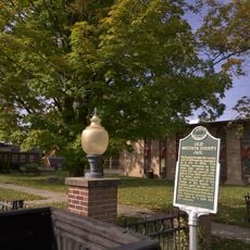
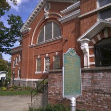
Marlborough Historic District, Historic district in Pleasant Plains Township, United States.

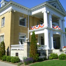
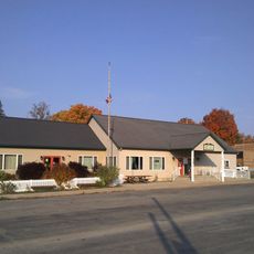
Marlborough Historic District contains multiple buildings with different architectural features in Pleasant Plains Township. The structures come from different building periods and show how the area developed over several generations.

The district was added to the National Register of Historic Places because it documents America's architectural and social development. This recognition was based on detailed documentation of its importance to local history.

The buildings show construction methods and materials that reflect different phases of settlement in Michigan. You can see how building styles and design choices changed over time in the district.

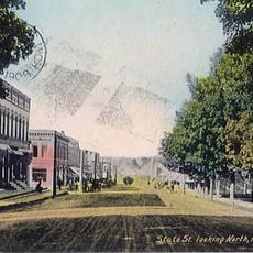
The area is easy to explore on foot and gives you views of different building styles in various locations. Visitors should allow time to walk through and explore the different buildings and their details.

Many houses show old handcrafted building techniques that are rarely seen in modern construction anymore. These forgotten methods make this place particularly interesting for those who care about how buildings were really made.

The community of curious travelers

AroundUs brings together thousands of curated places, local tips, and hidden gems, enriched daily by 60,000 contributors worldwide.

Start exploring
GPS coordinates
43.86111,-85.83806
Latest update
December 12, 2025 17:45
Around this place
White Pine Trail State Park
United States of America

White Pine Trail State Park

32.5 km
Mears State Park
United States of America

Mears State Park

48.9 km
Newaygo State Park
United States of America

Newaygo State Park

44.7 km
Udell Lookout Tower
United States of America

Udell Lookout Tower

43.9 km
Mason County Courthouse
United States of America

Mason County Courthouse

49.7 km
Warren A. and Catherine Cartier House
United States of America

Warren A. and Catherine Cartier House

49.6 km
Dumaw Creek Site
United States of America

Dumaw Creek Site

43.5 km
Scottville School
United States of America

Scottville School

37 km
Hart Downtown Historic District
United States of America

Hart Downtown Historic District

45.8 km
Nisbett Building
United States of America

Nisbett Building

33.9 km
Jared H. Gay House
United States of America

Jared H. Gay House

33.5 km
Fremont High School
United States of America

Fremont High School

44.7 km
Navigation Structures at Pentwater Harbor
United States of America

Navigation Structures at Pentwater Harbor

49.2 km
East Ludington Avenue Historic District
United States of America

East Ludington Avenue Historic District

49.4 km
Jim Crow Museum of Racist Memorabilia
United States of America

Jim Crow Museum of Racist Memorabilia

34.5 km
Pentwater South Pierhead Light
United States of America

Pentwater South Pierhead Light

49.5 km
Pentwater North Pierhead Light
United States of America

Pentwater North Pierhead Light

49.4 km
Big Rapids Community Library
United States of America

Big Rapids Community Library

34.2 km
Ludington Public Library
United States of America

Ludington Public Library

49.8 km
AMC Classic Big Rapids 4
United States of America

AMC Classic Big Rapids 4

34 km
White Cloud Community Library
United States of America

White Cloud Community Library

35 km
Pentwater Light
United States of America

Pentwater Light

49.5 km
Hardy Hydroelectric Plant‎ historical marker
United States of America

Hardy Hydroelectric Plant‎ historical marker

45.1 km
Croton Township Library
United States of America

Croton Township Library

49.2 km
Old Mecosta County Jail Historical Marker
United States of America

Old Mecosta County Jail Historical Marker

34.2 km
Luther Area Public Library
United States of America

Luther Area Public Library

23.1 km
First United Methodist Church Historical Marker
United States of America

First United Methodist Church Historical Marker

34.1 km
Udell Rollways Day Use Area
United States of America

Udell Rollways Day Use Area

48.2 km
Show the full map
« Marlborough Historic District - Historic district in Pleasant Plains Township, United States » is provided by Around Us (aroundus.com). Images and texts are derived from Wikimedia project under a Creative Commons license. You are allowed to copy, distribute, and modify copies of this page, under the conditions set by the license, as long as this note is clearly visible.

Discover hidden gems everywhere you go!

From secret cafés to breathtaking viewpoints, skip the crowded tourist spots and find places that match your style. Our app makes it easy with voice search, smart filtering, route optimization, and insider tips from travelers worldwide. Download now for the complete mobile experience.

Around Us App Screenshot

A unique approach to discovering new places

Le Figaro

All the places worth exploring

France Info

A tailor-made excursion in just a few clicks

20 Minutes

Around Us
Travel Guide & Maps
Download

Send to your phone

QR Code
1

Open the camera app on your mobile.

2

Point at the QR code with your camera. A notification will appear.

3

Tap the notification to open the link.