Enable Location

We need your location to show you interesting places around you

Discover nearby places

Find interesting locations and hidden gems around you

Precise directions

Get accurate directions and distances to places

Your location is never shared with other users. It's only used when you tap the location button.

Mears State Park

Log in to your account

Start exploring — it's free

Trusted by 61,913 travelers worldwide

Continue with Google
Continue with Apple
or

We will send you a code to connect

By continuing, you accept our Terms and Conditions and our Privacy Policy

Check your inbox

We've sent a pincode in your inbox. Please enter the code below.

Mears State Park

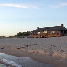
Mears State Park, State park in Pentwater, United States.

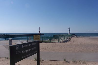
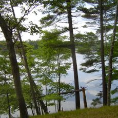
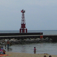
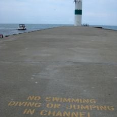
Mears State Park is a waterfront recreation area along Lake Michigan featuring a sandy beach, camping facilities, and a channel that connects to Pentwater Lake. The park covers about 50 acres and provides multiple outdoor activities centered on the shoreline.

The park was established in 1923 when Carrie Mears, daughter of a lumber merchant, donated the initial lakeside acres to the state. This gift marked the beginning of what would become the present-day recreation area.

The park serves as a central gathering place for summer recreation, connecting visitors to Michigan's maritime heritage through its waterfront location.

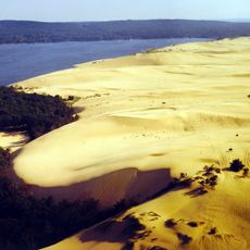
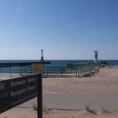
The park offers a swimming beach, a fishing pier, and a hiking trail of about one mile leading to the Old Baldy sand dune overlook. Wind can be strong along the shoreline, so visitors may want to bring extra layers and plan activities accordingly.

In the early 1920s, marsh hay was distributed across the park's sandy grounds to combat wind erosion and stabilize the shifting dunes. This resourceful approach to land management shows how early park managers addressed environmental challenges creatively.

The community of curious travelers

AroundUs brings together thousands of curated places, local tips, and hidden gems, enriched daily by 60,000 contributors worldwide.

Start exploring
Location
Inception
1923
GPS coordinates
43.78340,-86.43770
Latest update
December 12, 2025 09:01
Around this place
SS Badger
United States of America

SS Badger

18.5 km
United States of America

Michigan's Adventure

50.2 km
Silver Lake State Park
United States of America

Silver Lake State Park

13.1 km
Big Sable Point Light
United States of America

Big Sable Point Light

31.1 km
Owasippe Scout Reservation
United States of America

Owasippe Scout Reservation

44.9 km
Duck Lake State Park
United States of America

Duck Lake State Park

48.7 km
Marlborough Historic District
United States of America

Marlborough Historic District

48.9 km
Michillinda Lodge
United States of America

Michillinda Lodge

48.2 km
White River Light
United States of America

White River Light

45.5 km
Mason County Courthouse
United States of America

Mason County Courthouse

19.1 km
Ludington State Park Beach House
United States of America

Ludington State Park Beach House

28.3 km
Warren A. and Catherine Cartier House
United States of America

Warren A. and Catherine Cartier House

19.2 km
Dumaw Creek Site
United States of America

Dumaw Creek Site

5.8 km
Scottville School
United States of America

Scottville School

23.1 km
Hart Downtown Historic District
United States of America

Hart Downtown Historic District

10.8 km
Jared H. Gay House
United States of America

Jared H. Gay House

16.1 km
Charles Mears Silver Lake Boardinghouse
United States of America

Charles Mears Silver Lake Boardinghouse

16.3 km
Ludington United States Coast Guard Station
United States of America

Ludington United States Coast Guard Station

19 km
Navigation Structures at Pentwater Harbor
United States of America

Navigation Structures at Pentwater Harbor

357 m
East Ludington Avenue Historic District
United States of America

East Ludington Avenue Historic District

19.2 km
John C. and Augusta Lewis House
United States of America

John C. and Augusta Lewis House

42.5 km
Little Sable Point Light
United States of America

Little Sable Point Light

16.8 km
Thoroughbred Golf Club
United States of America

Thoroughbred Golf Club

28.1 km
Ludington Light
United States of America

Ludington Light

19.1 km
Ludington State Park
United States of America

Ludington State Park

29.2 km
Pentwater South Pierhead Light
United States of America

Pentwater South Pierhead Light

554 m
Pentwater North Pierhead Light
United States of America

Pentwater North Pierhead Light

507 m
Ludington Public Library
United States of America

Ludington Public Library

19.2 km
Show the full map
« Mears State Park - State park in Pentwater, United States » is provided by Around Us (aroundus.com). Images and texts are derived from Wikimedia project under a Creative Commons license. You are allowed to copy, distribute, and modify copies of this page, under the conditions set by the license, as long as this note is clearly visible.

Discover hidden gems everywhere you go!

From secret cafés to breathtaking viewpoints, skip the crowded tourist spots and find places that match your style. Our app makes it easy with voice search, smart filtering, route optimization, and insider tips from travelers worldwide. Download now for the complete mobile experience.

Around Us App Screenshot

A unique approach to discovering new places

Le Figaro

All the places worth exploring

France Info

A tailor-made excursion in just a few clicks

20 Minutes

Around Us
Travel Guide & Maps
Download

Send to your phone

QR Code
1

Open the camera app on your mobile.

2

Point at the QR code with your camera. A notification will appear.

3

Tap the notification to open the link.