Chest opened
+${chestReward.xp} XP
Explorer
NOUVEAU ×${chestReward.collectible.quantity}
tapez pour fermer
Chest locked

Open chests in the app

Around Us is built for your phone — chests unlock when you walk, explore and capture nearby places.

Enable Location

We need your location to show you interesting places around you

Discover nearby places

Find interesting locations and hidden gems around you

Precise directions

Get accurate directions and distances to places

Your location is never shared with other users. It's only used when you tap the location button.

Log in to your account

Start exploring — it's free

Trusted by 72,906 travelers worldwide

Continue with Google
Continue with Apple
or

We will send you a code to connect

By continuing, you accept our Terms and Conditions and our Privacy Policy

Check your inbox

We've sent a pincode in your inbox. Please enter the code below.

Woodbury Point
Discussion Reviews Photo
2.5k Popularity

Woodbury Point, Historic peninsula in Beverly, Massachusetts.

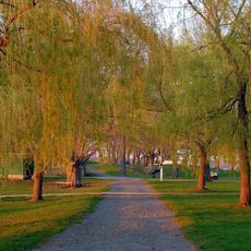
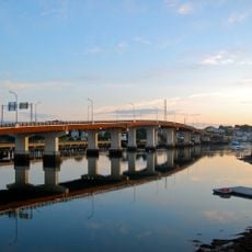
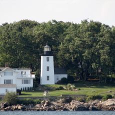
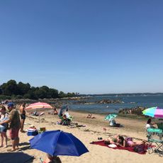
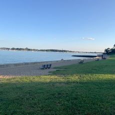
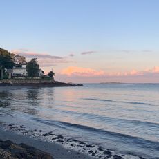
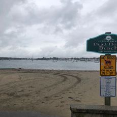
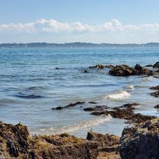
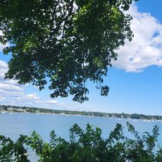
Woodbury Point is a small peninsula on Mackerel Cove in Beverly that projects into the harbor and is now part of Lynch Park open to the public. The property features manicured gardens, walking paths, and waterfront views that showcase its developed landscape.

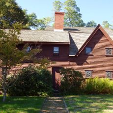
The Woodbury family established their estate here in the 1600s during Beverly's early European settlement. The site later became a prestigious summer residence favored by prominent families from the region's upper class.

Today visitors come to enjoy waterfront recreation and explore the manicured gardens that reflect the property's past as a retreat for the wealthy elite. The landscaped grounds reveal how the peninsula once served as a private escape from city life.

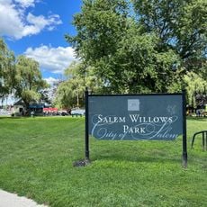
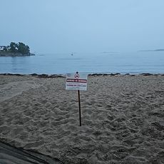
Lynch Park is open year-round with free public access to the waterfront area, gardens, and recreation facilities. Wear appropriate footwear when exploring the grounds and paths, as conditions can vary with the weather and season.

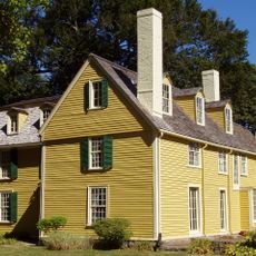
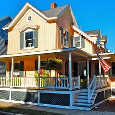
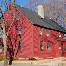
The original residence that once stood here was moved to nearby Marblehead where it remains preserved as a reminder of the region's architectural past. This relocation reveals how the site's history connects with other coastal communities in the area.

The community of curious travelers

AroundUs brings together thousands of curated places, local tips, and hidden gems, enriched daily by 60,000 contributors worldwide.

Start exploring
Location
GPS coordinates
42.54530,-70.86090
Latest update
December 12, 2025 17:43
Around this place
Salem Willows
United States of America

Salem Willows

1.3 km
Cabot Street Cinema Theatre
United States of America

Cabot Street Cinema Theatre

1.6 km
John Balch House
United States of America

John Balch House

2.7 km
John Cabot House
United States of America

John Cabot House

1.6 km
Salem Willows Beach
United States of America

Salem Willows Beach

1.2 km
John Hale House
United States of America

John Hale House

1.2 km
Veterans Memorial Bridge
United States of America

Veterans Memorial Bridge

2.3 km
United States of America

Juniper Cove

1.6 km
Hospital Point Range Front Light
United States of America

Hospital Point Range Front Light

428 m
Fort Pickering Light
United States of America

Fort Pickering Light

2.1 km
Waikiki Beach
United States of America

Waikiki Beach

2 km
Odd Fellows' Hall
United States of America

Odd Fellows' Hall

1.5 km
Hospital Point Range Rear Light
United States of America

Hospital Point Range Rear Light

1.5 km
Salem Willows Historic District
United States of America

Salem Willows Historic District

1.6 km
United States Post Office
United States of America

United States Post Office

1.9 km
Beverly Powder House
United States of America

Beverly Powder House

1.5 km
Beverly Grammar School
United States of America

Beverly Grammar School

1.4 km
Fish Flake Hill Historic District
United States of America

Fish Flake Hill Historic District

1.9 km
William Livermore House
United States of America

William Livermore House

2.4 km
Beverly Center Business District
United States of America

Beverly Center Business District

1.4 km
Hazadiah Smith House
United States of America

Hazadiah Smith House

1.8 km
Beverly Depot-Odell Park Historic District
United States of America

Beverly Depot-Odell Park Historic District

2 km
Dane Street Beach
United States of America

Dane Street Beach

1.1 km
Rice's Beach
United States of America

Rice's Beach

278 m
Dead Horse Beach
United States of America

Dead Horse Beach

1.7 km
Mingo Beach
United States of America

Mingo Beach

1.9 km
Fort Pickering Beach
United States of America

Fort Pickering Beach

1.4 km
Patch Beach
United States of America

Patch Beach

883 m
Show the full map
Reviews
Share your experience

No review yet

Discussions
Start a discussion...

No discussion yet

« Woodbury Point - Historic peninsula in Beverly, Massachusetts » is provided by Around Us (aroundus.com). Images and texts are derived from Wikimedia project under a Creative Commons license. You are allowed to copy, distribute, and modify copies of this page, under the conditions set by the license, as long as this note is clearly visible.

Discover hidden gems everywhere you go!

From secret cafés to breathtaking viewpoints, skip the crowded tourist spots and find places that match your style. Our app makes it easy with voice search, smart filtering, route optimization, and insider tips from travelers worldwide. Download now for the complete mobile experience.

Around Us App Screenshot

A unique approach to discovering new places

Le Figaro

All the places worth exploring

France Info

A tailor-made excursion in just a few clicks

20 Minutes

Around Us
Travel Guide & Maps
Download

Send to your phone

QR Code
1

Open the camera app on your mobile.

2

Point at the QR code with your camera. A notification will appear.

3

Tap the notification to open the link.