Chest opened
+${chestReward.xp} XP
Explorer
NOUVEAU ×${chestReward.collectible.quantity}
tapez pour fermer
Chest locked

Open chests in the app

Around Us is built for your phone — chests unlock when you walk, explore and capture nearby places.

Enable Location

We need your location to show you interesting places around you

Discover nearby places

Find interesting locations and hidden gems around you

Precise directions

Get accurate directions and distances to places

Your location is never shared with other users. It's only used when you tap the location button.

Thoroughfare Gap Battlefield

Log in to your account

Start exploring — it's free

Trusted by 72,930 travelers worldwide

Continue with Google
Continue with Apple
or

We will send you a code to connect

By continuing, you accept our Terms and Conditions and our Privacy Policy

Check your inbox

We've sent a pincode in your inbox. Please enter the code below.

Discussion Reviews 1 Photos
1.5k Popularity

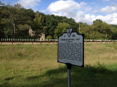
Thoroughfare Gap Battlefield, Civil War battlefield in Broad Run, United States.

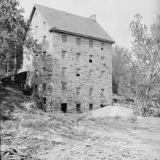
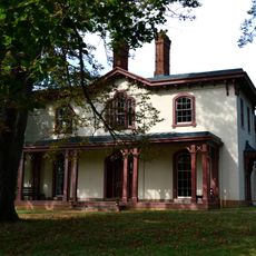
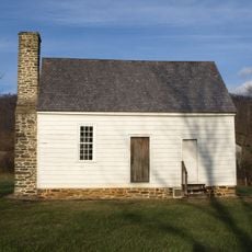
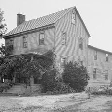
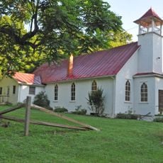
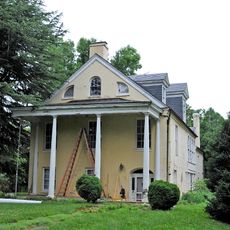
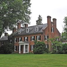
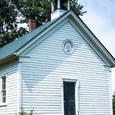
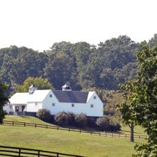
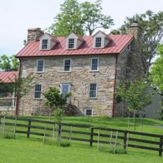
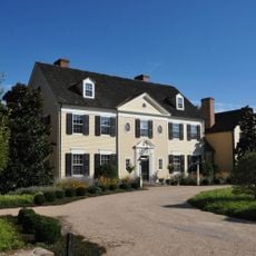
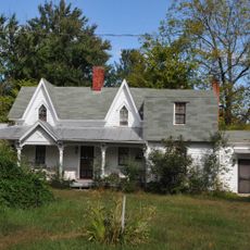
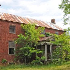
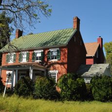
Thoroughfare Gap Battlefield is a 514-acre site with historic stone structures, including the five-story Beverley Mill positioned along the north side of this mountain pass. The land encompasses multiple buildings scattered across the terrain where Union and Confederate forces once clashed.

In August 1862, Confederate forces under General James Longstreet successfully defended this mountain pass against Union troops commanded by Brigadier General James Ricketts. The victory allowed Southern forces to continue their campaigns in northern Virginia.

The structures on this land reflect how civilians and soldiers coexisted in this mountain pass during the Civil War era. The mill and farm buildings show the daily lives of people who worked and lived here before and during the conflict.

The site is best explored on foot using marked trails north of Interstate 66 on Beverly Mill Drive. Information markers positioned along the roads help visitors understand the layout and significance of different areas.

Chapman's Mill served a strategic purpose during the fighting, as its upper windows provided vantage points for defenders. The height advantage allowed soldiers to monitor and control movement through the pass below.

The community of curious travelers

AroundUs brings together thousands of curated places, local tips, and hidden gems, enriched daily by 60,000 contributors worldwide.

Start exploring
GPS coordinates
38.82500,-77.71310
Latest update
December 14, 2025 15:01
Around this place
United States of America

Lake Manassas

8.2 km
Beverley Mill
United States of America

Beverley Mill

206 m
Brentmoor
United States of America

Brentmoor

14.3 km
The Hollow
United States of America

The Hollow

1.7 km
The Lawn
United States of America

The Lawn

10.2 km
Warrenton Historic District
United States of America

Warrenton Historic District

14.5 km
Old Fauquier County Jail
United States of America

Old Fauquier County Jail

14.3 km
Marshall Historic District
United States of America

Marshall Historic District

13.1 km
Mt. Atlas
United States of America

Mt. Atlas

6.5 km
Ashville Historic District
United States of America

Ashville Historic District

14.6 km
Monterosa
United States of America

Monterosa

15.1 km
Hopefield
United States of America

Hopefield

10.3 km
Loretta
United States of America

Loretta

12.1 km
Number 18 School in Marshall
United States of America

Number 18 School in Marshall

11.4 km
Yorkshire House
United States of America

Yorkshire House

13.4 km
Paradise
United States of America

Paradise

14.1 km
Galemont
United States of America

Galemont

2.1 km
Burrland Farm Historic District
United States of America

Burrland Farm Historic District

13.7 km
St. Paul's Episcopal Church
United States of America

St. Paul's Episcopal Church

6.3 km
Morgantown Historic District
United States of America

Morgantown Historic District

14.3 km
Broad Run-Little Georgetown Rural Historic District
United States of America

Broad Run-Little Georgetown Rural Historic District

3.6 km
Green Pastures (Middleburg, Virginia)
United States of America

Green Pastures (Middleburg, Virginia)

14.4 km
Old Denton
United States of America

Old Denton

12.3 km
Sumerduck Historic District
United States of America

Sumerduck Historic District

10.9 km
Mount Pleasant Baptist Church and Cemetery
United States of America

Mount Pleasant Baptist Church and Cemetery

7.6 km
Locust Bottom
United States of America

Locust Bottom

9.8 km
Orlean Historic District
United States of America

Orlean Historic District

10.9 km
New Baltimore Historic District
United States of America

New Baltimore Historic District

6.5 km
Show the full map
Reviews
Share your experience

No review yet

Discussions
Start a discussion...

No discussion yet

« Thoroughfare Gap Battlefield - Civil War battlefield in Broad Run, United States » is provided by Around Us (aroundus.com). Images and texts are derived from Wikimedia project under a Creative Commons license. You are allowed to copy, distribute, and modify copies of this page, under the conditions set by the license, as long as this note is clearly visible.

Discover hidden gems everywhere you go!

From secret cafés to breathtaking viewpoints, skip the crowded tourist spots and find places that match your style. Our app makes it easy with voice search, smart filtering, route optimization, and insider tips from travelers worldwide. Download now for the complete mobile experience.

Around Us App Screenshot

A unique approach to discovering new places

Le Figaro

All the places worth exploring

France Info

A tailor-made excursion in just a few clicks

20 Minutes

Around Us
Travel Guide & Maps
Download

Send to your phone

QR Code
1

Open the camera app on your mobile.

2

Point at the QR code with your camera. A notification will appear.

3

Tap the notification to open the link.