Maquinna Protected Area, protected area in British Columbia, Canada
Location: Alberni-Clayoquot Regional District
GPS coordinates: 49.37167,-126.27667
Latest update: November 24, 2023 23:42
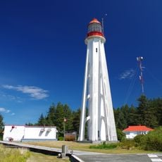
Estevan Point lighthouse
19.4 km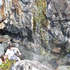
Ramsay Hot Springs
2.5 km
Vargas Island Provincial Park
28 km
Hesquiat Peninsula Provincial Park
19.1 km
Sydney Inlet Provincial Park
12.1 km
Gibson Marine Provincial Park
19.2 km
Wildside
19.2 km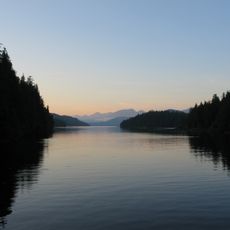
Flores Island Provincial Park
11.2 km
Bligh Island Marine Provincial Park
34.9 km
Epper Passage Provincial Park
29.1 km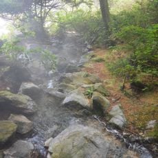
Maquinna Marine Provincial Park
5.7 km
Hesquiat Lake Provincial Park
16.6 km
Muchalat Inlet
30.7 km
Sulphur Passage Provincial Park
8.4 km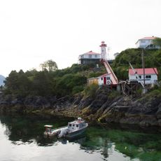
Nootka Lighthouse
34.7 km
Megin River Ecological Reserve
15.5 km
Cleland Island Ecological Reserve
26 km
Hesquiat Bar
10.7 km
Bare Bluff
34.7 km
Whaler's Shrine Site
34.7 km
Cable Beach
22.3 km
Scenic viewpoint
32.3 km
Scenic viewpoint
32.3 km
Medallion Beach
32.8 km
Scenic viewpoint
32.2 km
Scenic viewpoint
32.2 km
Scenic viewpoint
2.1 km
Shark Creek Falls
15.5 kmReviews
Visited this place? Tap the stars to rate it and share your experience / photos with the community! Try now! You can cancel it anytime.
Discover hidden gems everywhere you go!
From secret cafés to breathtaking viewpoints, skip the crowded tourist spots and find places that match your style. Our app makes it easy with voice search, smart filtering, route optimization, and insider tips from travelers worldwide. Download now for the complete mobile experience.

A unique approach to discovering new places❞
— Le Figaro
All the places worth exploring❞
— France Info
A tailor-made excursion in just a few clicks❞
— 20 Minutes