Großer Picho, Mountain peak in Bautzen District, Germany.
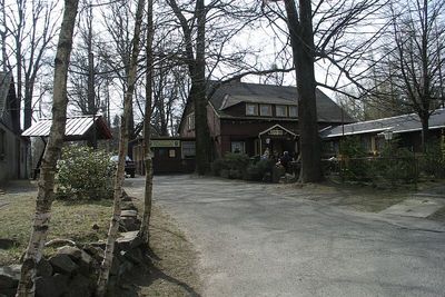
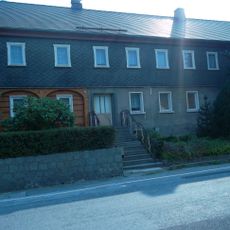
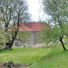
The Großer Picho rises to an elevation of 498.6 meters within the Lusatian Highlands, featuring natural pathways through mixed forest terrain.
The mountain has long served as a geographical marker in southeastern Germany, helping travelers navigate through the Lusatian region since medieval times.
Local residents refer to the mountain as Wulki Pichow in Upper Sorbian language, reflecting the strong presence of Sorbian culture in this area.
Visitors can access the mountain via the Pumphutsteig trail, which leads to the Berggasthof Pichobaude restaurant at the Bautzenblick viewpoint.
The summit provides views across multiple German states and into neighboring countries, making it a reference point for geographical surveys.
Location: Bautzen District
Elevation above the sea: 498.6 m
Shares border with: Arnsdorf/Warnoćicy
GPS coordinates: 51.10882,14.35535
Latest update: March 17, 2025 20:01
Wohnstallhaus (Umgebinde) Irgersdorf 30
2.2 km
Gefallenendenkmal Dretschen
1.8 km
Denkmal für die Gefallenen des Ersten Weltkrieges in Tautewalde
1.1 km
Einbogige Brücke (zwischen km 17,0 und 17,2)
1.3 km
Buchenwaldgebiet Wilthen
1.3 km
Wilthener Straße 18
1.1 km
Dorfteich mit Resten der Einfassungsmauer in Tautewalde
1.1 km
Tautewalde Erbgericht
1.1 km
Bauernhaus Tautewalde 59
1.1 km
Tautewalde 50
1.2 km
Tautewalde 40
1.2 km
Brennerei-Kelterei; Wohnhaus mit Einfriedung, Kelterei und Nebengebäude Oststraße 17
2.1 km
Rittergut und Gutspark Arnsdorf bei Bautzen (Sachgesamtheit) Wilthener Straße 2, 4, 6, 8, 10, 12 (im Park des ehemaligen Rittergutes)
1.2 km
Wohnhaus in offener Bebauung, mit Windfang und Stützmauer mit Tür Wilthener Straße 49
2.1 km
Wohnstallhaus (Umgebinde) Tautewalde 13
976 m
Wohnstallhaus (Umgebinde) und Granittrog Neukircher Straße 46
1.8 km
Wohnstallhaus (Umgebinde) Michael-Rostock-Straße 10
1.8 km
Rittergut Arnsdorf
1.2 km
Wassereinzugshäuschen
665 m
Neukircher Straße 59
2 km
Schule und Trog Tautewalde 24b
1.1 km
Gasthof „Zwei Linden“ mit Tanzsaal und Stall Oststraße 27
2 km
Wegestein Wilthener Straße, gegenüber dem Kriegerdenkmal
1.1 km
Denkmal für die Gefallenen des Ersten Weltkrieges Wilthener Straße, Kreuzung Soraer Straße
1.1 km
Peter-Heim; Großes Wohnhaus Wilthener Straße 71
1.8 km
Wohnhaus in offener Bebauung Wilthener Straße 68
2 km
Schullandheim; Schulgebäude mit Einfriedung Wilthener Straße 55
2 km
Wohnstallhaus und Scheune sowie mehrere Granitpfosten der Einfriedung Wilthener Straße 18
1.1 kmReviews
Visited this place? Tap the stars to rate it and share your experience / photos with the community! Try now! You can cancel it anytime.
Discover hidden gems everywhere you go!
From secret cafés to breathtaking viewpoints, skip the crowded tourist spots and find places that match your style. Our app makes it easy with voice search, smart filtering, route optimization, and insider tips from travelers worldwide. Download now for the complete mobile experience.
A unique approach to discovering new places❞
— Le Figaro
All the places worth exploring❞
— France Info
A tailor-made excursion in just a few clicks❞
— 20 Minutes