Mönchswalder Berg, Mountain summit in Bautzen District, Germany.
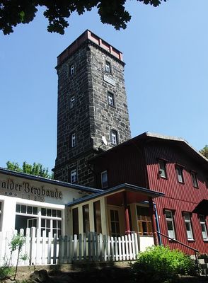
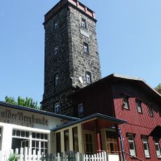
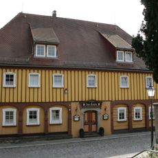
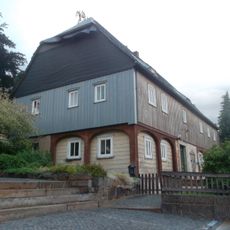
Mönchswalder Berg is a mountain summit in the Bautzen District that rises to 447 meters elevation and commands broad views across the region. On top sits a mountain lodge with a restaurant, beer garden, and observation tower that visitors can use while taking in views of Bautzen, the Lusatian Highlands, and surrounding mountain ranges.
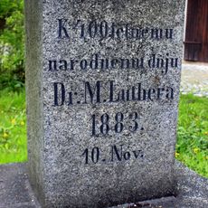
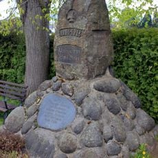
The mountain acquired its name from a small monastery established on its northern slope during the 15th century, which also led to the founding of the settlement of Mönchswalde. This monastic foundation shaped the location's identity and remains central to its history.
The Pumphut Pavilion built in the 1960s references Martin Pumphut, a legendary sorcerer from Upper Lusatia whose tales remain part of local folklore and memory. This structure has become an identifiable landmark that keeps these regional stories alive for visitors.
Visitors can hike to the summit via the Mönchswalder Straße trail, which provides a straightforward route up the mountain. Once at the top, the mountain lodge and beer garden offer a place to rest and eat after the climb.
On clear days, observers from the peak can spot around 51 different peaks in the distance, including the Jizera Mountains, Giant Mountains, Saxon Switzerland, and the Zittau ranges. This abundance of visible summits makes any visit on good weather days a special experience.
Location: Bautzen District
Elevation above the sea: 447.4 m
GPS coordinates: 51.11345,14.41267
Latest update: December 13, 2025 11:41
Bahnhof Großpostwitz
1.8 km
Bohemian Bridge
1.7 km
Evangelische Kirche Wilthen
1.6 km
Villa Hünlich; Fabrikantenvilla mit gemauertem Torbogen am Nebengebäude Schulstraße 45
1.8 km
Weinbrennerei Wilthen
1.8 km
Kocorowy pomnik
1.2 km
Villa mit Stützmauer und Einfriedung sowie Villengarten St.-Barbara-Platz 1
1.8 km
Pinkmühle
1.7 km
St.-Barbara-Platz
1.8 km
Mönchswalder Bergbaude
34 m
Talstraße 7
1.4 km
Lutherstein Spreeweg (Ecke Dorfstraße)
1.7 km
War memorial (WWI) in Berge 4
1.2 km
Herrenhaus Wilthen
1.7 km
Irgersdorf 18
1.8 km
Gefallenendenkmal Mönchswalde
1.3 km
Gasthof Zur Linde
1.7 km
Kantorenhaus
1.7 km
Wohnstallhaus (Umgebinde) Irgersdorf 12 (neben) (nördlich von Wohnhaus Nr. 12)
1.8 km
Irgersdorf 4
1.9 km
Pfarrhaus (Nr. 7) und östliches Nebengebäude (Nr. 5) Straße der Befreiung 5, 7
1.6 km
Wohnstallhaus Blumenthal 3
1.6 km
Papiermühle
1.3 km
Wohnstallhaus (Umgebinde), ohne rückwärtigen Anbau Kleinpostwitzer Weg 1
1.5 km
Irgersdorf 3
1.8 km
Wohnstallhaus (Umgebinde) Irgersdorf 12
1.8 km
Evangelische Stadtkirche und Kirchhof Wilthen mit Friedhofserweiterung (Sachgesamtheit) Straße der Befreiung 3a
1.6 km
Herrenhaus (Einzeldenkmal zu ID-Nr. 09301406) St.-Barbara-Platz 3; 3a
1.7 kmVisited this place? Tap the stars to rate it and share your experience / photos with the community! Try now! You can cancel it anytime.
Discover hidden gems everywhere you go!
From secret cafés to breathtaking viewpoints, skip the crowded tourist spots and find places that match your style. Our app makes it easy with voice search, smart filtering, route optimization, and insider tips from travelers worldwide. Download now for the complete mobile experience.
A unique approach to discovering new places❞
— Le Figaro
All the places worth exploring❞
— France Info
A tailor-made excursion in just a few clicks❞
— 20 Minutes