Wetthöhe, hill in Germany
Location: Rhineland-Palatinate
GPS coordinates: 49.22660,7.77256
Latest update: November 24, 2023 23:43
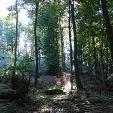
Quellgebiet der Wieslauter
2 km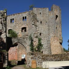
Gräfenstein Castle
2 km
Wieslauterhof
1.5 km
Schloß-Berg
2 km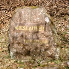
Ritterstein 230 "Wieslauter Ursprung"
1.5 km
Hanseneck
2.1 km
Ritterstein 54 Schäferei
2.1 km
Wartenberg
1.9 km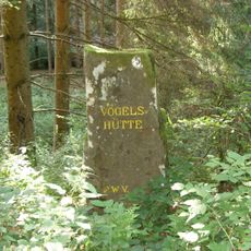
Ritterstein 38 "Vogelshütte"
1.1 km
Große Boll
1.2 km
Pfaffenberg
2 km
Wartenberg
2 km
Rotenstein
1.9 km
Weir
2 km
Weir
1.5 km
Rotenstein
1.9 km
Triangulation station, survey marker, scenic viewpoint
2 km
Weir
1.8 km
Schleiffstein
1.8 km
Ritterstein 50 "Wildsauhütte"
1.9 km
Ritterstein 40 "R. Granitzenhütte"
1.8 km
Weir
1.3 km
Hirsch
16 m
Ritterstein 39 "Kunzelmannsgut"
2.1 km
Weir
2.1 km
Waterfall
2.3 km
Ritterstein 56 "Königswoog"
2.3 km
Scenic viewpoint
2.3 kmReviews
Visited this place? Tap the stars to rate it and share your experience / photos with the community! Try now! You can cancel it anytime.
Discover hidden gems everywhere you go!
From secret cafés to breathtaking viewpoints, skip the crowded tourist spots and find places that match your style. Our app makes it easy with voice search, smart filtering, route optimization, and insider tips from travelers worldwide. Download now for the complete mobile experience.

A unique approach to discovering new places❞
— Le Figaro
All the places worth exploring❞
— France Info
A tailor-made excursion in just a few clicks❞
— 20 Minutes