Lueger Horn, Berggipfel in Deutschland
Location: Bavaria
Elevation above the sea: 1,210 m
GPS coordinates: 47.67653,12.83972
Latest update: November 21, 2025 05:44

Anthauptenalm
920 m
Röthelbachklause
2.4 km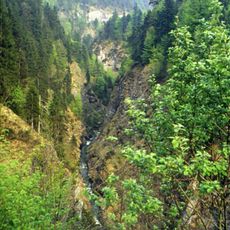
Schwarzbach
1.4 km
Kapelle St. Maria
1.2 km
Hofkapelle des Lugerbauern
1.7 km
Horn
2.4 km
Alphorn
2.2 km
Bauernhaus
1.3 km
Kreuzgruppe
1.3 km
Prechl Kopf
1.8 km
Brücke über den Staubbach
719 m
Hochmais Kopf
955 m
Vogel-Spitz
954 m
Übeleck
2.5 km
Bauernhaus
1.3 km
Kaser Anthauptenalm in Schneizlreuth
1 km
Bauernhaus
1.3 km
Ehemals Brunnhaus der Soleleitung Berchtesgaden–Reichenhall, jetzt Gasthaus
814 m
Scenic viewpoint
2.5 km
Scenic viewpoint
1.7 km
Wayside cross
655 m
Wayside shrine, Christianity
1.3 km
Bench, wayside cross
1.8 km
Wayside cross
837 m
Wayside cross
837 m
Wayside shrine, Christianity
1.9 km
Wayside cross
1.1 km
Maria bitt' für uns
2.5 kmReviews
Visited this place? Tap the stars to rate it and share your experience / photos with the community! Try now! You can cancel it anytime.
Discover hidden gems everywhere you go!
From secret cafés to breathtaking viewpoints, skip the crowded tourist spots and find places that match your style. Our app makes it easy with voice search, smart filtering, route optimization, and insider tips from travelers worldwide. Download now for the complete mobile experience.

A unique approach to discovering new places❞
— Le Figaro
All the places worth exploring❞
— France Info
A tailor-made excursion in just a few clicks❞
— 20 Minutes