
Stadel, zugehöriger Stadel mit Steilsatteldach und gebogenen Kopfbügen, 1. Drittel 19. Jahrhundert
Location: Fürstenstein
Address: Raming 3
GPS coordinates: 48.69401,13.34567
Latest update: November 14, 2025 23:57

KZ-Transport 1945 Memorial
2.2 km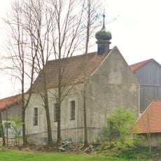
Katholische Filialkirche St. Laurentius
364 m
Wegkapelle
1.3 km
Kapelle
1.3 km
Wegkapelle
2.4 km
Kleine Weilerkapelle
1.5 km
Kleine Hofkapelle
12 m
Hoftor Ferzing 2 in Neukirchen vorm Wald
1.5 km
Cultural heritage D-2-7346-0164 in Fürstenstein
364 m
Zugehöriger altertümlicher Traidkasten
2 km
Bauernhaus eines Vierseithofes
1.3 km
Nebengebäude Ferzing 2 in Neukirchen vorm Wald
1.5 km
Bauernhaus eines Vierseithofes
2.1 km
Bildstock Raming 3 in Fürstenstein
44 m
Zum Vierseithof zugehöriger Traidkasten
1.6 km
Stattliches Bauernhaus eines Dreiseithofes
1.5 km
Cultural heritage D-2-7346-0166 in Fürstenstein
430 m
Zum Dreiseithof zugehöriger langgestreckter Stallflügel
1.6 km
Mittertennbau mit Blockbau-Obergeschoss
1.3 km
Zugehöriger Westflügel
2.1 km
Zugehöriger großer Stadel mit Steilsatteldach
2.2 km
Kleinbauernhaus
2.1 km
Bauernhaus
1.3 km
Traidkasten
1.3 km
Waldlerhaus
1.3 km
Traidkasten
1.3 km
Waldlerhaus
1.6 km
Wohnhaus
1.9 kmReviews
Visited this place? Tap the stars to rate it and share your experience / photos with the community! Try now! You can cancel it anytime.
Discover hidden gems everywhere you go!
From secret cafés to breathtaking viewpoints, skip the crowded tourist spots and find places that match your style. Our app makes it easy with voice search, smart filtering, route optimization, and insider tips from travelers worldwide. Download now for the complete mobile experience.

A unique approach to discovering new places❞
— Le Figaro
All the places worth exploring❞
— France Info
A tailor-made excursion in just a few clicks❞
— 20 Minutes