
Grenzstein am Marktfleckl
Grenzstein am Marktfleckl, mauth; Knapp einen Meter hoher, vierkantiger Stein auf dem Grenzkamm in 1300 m Höhe, auf der Südseite kurbayerisches Wappen (42 azur- und silberfarbene Rauten) und auf der Nordseite böhmisches Wappen (silberner Löwe auf Rot), bezeichnet „1772“
Location: Schönbrunner Wald
Address: Lusen-Markfleckl-Wanderwegmarkierung „Soldanelle“
GPS coordinates: 48.94211,13.50831
Latest update: November 13, 2025 12:15
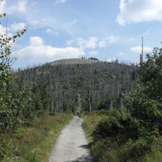
Lusen
343 m
Moorberg
1.4 km
Steinfleckberg
1.6 km
Sulzriegel
2.4 km
Waldhäuserriegel
2.6 km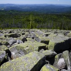
Blockmeer am Lusen
332 m
Tummelplatz
3.1 km
Luchsstein
2.1 km
Trift Heinrichsbrunner Schwarzwassergraben in Mauther Forst
3.2 km
Backhaus Tummelplatz 1 in Mauth
3.1 km
Forsthaus
3 km
Hochgfeichtstein
2.3 km
Farrenberg
3 km
Teufelsloch
1.9 km
Wayside cross
475 m
Glasarche
1.6 km
Scenic viewpoint
1.6 km
Scenic viewpoint
1.4 km
Scenic viewpoint
1.5 km
Scenic viewpoint
1.6 km
Hirschkopfbrücke
2.5 km
Blaue Säule
1.4 km
Wayside cross
352 m
Wayside cross
1.8 km
Wildererkreuz (Franz Kubitscheck-1941)
2.8 km
Heiligenberger Kreuz
1.8 km
Erbaut 1951 - (Steintafel)
2.5 km
Waterfall
2.4 kmReviews
Visited this place? Tap the stars to rate it and share your experience / photos with the community! Try now! You can cancel it anytime.
Discover hidden gems everywhere you go!
From secret cafés to breathtaking viewpoints, skip the crowded tourist spots and find places that match your style. Our app makes it easy with voice search, smart filtering, route optimization, and insider tips from travelers worldwide. Download now for the complete mobile experience.

A unique approach to discovering new places❞
— Le Figaro
All the places worth exploring❞
— France Info
A tailor-made excursion in just a few clicks❞
— 20 Minutes