Enable Location

We need your location to show you interesting places around you

Discover nearby places

Find interesting locations and hidden gems around you

Precise directions

Get accurate directions and distances to places

Your location is never shared with other users. It's only used when you tap the location button.

Neuenstadt am Kocher

Log in to your account

Start exploring — it's free

Trusted by 65,699 travelers worldwide

Continue with Google
Continue with Apple
or

We will send you a code to connect

By continuing, you accept our Terms and Conditions and our Privacy Policy

Check your inbox

We've sent a pincode in your inbox. Please enter the code below.

Discussion Reviews 1 Photos
17.2k Popularity

Neuenstadt am Kocher, municipality in Germany

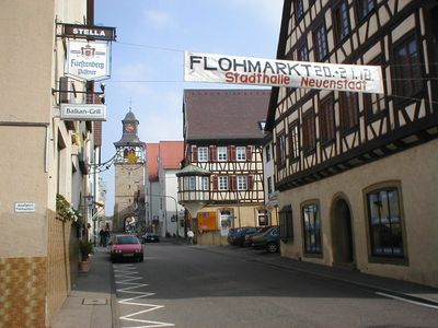
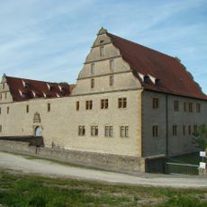
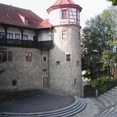
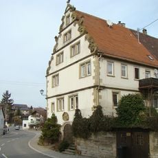
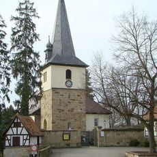
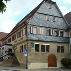
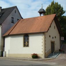
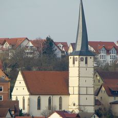
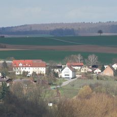
Neuenstadt am Kocher is a small town in the Heilbronn district, situated along the Kocher River and made up of several districts including Burg, Cleversulzbach, Kocherturn, and Stein am Kocher. The old town center is laid out along narrow streets with half-timbered houses, a section of old city walls, and a gate tower that faces the river.

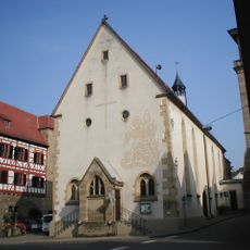
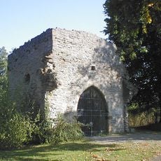
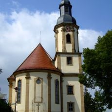
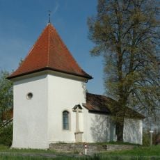
The settlement was first recorded in 797 under the name Helmbund, and the remains of a Gothic church can still be seen at that original site. Around 500 years later, the town moved to its current location, and the name Neuenstadt reflects that relocation.

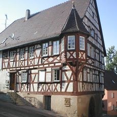
The town's name reflects its founding as a new settlement in the 16th century after the original location was abandoned. In the old town, half-timbered houses with visible wooden beams line the streets and show how local building traditions have survived across centuries.

The town can be reached by train, car, or bicycle, and a visitor office in the old Kegelbahn building hands out maps and information about the area. Walking and cycling paths run along the Kocher River and through the surrounding countryside, and most routes are easy enough for a casual outing.

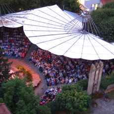
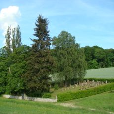
In the town park, a memorial marks the spot where a linden tree stood for around 1000 years before being struck by lightning in 1945, with nearly 100 stone columns carved with coats of arms now standing in its place. The poet Eduard Morike mentioned the town in a poem written in 1834, and visitors today can follow a dedicated walking route called the Morike Path that traces his connection to the area.

The community of curious travelers

AroundUs brings together thousands of curated places, local tips, and hidden gems, enriched daily by 60,000 contributors worldwide.

Start exploring
Location
Location
Neuenstadt am Kocher VVG
Elevation above the sea
187 m
GPS coordinates
49.23333,9.33333
Latest update
March 3, 2026 10:14
Reviews
Share your experience

No review yet

Discussions
Start a discussion...

No discussion yet

« Neuenstadt am Kocher - municipality in Germany » is provided by Around Us (aroundus.com). Images and texts are derived from Wikimedia project under a Creative Commons license. You are allowed to copy, distribute, and modify copies of this page, under the conditions set by the license, as long as this note is clearly visible.

Discover hidden gems everywhere you go!

From secret cafés to breathtaking viewpoints, skip the crowded tourist spots and find places that match your style. Our app makes it easy with voice search, smart filtering, route optimization, and insider tips from travelers worldwide. Download now for the complete mobile experience.

Around Us App Screenshot

A unique approach to discovering new places

Le Figaro

All the places worth exploring

France Info

A tailor-made excursion in just a few clicks

20 Minutes

Around Us
Travel Guide & Maps
Download

Send to your phone

QR Code
1

Open the camera app on your mobile.

2

Point at the QR code with your camera. A notification will appear.

3

Tap the notification to open the link.