Rauschwalde, Residential district in Görlitz, Germany
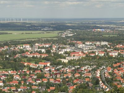
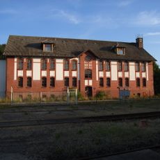
Rauschwalde is a residential district of Görlitz that displays varied architectural styles, from late 19th-century structures to 1960s apartment blocks. The area sits at roughly 200 meters elevation and shows a blend of different building periods.
The area was first mentioned in records as Rushenwalde in 1310 and existed as a separate village. It was incorporated into the city of Görlitz in 1925 and has remained part of it since then.
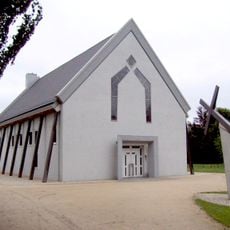
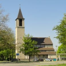
Two churches shape community life here: the Protestant Christuskirche built in 1938 and the Catholic Hedwig Church, reconstructed in 1997. Both serve as gathering places where residents practice their faith and connect with neighbors.
The district connects to central Görlitz through several bus lines, which took over after the tram system stopped operating in 1986. Public transport makes it easy to reach other parts of the city from here.
A major housing estate with roughly 1500 apartments took shape between 1975 and 1977 near Karl-Eichler-Straße, becoming the city's second-largest residential complex. This large-scale project continues to define the district's character today.
Location: Görlitz
Elevation above the sea: 200 m
GPS coordinates: 51.14083,14.94583
Latest update: December 14, 2025 09:44
Biesnitz
992 m
St. Hedwig
614 m
Christuskirche (Görlitz)
343 m
Versuchsanlage Schlauroth
1.1 km
Stelen der Erinnerung
1.5 km
Wasserturm Rosenhof Görlitz
1.2 km
Hohenzollernburg; Gasthof mit Saal und Turm Promenadenstraße 60
595 m
Schule Paul-Taubadel-Straße 3
318 m
Doppelwohnhaus mit Einfriedung Biesnitzer Straße 56, 57
1.4 km
Wohnhaus und Einfriedungsmauer Friedersdorfer Straße 8
1.2 km
Wohnhaus Promenadenstraße 106
833 m
Wohnhaus (Nr. 65) und Stallgewölbe (in Nr. 63i und k) Walther-Rathenau-Straße 63i, 63k, 65
715 m
Wohnhaus Promenadenstraße 122
1 km
Loensches Gut
1.5 km
Denkmal eines Kesselschmieds, aus Lauchhammer Eisenguss Promenadenstraße (bei Einmündung Friesenstraße)
580 m
Wohnhaus und Einfriedung, Doppelwohnhaus mit Pestalozzistraße 1 Biesnitzer Straße 58
1.4 km
Mietshaus, nach links in geschlossener Bebauung Friesenstraße 5
543 m
Villa Elfriede / Ilse Promenadenstraße 64
584 m
Denkmal für die Gefallenen des Ersten Weltkrieges mit umgebender Baumpflanzung Diesterwegplatz (in der Platzmitte)
343 m
Touristenheim; Gasthof mit vorgelagerter Holzveranda Promenadenstraße 120
968 m
Mietshaus Friesenstraße 1
568 m
Wohnhaus mit Einfriedung Friesenstraße 2
609 m
Wohnhaus und Einfriedung, Doppelwohnhaus mit Biesnitzer Straße 58 Pestalozzistraße 1
1.4 km
Ländliches Wohnhaus mit angebauter Scheune und Einfriedungsmauer Friedersdorfer Straße 10
1.2 km
Wasserturm Geschwister-Scholl-Straße 15
1.2 km
Wasserturm Stadtgraben
1.2 km
Mietshaus in geschlossener Bebauung, mit Laden Friesenstraße 3
555 m
Wohnhaus Promenadenstraße 58
632 mVisited this place? Tap the stars to rate it and share your experience / photos with the community! Try now! You can cancel it anytime.
Discover hidden gems everywhere you go!
From secret cafés to breathtaking viewpoints, skip the crowded tourist spots and find places that match your style. Our app makes it easy with voice search, smart filtering, route optimization, and insider tips from travelers worldwide. Download now for the complete mobile experience.
A unique approach to discovering new places❞
— Le Figaro
All the places worth exploring❞
— France Info
A tailor-made excursion in just a few clicks❞
— 20 Minutes