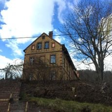
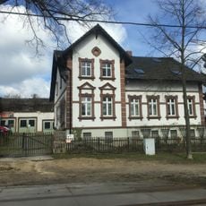
St. Hedwig, Parish church in Görlitz, Germany.
St. Hedwig is a parish church in Görlitz built from red brick with tall pointed windows and architectural elements from different construction periods. The building displays a mix of styles that developed over several decades of additions and modifications.
The church was founded to serve the Catholic population in eastern Görlitz during a period when diocesan boundaries were shifting in the region. This establishment reflects the religious reorganization of eastern Germany following major historical changes.
The church serves as a gathering place for the Catholic community and contributes to religious diversity in an area where Protestant traditions have long dominated. Visitors can observe how Catholic faith and community practices are lived out in daily life within the city.
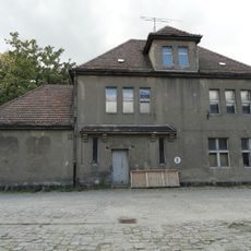
The church is accessible to visitors during specific times, particularly when religious services and masses take place according to the Catholic liturgical calendar. It is advisable to check opening times beforehand, as the building functions as an active parish center with other community activities.
The building stands as one of the few large Catholic structures in an area where Protestant churches long shaped the skyline. This minority status made the parish a special symbol of the city's religious diversity.
Location: Görlitz
GPS coordinates: 51.14540,14.94090
Latest update: December 14, 2025 17:00
Biesnitz
1.6 km
Rauschwalde
614 m
Bahnbetriebswerk Görlitz
1.6 km
Helenenbad
1.6 km
Christuskirche (Görlitz)
279 m
Versuchsanlage Schlauroth
535 m
Wasserturm Rosenhof Görlitz
1.8 km
Schule Paul-Taubadel-Straße 3
335 m
Hohenzollernburg; Gasthof mit Saal und Turm Promenadenstraße 60
1.2 km
Doppelwohnhaus mit Einfriedung Biesnitzer Straße 56, 57
1.7 km
Wohnhaus und Einfriedungsmauer Friedersdorfer Straße 8
1.6 km
Wohnhaus Promenadenstraße 106
1.4 km
Denkmal eines Kesselschmieds, aus Lauchhammer Eisenguss Promenadenstraße (bei Einmündung Friesenstraße)
1.2 km
Empfangsgebäude
1.7 km
Mietshaus, nach links in geschlossener Bebauung Friesenstraße 5
1.1 km
Denkmal für die Gefallenen des Ersten Weltkrieges mit umgebender Baumpflanzung Diesterwegplatz (in der Platzmitte)
275 m
Rittergut mit Herrenhaus mit überbauter Toreinfahrt (Nr. 63), Wirtschaftsgebäude (Nr. 65), große Scheune (Nr. 69) des westlich gelegenen Wirtschaftshofes mit Krüppelwalmdach und der im Osten des Herrenhauses gelegene kleine Gutspark mit Einfriedu
1.4 km
Villa Elfriede / Ilse Promenadenstraße 64
1.2 km
Wohnhaus mit Einfriedung Friesenstraße 2
1.2 km
Touristenheim; Gasthof mit vorgelagerter Holzveranda Promenadenstraße 120
1.4 km
Wohnhaus Promenadenstraße 122
1.4 km
Wohnhaus (Nr. 65) und Stallgewölbe (in Nr. 63i und k) Walther-Rathenau-Straße 63i, 63k, 65
1.2 km
Mietshaus Friesenstraße 1
1.2 km
Ländliches Wohnhaus mit angebauter Scheune und Einfriedungsmauer Friedersdorfer Straße 10
1.6 km
Wasserturm Geschwister-Scholl-Straße 15
1.8 km
Mietshaus in geschlossener Bebauung, mit Laden Friesenstraße 3
1.2 km
Wasserturm Stadtgraben
832 m
Wohnhaus Promenadenstraße 58
1.2 kmVisited this place? Tap the stars to rate it and share your experience / photos with the community! Try now! You can cancel it anytime.
Discover hidden gems everywhere you go!
From secret cafés to breathtaking viewpoints, skip the crowded tourist spots and find places that match your style. Our app makes it easy with voice search, smart filtering, route optimization, and insider tips from travelers worldwide. Download now for the complete mobile experience.
A unique approach to discovering new places❞
— Le Figaro
All the places worth exploring❞
— France Info
A tailor-made excursion in just a few clicks❞
— 20 Minutes