Brøndby Municipality

Log in to your account

AroundUs is a community-driven map of interesting places, built by curious explorers like you. It grows with every review, story, and photo you share.
Connect to save your favorite spots, contribute locations, and create personalized routes.
Continue with Google
Continue with Apple
Continue with X
Continue with Facebook
Continue with email
By continuing, you accept our Terms and Conditions and our Privacy Policy
Create an account
Add to collection
Map
Suggest a change
Share

Brøndby Municipality, Administrative municipality in Capital Region, Denmark

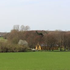
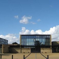
Brøndby Municipality is an administrative division in the Capital Region of Denmark, located about 13 kilometers west of Copenhagen across an area of about 21 square kilometers. The municipality is divided into three sections—Brøndbyvester, Brøndbyøster, and Brøndby Strand—each with distinct residential patterns and building types.

The municipality originated in 1842 as an administrative unit and remained independent for many years. In 2007, it became part of the newly formed Capital Region when Copenhagen County was dissolved.

The three districts each have a distinct character: Brøndbyvester shows older residential buildings, Brøndbyøster features apartment blocks, and Brøndby Strand is marked by modern high-rises where many residents have moved from other countries. Walking through these areas reveals how the built environment shapes community life and daily routines.

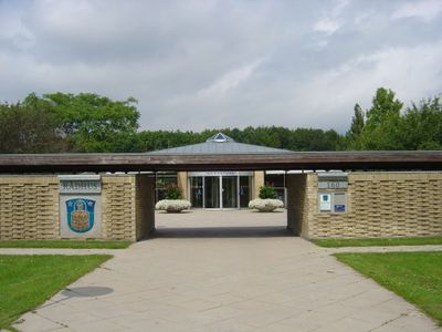
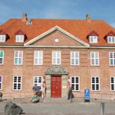
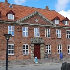
The Citizen Service center is located at RådhusPark Allé 16 and operates during weekdays for those needing municipal assistance. Since the area is divided into three districts, visitors should plan their route depending on which part they wish to explore.

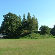
The name Brøndby means 'water well town', reflecting the historical importance of water sources in this area. Today, Brøndby Strand stands out as a place where more than half the residents have roots outside Denmark, creating a distinctly international community.

Location: Capital Region of Denmark

Inception: January 1, 1842

Capital city: Brøndbyvester

Elevation above the sea: 11 m

Shares border with: Hvidovre Municipality, Rødovre Municipality, Glostrup Municipality, Albertslund Municipality, Vallensbæk Municipality

Website: http://brondby.dk

GPS coordinates: 55.65472,12.41639

Latest update: December 7, 2025 20:24

Photos
Reviews

Visited this place? Tap the stars to rate it and share your experience / photos with the community! Try now! You can cancel it anytime.

« Brøndby Municipality - Administrative municipality in Capital Region, Denmark » is provided by Around Us (aroundus.com). Images and texts are derived from Wikimedia project under a Creative Commons license. You are allowed to copy, distribute, and modify copies of this page, under the conditions set by the license, as long as this note is clearly visible.

Discover hidden gems everywhere you go!

From secret cafés to breathtaking viewpoints, skip the crowded tourist spots and find places that match your style. Our app makes it easy with voice search, smart filtering, route optimization, and insider tips from travelers worldwide. Download now for the complete mobile experience.

Around Us App Screenshot

A unique approach to discovering new places

Le Figaro

All the places worth exploring

France Info

A tailor-made excursion in just a few clicks

20 Minutes