Enable Location

We need your location to show you interesting places around you

Discover nearby places

Find interesting locations and hidden gems around you

Precise directions

Get accurate directions and distances to places

Your location is never shared with other users. It's only used when you tap the location button.

Ben Nevis

Log in to your account

Start exploring — it's free

Trusted by 62,824 travelers worldwide

Continue with Google
Continue with Apple
or

We will send you a code to connect

By continuing, you accept our Terms and Conditions and our Privacy Policy

Check your inbox

We've sent a pincode in your inbox. Please enter the code below.

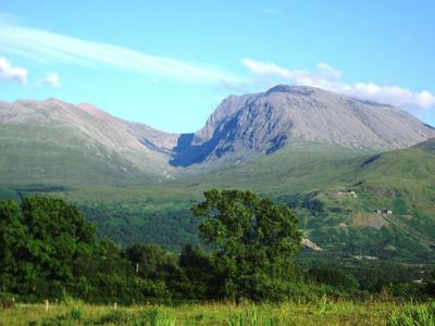
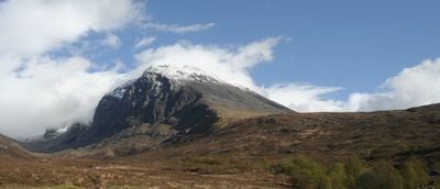
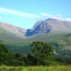
Ben Nevis, Mountain summit in Highland, United Kingdom.

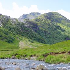
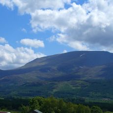
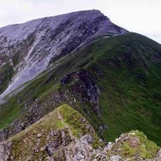
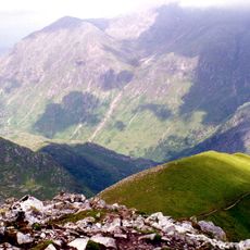
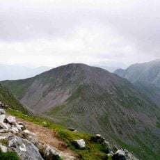
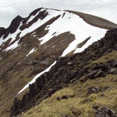
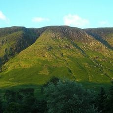
Ben Nevis reaches 1,344 meters (4,409 feet) above sea level with steep slopes of igneous rock leading to a broad rocky plateau at the top. The route from the valley floor follows a winding path over stony sections and open highland terrain.

The first documented climb took place in 1771 when Edinburgh botanist James Robertson crossed the mountain while gathering plant specimens for scientific research. Later, the slopes became the site of various competitions, including mountain races in the early 20th century.

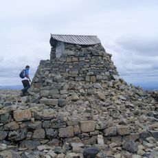
Local climbers often speak of the mountain with a mix of respect and familiarity, calling it simply 'the Ben' in everyday conversation. Many walkers carry small stones to add to the summit cairn, continuing a tradition that marks their arrival at Britain's highest point.

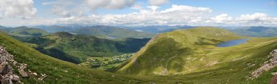
Climbers need waterproof gear, sturdy boots, navigation tools, and weather forecasts as conditions can shift quickly with fog and rain reducing visibility. The main route starts in Glen Nevis and takes between seven and nine hours for the round trip, depending on pace and rest breaks.

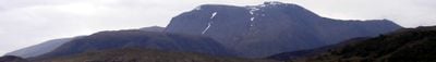
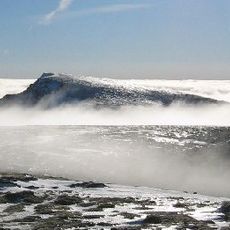
The summit hosted a weather observatory from 1883 to 1929, gathering meteorological data despite the harsh highland weather. The ruins of the observatory remain visible today, reminding visitors of this period of scientific observation at Britain's highest point.

The community of curious travelers

AroundUs brings together thousands of curated places, local tips, and hidden gems, enriched daily by 60,000 contributors worldwide.

Start exploring
Location
Location
Elevation above the sea
1,344.53 m
Accessibility
No accesible en silla de ruedas
Made from material
igneous rock
GPS coordinates
56.79686,-5.00353
Latest update
December 14, 2025 18:36
« Ben Nevis - Mountain summit in Highland, United Kingdom » is provided by Around Us (aroundus.com). Images and texts are derived from Wikimedia project under a Creative Commons license. You are allowed to copy, distribute, and modify copies of this page, under the conditions set by the license, as long as this note is clearly visible.

Discover hidden gems everywhere you go!

From secret cafés to breathtaking viewpoints, skip the crowded tourist spots and find places that match your style. Our app makes it easy with voice search, smart filtering, route optimization, and insider tips from travelers worldwide. Download now for the complete mobile experience.

Around Us App Screenshot

A unique approach to discovering new places

Le Figaro

All the places worth exploring

France Info

A tailor-made excursion in just a few clicks

20 Minutes

Around Us
Travel Guide & Maps
Download

Send to your phone

QR Code
1

Open the camera app on your mobile.

2

Point at the QR code with your camera. A notification will appear.

3

Tap the notification to open the link.