Chest opened
+${chestReward.xp} XP
Explorer
NOUVEAU ×${chestReward.collectible.quantity}
tapez pour fermer

See the monuments around you in AR Open chests in the app

Around Us is built for your phone — point your camera at the streets and discover the monuments and places around you in augmented reality. Around Us is built for your phone — chests unlock when you walk, explore and capture nearby places.

Enable Location

We need your location to show you interesting places around you

Discover nearby places

Find interesting locations and hidden gems around you

Precise directions

Get accurate directions and distances to places

Your location is never shared with other users. It's only used when you tap the location button.

Figsbury Ring

Log in to your account

Start exploring — it's free

Trusted by 83,970 travelers worldwide

Continue with Google
Continue with Apple
or

We will send you a code to connect

By continuing, you accept our Terms and Conditions and our Privacy Policy

Check your inbox

We've sent a pincode in your inbox. Please enter the code below.

Discussion Reviews 1 Photos
5.1k Popularity

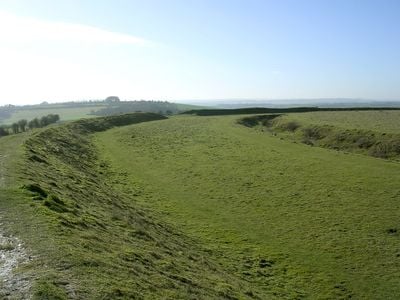
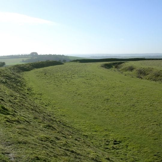
Figsbury Ring, Iron Age hillfort and Neolithic henge in Firsdown, England

Figsbury Ring is an ancient hilltop fortification with earthen ramparts and ditches built in two separate periods. The oval-shaped site shows clear traces of construction from different eras, with older structures visible beneath later defensive additions.

The site was first used in the late Neolithic period as a ritual gathering place. During the Iron Age it was transformed into a defended settlement with strengthened earthworks.

The National Trust manages this ancient monument, which contains both a late Neolithic henge and subsequent Iron Age defensive structures in one location.

The site is accessible through a latched gate with pathways crossing the earthworks that allow for flexible exploration. Visitors can easily navigate the area and enjoy views from different vantage points across the hilltop.

The inner ditch measures 14 meters wide and 4.5 meters deep, forming an oval shape of 187 meters by 151 meters within the main fortification.

The community of curious travelers

AroundUs brings together thousands of curated places, local tips, and hidden gems, enriched daily by 60,000 contributors worldwide.

Start exploring
Location
GPS coordinates
51.10335,-1.73236
Latest update
August 23, 2026 18:31
Around this place
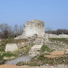
Clarendon Palace
United Kingdom

Clarendon Palace

3.7 km
Raymond McEnhill Stadium
United Kingdom

Raymond McEnhill Stadium

3.7 km
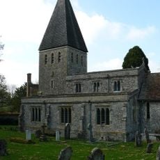
All Saints Church, Idmiston
United Kingdom

All Saints Church, Idmiston

3.6 km
Boscombe Down Aviation Collection
United Kingdom

Boscombe Down Aviation Collection

3.8 km
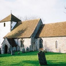
Church of St Mary the Virgin
United Kingdom

Church of St Mary the Virgin

1.7 km
Church of St Peter
United Kingdom

Church of St Peter

3.3 km
Church of St Andrew
United Kingdom

Church of St Andrew

4.1 km
Church of St Nicholas
United Kingdom

Church of St Nicholas

2.7 km
United Kingdom

Unidentified Monument 5 Metres East Of Chancel, Church Of St Mary

1.7 km
Idmiston Manor
United Kingdom

Idmiston Manor

3.6 km
Church of St Michael and All Angels
United Kingdom

Church of St Michael and All Angels

1.5 km
United Kingdom

Whittock Monument In Churchyard, 9 Metres South Of Chancel, Church Of St Peter

3.3 km
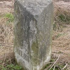
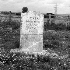
Milestone
United Kingdom

Milestone

886 m
United Kingdom

Garden Wall To Figsbury Farm

1.6 km
United Kingdom

Windmill

2.4 km
United Kingdom

Roman road between A30 main road and Winterslow Corner

1.1 km
Milestone
United Kingdom

Milestone

1 km
United Kingdom

Garden Wall To Corner Cottage

4.1 km
Milepost, Bishopdown
United Kingdom

Milepost, Bishopdown

4 km
United Kingdom

Wall To North Of Front Garden Of Church Farmhouse

3.4 km
United Kingdom

Wall, Gate Piers And Gates To The Old Rectory

3.7 km
United Kingdom

Blatch And Two Associated Monuments In Graveyard Of Former Church Of Winterbourne Dauntsey

1.7 km
United Kingdom

Gilbert Monument In Churchyard, 7 Metres North Of Chancel, Church Of All Saints

3.7 km
United Kingdom

Winterbourne War Memorial

1.5 km
United Kingdom

Two Bowle Monuments In Churchyard, 2 Metres South Of Chancel, Church Of All Saints

3.6 km
United Kingdom

Gates And Front Wall To Manor House

1.5 km
United Kingdom

Barnes Monument In Churchyard, 8.5 Metres North East Of Chancel, Church Of All Saints

3.7 km
United Kingdom

Scenic viewpoint

4 km
Show the full map
Reviews
Share your experience

No review yet

Discussions
Start a discussion...

No discussion yet

« Figsbury Ring - Iron Age hillfort and Neolithic henge in Firsdown, England » is provided by Around Us (aroundus.com). Images and texts are derived from Wikimedia project under a Creative Commons license. You are allowed to copy, distribute, and modify copies of this page, under the conditions set by the license, as long as this note is clearly visible.

Discover hidden gems everywhere you go!

From secret cafés to breathtaking viewpoints, skip the crowded tourist spots and find places that match your style. Our app makes it easy with voice search, smart filtering, route optimization, and insider tips from travelers worldwide. Download now for the complete mobile experience.

Around Us App Screenshot

A unique approach to discovering new places

Le Figaro

All the places worth exploring

France Info

A tailor-made excursion in just a few clicks

20 Minutes

Around Us
Travel Guide & Maps
Download

Send to your phone

QR Code
1

Open the camera app on your mobile.

2

Point at the QR code with your camera. A notification will appear.

3

Tap the notification to open the link.