Enable Location

We need your location to show you interesting places around you

Discover nearby places

Find interesting locations and hidden gems around you

Precise directions

Get accurate directions and distances to places

Your location is never shared with other users. It's only used when you tap the location button.

Dyce stones

Log in to your account

Start exploring — it's free

Trusted by 62,274 travelers worldwide

Continue with Google
Continue with Apple
or

We will send you a code to connect

By continuing, you accept our Terms and Conditions and our Privacy Policy

Check your inbox

We've sent a pincode in your inbox. Please enter the code below.

Dyce stones

Dyce stones, Pictish stones near St Fergus Chapel, Aberdeen, Scotland

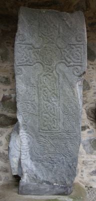
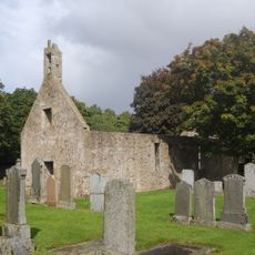
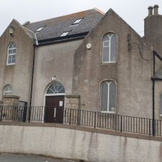
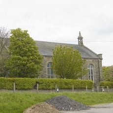
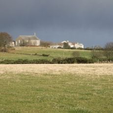
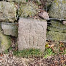
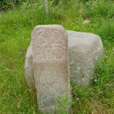
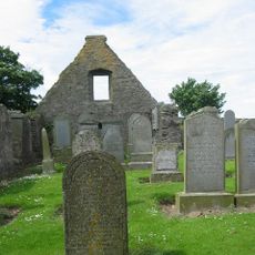
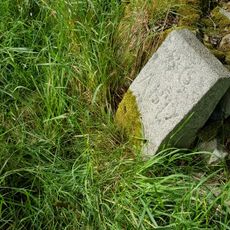
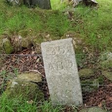
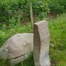
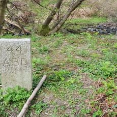
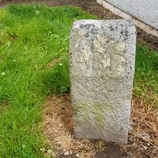
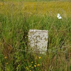
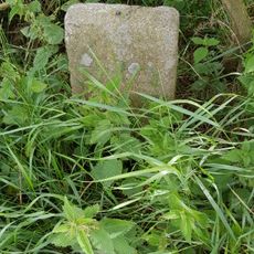
The Dyce stones are two large granite blocks with fine carvings standing at the western end of St. Fergus Chapel overlooking the River Don. They display ancient symbols, patterns, and inscriptions from early medieval Scotland.

The older stone dates to the 6th century and features a water-beast motif, while the younger one from the 7th century bears a cross with interlace patterns. Both were created when Christian and Celtic influences met in Scotland.

The stones display early medieval Scottish art through carved symbols and geometric patterns shaped by Irish missionary influence. The carvings tell of a time when artists recorded their skills in stone.

The stones remain accessible year-round within a slate-roofed shelter in a quiet setting. They are easily reached by car or on foot from the nearby village of Dyce.

Modern laser techniques have revealed hidden details in the inscriptions that are barely visible to the naked eye. This enabled experts to understand more about the original meaning and craftsmanship of these ancient objects.

The community of curious travelers

AroundUs brings together thousands of curated places, local tips, and hidden gems, enriched daily by 60,000 contributors worldwide.

Start exploring
Location
Aberdeen City
GPS coordinates
57.22926,-2.20824
Latest update
December 14, 2025 18:47
Around this place
Tyrebagger
United Kingdom

Tyrebagger

2.7 km
Dyce, Old Parish Church And Burial-ground
United Kingdom

Dyce, Old Parish Church And Burial-ground

5 m
Dyce, Liddell's Monument
United Kingdom

Dyce, Liddell's Monument

637 m
Persley Bridge
United Kingdom

Persley Bridge

6.8 km
Newmachar, School Road, Newmachar Church
United Kingdom

Newmachar, School Road, Newmachar Church

4.2 km
War Memorial, Gordon Terrace, Dyce, Aberdeen
United Kingdom

War Memorial, Gordon Terrace, Dyce, Aberdeen

2.9 km
Newhills Parish Church
United Kingdom

Newhills Parish Church

6 km
Newhills House
United Kingdom

Newhills House

6.1 km
Boundary Marker 40, Kirkhill Farm, Aberdeen,
United Kingdom

Boundary Marker 40, Kirkhill Farm, Aberdeen,

5.7 km
Gouk Stone, standing stone
United Kingdom

Gouk Stone, standing stone

4.1 km
Boundary Marker 34, Greenwelltree, Aberdeen
United Kingdom

Boundary Marker 34, Greenwelltree, Aberdeen

5.2 km
Parkhill, Railway Viaduct
United Kingdom

Parkhill, Railway Viaduct

1.8 km
Boundary Marker 45, Newton Of Auchmill, Aberdeen
United Kingdom

Boundary Marker 45, Newton Of Auchmill, Aberdeen

6.6 km
Boundary Marker 32, Tulloch, Aberdeen
United Kingdom

Boundary Marker 32, Tulloch, Aberdeen

6.1 km
Newhills, Old Parish Church, Burial-ground
United Kingdom

Newhills, Old Parish Church, Burial-ground

6 km
Boundary Marker 36, Greenwelltree, Aberdeen
United Kingdom

Boundary Marker 36, Greenwelltree, Aberdeen

5.3 km
Boundary Marker 39, Ashtown, Aberdeen
United Kingdom

Boundary Marker 39, Ashtown, Aberdeen

5.6 km
Boundary Marker 35, Greenwelltree, Aberdeen
United Kingdom

Boundary Marker 35, Greenwelltree, Aberdeen

5.2 km
Boundary Marker 33, Tulloch, Aberdeen
United Kingdom

Boundary Marker 33, Tulloch, Aberdeen

5.9 km
Boundary Marker 37, East Wall, Steading, Ashtown, Aberdeen
United Kingdom

Boundary Marker 37, East Wall, Steading, Ashtown, Aberdeen

5.4 km
Boundary Marker 44, Bucksburn, Aberdeen
United Kingdom

Boundary Marker 44, Bucksburn, Aberdeen

6.5 km
Boundary Marker 43, Kepplehills Road, Aberdeen
United Kingdom

Boundary Marker 43, Kepplehills Road, Aberdeen

6.2 km
Boundary Marker 42, Netherhills Farm, Aberdeen
United Kingdom

Boundary Marker 42, Netherhills Farm, Aberdeen

6 km
Boundary Marker 41, Netherhills Farm, Aberdeen
United Kingdom

Boundary Marker 41, Netherhills Farm, Aberdeen

6 km
Boundary Marker 38, Ashtown, Aberdeen
United Kingdom

Boundary Marker 38, Ashtown, Aberdeen

5.6 km
Stoneywood
United Kingdom

Stoneywood

4.5 km
Commemorative plaque to Persley Bridge, Aberdeen
United Kingdom

Commemorative plaque to Persley Bridge, Aberdeen

6.8 km
Commemorative plaque to St Mary's Chapel
United Kingdom

Commemorative plaque to St Mary's Chapel

4.3 km
Show the full map
« Dyce stones - Pictish stones near St Fergus Chapel, Aberdeen, Scotland » is provided by Around Us (aroundus.com). Images and texts are derived from Wikimedia project under a Creative Commons license. You are allowed to copy, distribute, and modify copies of this page, under the conditions set by the license, as long as this note is clearly visible.

Discover hidden gems everywhere you go!

From secret cafés to breathtaking viewpoints, skip the crowded tourist spots and find places that match your style. Our app makes it easy with voice search, smart filtering, route optimization, and insider tips from travelers worldwide. Download now for the complete mobile experience.

Around Us App Screenshot

A unique approach to discovering new places

Le Figaro

All the places worth exploring

France Info

A tailor-made excursion in just a few clicks

20 Minutes

Around Us
Travel Guide & Maps
Download

Send to your phone

QR Code
1

Open the camera app on your mobile.

2

Point at the QR code with your camera. A notification will appear.

3

Tap the notification to open the link.