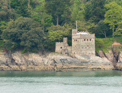
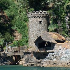
Kingswear Castle, Artillery fort in Kingswear, England
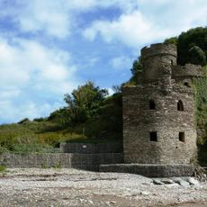
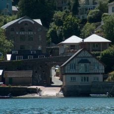
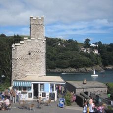
Kingswear Castle is a square fortress near the mouth of the River Dart with three stories and ground-level gun ports for cannons. The building sits directly at the water's edge and shows the typical design of coastal defense structures from the early 16th century.
The fort was built between 1491 and 1502 and formed part of a defense system with Dartmouth Castle across the river mouth. Together these two fortifications were meant to stop French raiders and protect the Dart harbor.
The structure represents early British military engineering with its ground-floor gun mounting system and strategic positioning for harbor defense.
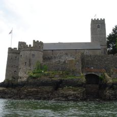
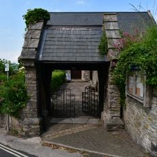
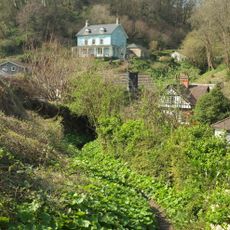
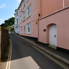
The building is now a holiday rental managed by a conservation trust, reached via a narrow unmade road suitable only for small vehicles. Visitors should walk the final stretch and expect tight spaces and steep stairs inside.
The castle's ground-floor gun ports were positioned close to water level, making it one of the earliest purpose-built artillery fortifications in Britain.
Location: Kingswear
Inception: 1491
Website: https://landmarktrust.org.uk/search-and-book/properties/kingswear-castle-8737#Overview
GPS coordinates: 50.34214,-3.55981
Latest update: December 8, 2025 19:51
Dartmouth Castle
435 m
Kingswear Daymark
1.2 km
Church of St Thomas of Canterbury, Kingswear
1.1 km
Dartmouth Friary
447 m
Church of St Petrox, Dartmouth
445 m
Royal Dart Hotel
1.2 km
Dartmouth Hawleys Castle
473 m
The Mill At Mill Bay Cove
275 m
Mile Post Immediately South Of Royal Dart Hotel
1.2 km
Bridge Over Warfleet Creek Road
985 m
Paradise Point and Oriel House
963 m
Lychgate South of Church of St Thomas of Canterbury
1.1 km
K6 Telephone Kiosk
1.2 km
Gateway North Of The Priory
1.2 km
Kittery Court Including Wall And Gateway Adjoining North West
1.1 km
Summerhouse Approximately 75 Metres To South West Of Stokecliff
1.1 km
Castle Tearooms
429 m
Sarah Roope's Almshouses
1.1 km
Dartmouth Pottery
1 km
23, Southtown
1.3 km
Kingswear Torpedo Battery
75 m
Woodlands
1.1 km
Conduit Adjoining North Side Of No 148 (No 148 Not Included)
1.3 km
24, Southtown
1.3 km
Ashleigh Flat
1.1 km
25, Southtown
1.3 km
No 22 And Attached Front Wall And Gateway Adjoining To North
1.4 km
Milestone, Brixham Road, opp. bus stop where Lower Contour Road joins at a banjo
1.1 kmVisited this place? Tap the stars to rate it and share your experience / photos with the community! Try now! You can cancel it anytime.
Discover hidden gems everywhere you go!
From secret cafés to breathtaking viewpoints, skip the crowded tourist spots and find places that match your style. Our app makes it easy with voice search, smart filtering, route optimization, and insider tips from travelers worldwide. Download now for the complete mobile experience.
A unique approach to discovering new places❞
— Le Figaro
All the places worth exploring❞
— France Info
A tailor-made excursion in just a few clicks❞
— 20 Minutes