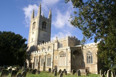
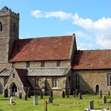
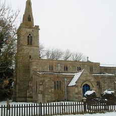
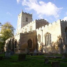
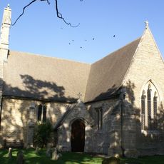
All Saints Church, Conington, Medieval parish church in Conington, England
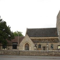
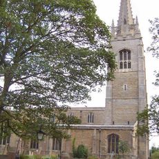
All Saints Church in Conington is a stone parish church with a tall tower crowned by pinnacles. The interior features Gothic arcades, an octagonal baptismal font from the 15th century, and several monuments set into the walls.
The church was rebuilt around 1500 on land that once belonged to Maud, niece of William the Conqueror. Her marriage to a Scottish prince in 1109 created a lasting tie between this rural spot and major European royal houses.
The church holds monuments to the Cotton family and Scottish nobility, reflecting the social ties that bound this place to wider networks. These memorials show how the site mattered to powerful families across centuries.
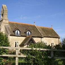
A grassy path leads to the west entrance, which is straightforward for most visitors to access. The interior has fixed seating but lacks heating or restroom facilities, so plan accordingly.
The structure combines rubble and fieldstone in a building material mix that reflects repairs and reworking across centuries. The clear Perpendicular windows with elaborate stone tracery show the skilled craftsmanship of a later construction phase.
Location: Conington
Inception: 1500
Architectural style: English Gothic architecture
GPS coordinates: 52.45830,-0.26420
Latest update: December 14, 2025 16:43
Holme Fen
3.9 km
Monks Wood
6.2 km
Great Fen Project
4.5 km
Woodwalton Fen
5.6 km
St Andrew's Church, Wood Walton
4.7 km
Gamsey Wood
6.1 km
Woodwalton Castle
4.4 km
St Andrew's Church, Steeple Gidding
6.6 km
Aversley Wood
4.4 km
Church of All Saints, Sawtry
2.1 km
Woodwalton Marsh
5.6 km
Parish Church of St Nicholas
2.7 km
Parish Church of St Giles
2.3 km
Parish Church of St Mary
4 km
Parish Church of St Mary Magdalene
4.7 km
Parish Church of All Saints
3.6 km
Parish Church of St Peter
6 km
Parish Church of St Helen
5.6 km
The Bell Inn
3.8 km
Monument 1/4 Mile North Of Norman Cross
5.9 km
88, Main Street
6.2 km
Tower Mill
6.4 km
Mile Post Circa 50 Metres South Of Norman House
5.4 km
Milepost, Great North Road, nr Ratcliffe Heavy Recovery
1.5 km
Boundary Post To South Of Stanch Hill Bridge
2.7 km
Parish Boundary Post To South Of Woolpack Farm
1.3 km
Deserted village (site of)
6.7 km
Milestone, High Street, Bell Inn
3.8 kmVisited this place? Tap the stars to rate it and share your experience / photos with the community! Try now! You can cancel it anytime.
Discover hidden gems everywhere you go!
From secret cafés to breathtaking viewpoints, skip the crowded tourist spots and find places that match your style. Our app makes it easy with voice search, smart filtering, route optimization, and insider tips from travelers worldwide. Download now for the complete mobile experience.
A unique approach to discovering new places❞
— Le Figaro
All the places worth exploring❞
— France Info
A tailor-made excursion in just a few clicks❞
— 20 Minutes