Enable Location

We need your location to show you interesting places around you

Discover nearby places

Find interesting locations and hidden gems around you

Precise directions

Get accurate directions and distances to places

Your location is never shared with other users. It's only used when you tap the location button.

All Saints Church, Leigh

Log in to your account

Start exploring — it's free

Trusted by 62,207 travelers worldwide

Continue with Google
Continue with Apple
or

We will send you a code to connect

By continuing, you accept our Terms and Conditions and our Privacy Policy

Check your inbox

We've sent a pincode in your inbox. Please enter the code below.

All Saints Church, Leigh

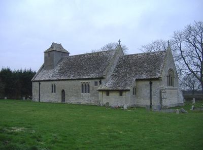
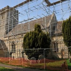
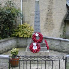
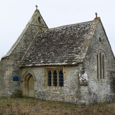
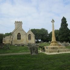
All Saints Church, Leigh, Medieval church in Leigh, England

All Saints Church is a stone building from the 13th century featuring Gothic wooden beams and decorative carved heads throughout its structure. The late 14th-century porch retains its original roof and represents a significant example of medieval church architecture.

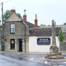
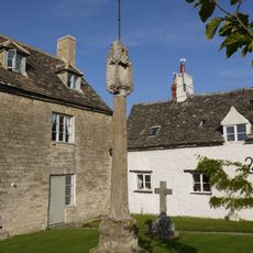
The building was moved stone by stone in 1896 from its original location to its current site on Swan Lane. This remarkable relocation was undertaken to improve accessibility and create better conditions for the community.

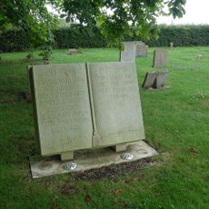
The structure maintains a collection of religious artifacts, including an 18th-century pulpit and chalices from the time of Elizabeth I's reign.

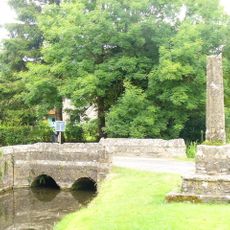
The location is easy to reach on foot and offers improved access following the building's relocation. Visitors should allow adequate time to explore the architectural details and carved elements throughout the interior.

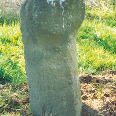
The original baptismal font was repurposed as a cheese press before being restored and returned to its proper place inside. This object tells a story of how religious artifacts were adapted for everyday use in rural communities.

The community of curious travelers

AroundUs brings together thousands of curated places, local tips, and hidden gems, enriched daily by 60,000 contributors worldwide.

Start exploring
Location
Inception
14 century
GPS coordinates
51.62830,-1.91139
Latest update
December 14, 2025 18:43
Around this place
North Meadow, Cricklade
United Kingdom

North Meadow, Cricklade

4 km
St Sampson's Church
United Kingdom

St Sampson's Church

3.9 km
Ashton Keynes Castle
United Kingdom

Ashton Keynes Castle

2.7 km
Elmlea Meadows
United Kingdom

Elmlea Meadows

3.2 km
Jenner's School
United Kingdom

Jenner's School

4 km
Church of the Holy Cross, Ashton Keynes
United Kingdom

Church of the Holy Cross, Ashton Keynes

3 km
3, Church Lane
United Kingdom

3, Church Lane

4 km
Midland and South Western Junction Railway bridge
United Kingdom

Midland and South Western Junction Railway bridge

3.3 km
Unnamed footbridge
United Kingdom

Unnamed footbridge

1.5 km
Waterhay bridge
United Kingdom

Waterhay bridge

1.1 km
Stones Lane footbridge
United Kingdom

Stones Lane footbridge

2.9 km
Aqueduct footings footbridge
United Kingdom

Aqueduct footings footbridge

3.6 km
RAF Blakehill Farm WWII Memorial
United Kingdom

RAF Blakehill Farm WWII Memorial

1.7 km
Bridge on The Derry
United Kingdom

Bridge on The Derry

2.1 km
Minety War Memorial
United Kingdom

Minety War Memorial

3.9 km
Leigh All Saints Old Chancel
United Kingdom

Leigh All Saints Old Chancel

786 m
Leigh War Memorial
United Kingdom

Leigh War Memorial

16 m
Medieval cross immediately south of Gumstool Bridge
United Kingdom

Medieval cross immediately south of Gumstool Bridge

2.6 km
23, High Street
United Kingdom

23, High Street

4 km
Milestone At Calowe Hill
United Kingdom

Milestone At Calowe Hill

1.7 km
Alkerton House
United Kingdom

Alkerton House

4 km
Orthostatic Wall To Churchyard Between Jenners School And The Gatehouse
United Kingdom

Orthostatic Wall To Churchyard Between Jenners School And The Gatehouse

4 km
Medieval village cross at the junction of Park Place and the High Road 210m south of Gumstool Bridge
United Kingdom

Medieval village cross at the junction of Park Place and the High Road 210m south of Gumstool Bridge

2.5 km
Old Town Cross
United Kingdom

Old Town Cross

4 km
Medieval cross 40m east of Holy Cross Church
United Kingdom

Medieval cross 40m east of Holy Cross Church

3 km
Milestone, S of crossroads at Broadleaze House at SU09439193
United Kingdom

Milestone, S of crossroads at Broadleaze House at SU09439193

3.2 km
Milestone, S of crossroads at Broadleaze House at SU09479201
United Kingdom

Milestone, S of crossroads at Broadleaze House at SU09479201

3.2 km
Milestone, Minety Road; Calowe Hill, in front of Brookdeen House by drive to Leighfield Lodge Farm
United Kingdom

Milestone, Minety Road; Calowe Hill, in front of Brookdeen House by drive to Leighfield Lodge Farm

525 m
Show the full map
« All Saints Church, Leigh - Medieval church in Leigh, England » is provided by Around Us (aroundus.com). Images and texts are derived from Wikimedia project under a Creative Commons license. You are allowed to copy, distribute, and modify copies of this page, under the conditions set by the license, as long as this note is clearly visible.

Discover hidden gems everywhere you go!

From secret cafés to breathtaking viewpoints, skip the crowded tourist spots and find places that match your style. Our app makes it easy with voice search, smart filtering, route optimization, and insider tips from travelers worldwide. Download now for the complete mobile experience.

Around Us App Screenshot

A unique approach to discovering new places

Le Figaro

All the places worth exploring

France Info

A tailor-made excursion in just a few clicks

20 Minutes

Around Us
Travel Guide & Maps
Download

Send to your phone

QR Code
1

Open the camera app on your mobile.

2

Point at the QR code with your camera. A notification will appear.

3

Tap the notification to open the link.