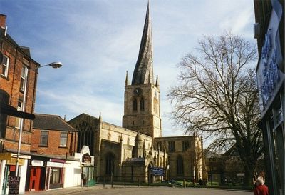
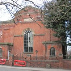
Church of St Mary and All Saints, Chesterfield, Medieval church in Chesterfield, England
The Church of St Mary and All Saints is a place of worship in the town of Chesterfield in Derbyshire and has a twisted tower rising about 230 feet (70 meters) into the air. Inside, rows of columns run along the nave, surrounded by stained glass windows and expanded by side chapels.
Building work began in 1234 and continued for several centuries, with sections completed in different Gothic styles. Later alterations and restorations have changed the appearance of the structure over time.
The tower twists 45 degrees and leans visibly to one side, something visitors notice immediately when walking across the churchyard. This shape has given the building its reputation and has defined the town skyline for centuries, so locals use the tower as a landmark.
The building sits on Church Way in the center of Chesterfield and opens daily, allowing visitors to explore the interior. Guided visits to the tower take place regularly but require climbing many steps and depend on weather conditions.
The deformation of the tower probably came from the weight of lead cladding laid on unseasoned timber, which shifted over the course of centuries. No other place of worship in Europe shows such a pronounced twist of this kind.
The community of curious travelers
AroundUs brings together thousands of curated places, local tips, and hidden gems, enriched daily by 60,000 contributors worldwide.