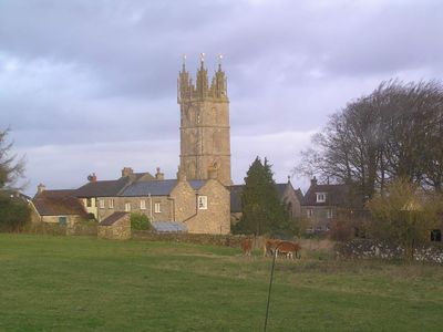
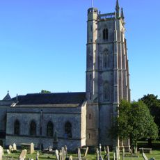
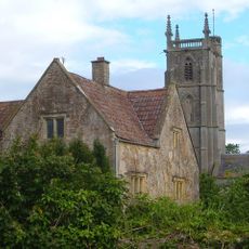
Church of St Michael, Dundry, Grade I listed church in Dundry, England
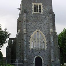
The Church of St Michael is a Grade I listed building in Dundry with a four-stage tower that rises prominently above the village, supported by buttresses and finished with corner turrets and a polygonal stair turret. The nave and side aisles were added in later periods, creating the complete structure visitors see today.
The tower was built in 1484, establishing the church's earliest major structure. The nave and side aisles were completed around 1861, representing a significant expansion that transformed the original tower into a fuller church building.
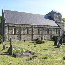
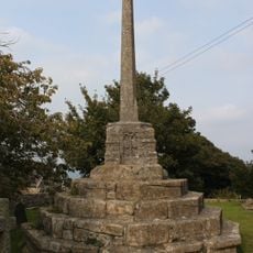
The churchyard displays memorial crosses and burial monuments that show how the community has honored its dead over many generations. These physical reminders remain central to the character of this local sacred space.
The church reopened to visitors in 2018 after significant restoration work was completed. Since it is an active parish building, visitors should check opening times before arriving to ensure access.
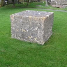
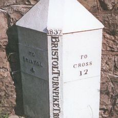
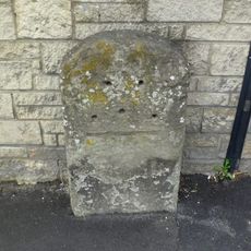
The Dole Stone stands beside the church, a dressed stone cube that once served as a distribution point for charitable aid to those in need. This modest structure tells a story about the church's role in supporting the community beyond worship.
Location: Dundry
Inception: 15 century
GPS coordinates: 51.39900,-2.63730
Latest update: December 14, 2025 17:03
Lakeshore, Bristol
3 km
St Peters Church, Bishopsworth
2.1 km
Hartcliff Rocks Quarry
2.4 km
Holy Cross Inns Court Vicarage
3.7 km
Church of St Mary and St Peter, Winford
2.3 km
Barns Batch Spinney
959 m
Dundry Main Road South Quarry
1.7 km
Hebron Church, Long Ashton
3.5 km
Littleton gunpowder works
2.6 km
Church of St Oswald
3.2 km
The George And Dragon Public House
3.8 km
Bishopsworth Library
2.7 km
Bishopsworth Manor And Attached Walls And Piers
2.5 km
Churchyard cross in St Michael's churchyard
27 m
Barn To South West Of Powdermill Farmhouse
2.7 km
Court Farmhouse
2.4 km
Outbuilding Circa 25 Metres East Of Littleton Court
2.3 km
Miliestone At St 544678
1.6 km
The Parsonage
3.8 km
Milestone At National Grid Reference St 5328 6987 At Junction With Wildcountry Lane
3.9 km
Rookstone
3.9 km
108, Weston Road
4 km
Milestone At National Grid Reference 5473 7050 Set In The Field Wall, Opposite Number 79
3.8 km
Powdermill Farmhouse
2.6 km
Portugal House
4 km
Littleton Court
2.3 km
Milestone, Bishopsworth Road, Bedminster Down, by No 138
3 km
Milestone, W side of triangle at Dundry to Bristol crossroads
819 mVisited this place? Tap the stars to rate it and share your experience / photos with the community! Try now! You can cancel it anytime.
Discover hidden gems everywhere you go!
From secret cafés to breathtaking viewpoints, skip the crowded tourist spots and find places that match your style. Our app makes it easy with voice search, smart filtering, route optimization, and insider tips from travelers worldwide. Download now for the complete mobile experience.
A unique approach to discovering new places❞
— Le Figaro
All the places worth exploring❞
— France Info
A tailor-made excursion in just a few clicks❞
— 20 Minutes