Chibburn Preceptory

Log in to your account

AroundUs is a community-driven map of interesting places, built by curious explorers like you. It grows with every review, story, and photo you share.
Connect to save your favorite spots, contribute locations, and create personalized routes.
Continue with Google
Continue with Apple
Continue with X
Continue with Facebook
Continue with email
By continuing, you accept our Terms and Conditions and our Privacy Policy
Create an account

Chibburn Preceptory

Add to collection
Map
Suggest a change
Share

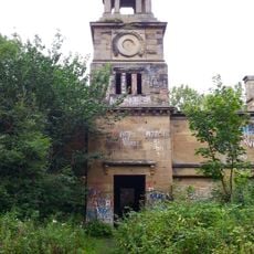
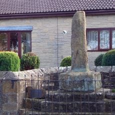
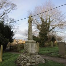
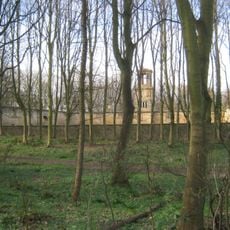
Chibburn Preceptory, Medieval priory ruins in Druridge Bay, Northumberland, England.

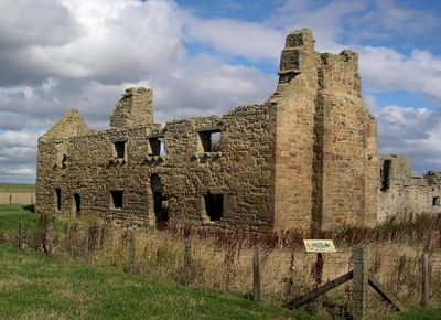
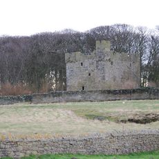
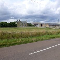
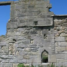
Chibburn Preceptory is a medieval priory near Druridge Bay, with remaining sections of the chapel's east, south, and north walls forming a small courtyard space. These stone walls show the modest scale of the original religious complex.

The site was first documented in 1313 as a Knights Hospitaller establishment. It ceased operation in 1540 when Henry VIII dissolved the monasteries and transferred its lands to the Crown.

The preceptory offered shelter and care to medieval pilgrims making their way to the holy island of Lindisfarne. Today, visitors can sense how this location welcomed travelers on their long journeys to a sacred destination.

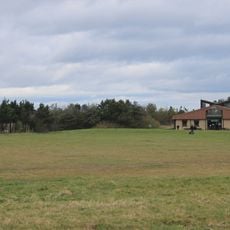
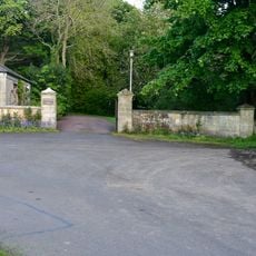
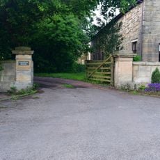
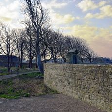
Parking is available along Druridge Pools beach road, with clear pathways leading to the ruins. Wear sturdy footwear as the ground is uneven and the site remains exposed to the elements.

During World War II, the medieval chapel was repurposed as a military pillbox for coastal defense. This unexpected transformation reveals how ancient structures were adapted to meet modern wartime needs.

Location: Northumberland

GPS coordinates: 55.26230,-1.58310

Latest update: December 14, 2025 14:20

Photos
Around this place
Cresswell Castle
United Kingdom

Cresswell Castle

4.2 km
Druridge Bay Country Park
United Kingdom

Druridge Bay Country Park

3.6 km
Church of St Bartholomew
United Kingdom

Church of St Bartholomew

4.1 km
Church of the Holy Trinity
United Kingdom

Church of the Holy Trinity

1.4 km
Church of St John the Baptist
United Kingdom

Church of St John the Baptist

5.1 km
St Aidan Lynemouth
United Kingdom

St Aidan Lynemouth

6.2 km
Togston House
United Kingdom

Togston House

6.4 km
Parish church of St. John the Divine Chevington
United Kingdom

Parish church of St. John the Divine Chevington

3.6 km
Ulgham War Memorial
United Kingdom

Ulgham War Memorial

5.1 km
Gate Lodge To Togston Hall
United Kingdom

Gate Lodge To Togston Hall

6.3 km
Hadston House Library
United Kingdom

Hadston House Library

3.7 km
Fenham House
United Kingdom

Fenham House

4.1 km
Entrance Screen To Togston Hall
United Kingdom

Entrance Screen To Togston Hall

6.3 km
Milestone 30 Metres South Of Entrance East Moor Farm
United Kingdom

Milestone 30 Metres South Of Entrance East Moor Farm

5.6 km
Stable Block Of Former Cresswell Hall
United Kingdom

Stable Block Of Former Cresswell Hall

4.2 km
Farm Buildings And Attached Yard Walls To North East Of Druridge Farmhouse
United Kingdom

Farm Buildings And Attached Yard Walls To North East Of Druridge Farmhouse

1.1 km
Togston Hall (northern Area Office Of British Coal Opencast Executive)
United Kingdom

Togston Hall (northern Area Office Of British Coal Opencast Executive)

6.3 km
Dovecote 100 Metres North West Of Togston House
United Kingdom

Dovecote 100 Metres North West Of Togston House

6.4 km
Entrance Screen And Front Wall To Togston House
United Kingdom

Entrance Screen And Front Wall To Togston House

6.4 km
Village Cross
United Kingdom

Village Cross

5.4 km
Roadside Wall From Parish Church To Old School House
United Kingdom

Roadside Wall From Parish Church To Old School House

4.1 km
Old School House
United Kingdom

Old School House

4.1 km
Druridge Farmhouse
United Kingdom

Druridge Farmhouse

1.1 km
Widdrington War Memorial
United Kingdom

Widdrington War Memorial

1.4 km
Hemscott Hill Farmhouse
United Kingdom

Hemscott Hill Farmhouse

2.1 km
Low Chibburn medieval preceptory, 16th century house and World War II pillbox
United Kingdom

Low Chibburn medieval preceptory, 16th century house and World War II pillbox

3 m
Boundary Wall To East Of Cresswell Tower
United Kingdom

Boundary Wall To East Of Cresswell Tower

4.2 km
Screen Wall Attached To South East Corner Of Stable Block
United Kingdom

Screen Wall Attached To South East Corner Of Stable Block

4.2 km
Show the full map
Reviews

Visited this place? Tap the stars to rate it and share your experience / photos with the community! Try now! You can cancel it anytime.

« Chibburn Preceptory - Medieval priory ruins in Druridge Bay, Northumberland, England » is provided by Around Us (aroundus.com). Images and texts are derived from Wikimedia project under a Creative Commons license. You are allowed to copy, distribute, and modify copies of this page, under the conditions set by the license, as long as this note is clearly visible.

Discover hidden gems everywhere you go!

From secret cafés to breathtaking viewpoints, skip the crowded tourist spots and find places that match your style. Our app makes it easy with voice search, smart filtering, route optimization, and insider tips from travelers worldwide. Download now for the complete mobile experience.

Around Us App Screenshot

A unique approach to discovering new places

Le Figaro

All the places worth exploring

France Info

A tailor-made excursion in just a few clicks

20 Minutes