Coleridge Way

Log in to your account

AroundUs is a community-driven map of interesting places, built by curious explorers like you. It grows with every review, story, and photo you share.
Connect to save your favorite spots, contribute locations, and create personalized routes.
Continue with Google
Continue with Apple
Continue with X
Continue with Facebook
Continue with email
By continuing, you accept our Terms and Conditions and our Privacy Policy
Create an account

Coleridge Way

Add to collection
Map
Suggest a change
Share

Coleridge Way, Walking trail in Somerset, England.
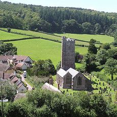
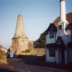
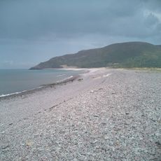
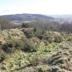
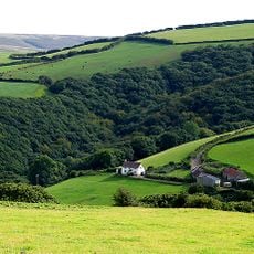
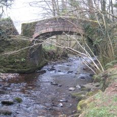
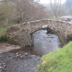
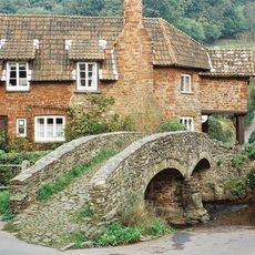
Coleridge Way is a walking trail that passes through the Quantock Hills, Brendon Hills, and Exmoor National Park, connecting different landscape types across the region. The route travels through woodlands, across moorlands, and opens to coastal views.

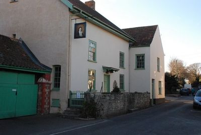
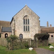
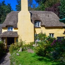
The trail was created to honor Samuel Taylor Coleridge, a poet who lived in Nether Stowey in the late 18th century and frequently walked through these areas. The landscapes he saw and explored on foot then form the basis of this walking route today.

The trail connects places where the poet Samuel Taylor Coleridge wrote his works, such as Alfoxton or the area around Nether Stowey where he lived and walked daily. Visitors can see these landscapes today and understand what nature inspired his poetry.
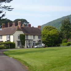
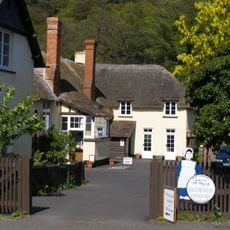
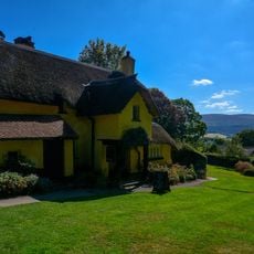
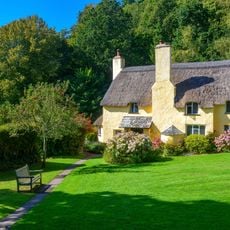
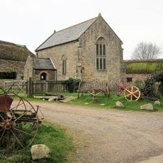
Walkers can complete the route over several days, with accommodation and luggage transfer services available at various points along the way. The path is well marked and allows you to set your own pace, whether staying overnight or walking multiple days.

Yellow quill markers guide walkers through the path, helping them discover hidden spots and avoid busy tourist areas. Along the way, visitors can watch red deer and wild ponies roaming freely through the moorlands and rolling hills.

GPS coordinates: 51.20860,-3.57889

Latest update: December 11, 2025 18:09

Photos
Around this place
Church of St Mary
United Kingdom

Church of St Mary

2.5 km
Church of St Dubricius, Porlock
United Kingdom

Church of St Dubricius, Porlock

1.2 km
Holnicote Estate
United Kingdom

Holnicote Estate

1.2 km
Porlock Bay
United Kingdom

Porlock Bay

2.2 km
Church of All Saints
United Kingdom

Church of All Saints

2.2 km
Bury Castle
United Kingdom

Bury Castle

2 km
Hawkcombe Woods
United Kingdom

Hawkcombe Woods

1.3 km
Dovery Manor Museum
United Kingdom

Dovery Manor Museum

997 m
West Somerset Rural Life Museum and Victorian School
United Kingdom

West Somerset Rural Life Museum and Victorian School

735 m
Lynch Chapel of Ease
United Kingdom

Lynch Chapel of Ease

1 km
The Ship Inn
United Kingdom

The Ship Inn

1.4 km
Periwinkle Cottage Tea Rooms
United Kingdom

Periwinkle Cottage Tea Rooms

2.1 km
Remains of churchyard cross
United Kingdom

Remains of churchyard cross

2.2 km
Horner packhorse bridge
United Kingdom

Horner packhorse bridge

1.1 km
Luccombe Post Office  Mounting Block And Wall Box
United Kingdom

Luccombe Post Office Mounting Block And Wall Box

2.5 km
Selworthy War Memorial Cross
United Kingdom

Selworthy War Memorial Cross

2.1 km
Westbourne Cottage
United Kingdom

Westbourne Cottage

2.1 km
Stables And Linhay Abutting West Lynch Farmhouse Returned To South
United Kingdom

Stables And Linhay Abutting West Lynch Farmhouse Returned To South

1 km
West Luccombe packhorse bridge
United Kingdom

West Luccombe packhorse bridge

574 m
Allerford packhorse bridge
United Kingdom

Allerford packhorse bridge

750 m
Cottage (National Trust Estate No 68)
United Kingdom

Cottage (National Trust Estate No 68)

2.1 km
Gatehouse and Gatehouse Cottage, Holnicote Estate
United Kingdom

Gatehouse and Gatehouse Cottage, Holnicote Estate

1.3 km
Barn And Round House At West Lynch Farm Park
United Kingdom

Barn And Round House At West Lynch Farm Park

996 m
West Lynch House, Dwarf Wall And Railings Returned To House As Curved Walls
United Kingdom

West Lynch House, Dwarf Wall And Railings Returned To House As Curved Walls

1.1 km
Lorna Doone  National Trust Shop And Information Centre
United Kingdom

Lorna Doone National Trust Shop And Information Centre

2.1 km
Porlock Library
United Kingdom

Porlock Library

1.4 km
Doverhay Reading Room And Cottage Abutting North End
United Kingdom

Doverhay Reading Room And Cottage Abutting North End

992 m
Churchyard Cross, About 10 Metres North East Of Porch, Church Of St Dubricius
United Kingdom

Churchyard Cross, About 10 Metres North East Of Porch, Church Of St Dubricius

1.2 km
Show the full map
Reviews

Visited this place? Tap the stars to rate it and share your experience / photos with the community! Try now! You can cancel it anytime.

« Coleridge Way - Walking trail in Somerset, England » is provided by Around Us (aroundus.com). Images and texts are derived from Wikimedia project under a Creative Commons license. You are allowed to copy, distribute, and modify copies of this page, under the conditions set by the license, as long as this note is clearly visible.

Discover hidden gems everywhere you go!

From secret cafés to breathtaking viewpoints, skip the crowded tourist spots and find places that match your style. Our app makes it easy with voice search, smart filtering, route optimization, and insider tips from travelers worldwide. Download now for the complete mobile experience.

Around Us App Screenshot

A unique approach to discovering new places

Le Figaro

All the places worth exploring

France Info

A tailor-made excursion in just a few clicks

20 Minutes