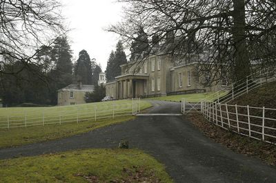
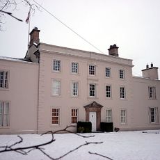
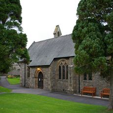
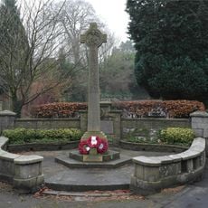
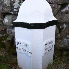
Dallam Tower, Grade I listed English country house in Beetham, England.
Dallam Tower is a three-story stone country house in Beetham with architectural elements from the early 18th century. The interior features wood paneling created by the craftsmen of Gillow of Lancaster, a renowned local workshop.
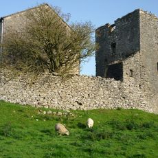
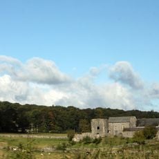
A fortified pele tower occupied this location from 1375 until its demolition in 1720, when the current house was built to replace it. The shift from medieval defensive tower to Georgian country house marks how life in this region transformed over the centuries.
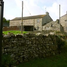
The layout of the main building and surrounding grounds follows the formal design traditions typical of English estates, with the deer park serving as the centerpiece of the property's visual composition. This arrangement shaped how the land was used for centuries and continues to define the character of the place today.
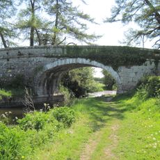
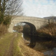
The house itself is private and not open to visitors, but the grounds can be accessed through public footpaths and a roadway that runs through the deer park. This allows you to walk around the historic landscape and see the property from the outside.
The property's name inspired at least three ships, including one built in 1866 that sailed between Liverpool and Melbourne. This maritime connection shows how a quiet English estate sent its name across the world's shipping routes.
Location: Beetham
GPS coordinates: 54.22250,-2.78300
Latest update: December 11, 2025 11:05
Ashton House
1.7 km
St Michael's Church, Beetham
1.6 km
St Peter's Church, Heversham
2.4 km
St James' Church, Arnside
3.9 km
Heron Corn Mill
1.2 km
St Thomas' Church, Milnthorpe
961 m
Hazelslack Tower
2.6 km
Saltcotes Farm
3.8 km
Arnside Signal Box
3.7 km
Holme Park Bridge Over Kendal/Lancaster Canal
3.9 km
Boundary Stone Opposite Leasgill Cottage
3.3 km
Heversham War Memorial
2.4 km
Boundary Post Approximately 650 Metres North East Of Holme Parish Church
3.4 km
Beetham War Memorial
1.6 km
Kendal/Lancaster Canal Garth's Bridge Over Kendal
3.9 km
Boundary Post At Junction Of B6384 With Paradise Lane Between Ackenthwaite And Whasset
1.6 km
Nelson's Bridge Over Kendal/Lancaster Canal
3.9 km
Beetham Hall And Attached Outbuildings
2.2 km
Market Cross
844 m
Footbridge over River Bela approximately 400 metres east-north-east of Milnthorpe Bridge
472 m
Boundary Stone At The Junction Off White Lane With The Woodhouse To Viver Road Approximately 300 Yards North Of Woodhouse
3.4 km
Boundary Stone At Entrance To Hawbarrow House
1.6 km
Boundary Stone At The Junction Of Rowell Lane With Woodhouse To Ackenthwaite Road Approximately 600 Yards South Of Woodhouse
2.6 km
Milestone Approximately 350 Metres North West Of Junction With Pye's Bridge Lane
2.5 km
Milestone Approximately 150 Meters North North West Of Junction With Paradise Lane North Of Beetham
1.1 km
Milepost, Haverflatts, opp. St Anthony's House
1.5 km
Milepost, Leasgill, by No.2 Milestone Cottage, High rise House
3 km
Guidestone, Levens Hall
3.8 kmVisited this place? Tap the stars to rate it and share your experience / photos with the community! Try now! You can cancel it anytime.
Discover hidden gems everywhere you go!
From secret cafés to breathtaking viewpoints, skip the crowded tourist spots and find places that match your style. Our app makes it easy with voice search, smart filtering, route optimization, and insider tips from travelers worldwide. Download now for the complete mobile experience.
A unique approach to discovering new places❞
— Le Figaro
All the places worth exploring❞
— France Info
A tailor-made excursion in just a few clicks❞
— 20 Minutes