Dunkery Beacon, Summit in Exmoor National Park, England
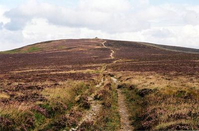
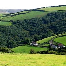
Dunkery Beacon is the highest point in Exmoor and the tallest summit south of there in mainland England outside Dartmoor, featuring a sandstone peak with sweeping views. A ridge extends across several kilometers and forms the main feature of this distinctive landscape.
The site shows traces of Bronze Age presence through multiple burial mounds and stone cairns known as Joaney How and Robin How. These remains point to early human settlement and use of the location.
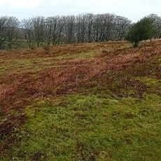
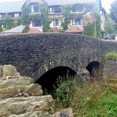
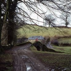
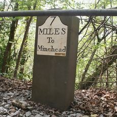
The location connects walking trails used by local communities and shows how the surrounding countryside is managed through traditional practices. The heathland and grazing lands shape the everyday landscape of the area.
The ascent can begin from Dunkery Gate car park, where a path of about 1 kilometer leads directly to the summit along maintained trails. The terrain is open and partly exposed, so it is wise to prepare for changeable weather conditions.
On clear days, views extend to the Bristol Channel, Wales, and distant mountains like the Brecon Beacons and Dartmoor from the summit. The vista connects three different landscapes in a single sightline.
Location: Cutcombe
Made from material: sandstone
Part of: Dunkery Hill
GPS coordinates: 51.16197,-3.58736
Latest update: December 10, 2025 15:58
Church of St Mary
3.6 km
Church of St Dubricius, Porlock
5.2 km
Holnicote Estate
5.2 km
Coleridge Way
5.2 km
Stoke Pero Church
2.4 km
Dovecot at Blackford Farm
5.1 km
Church of All Saints, Wootton Courtenay
5.1 km
Sweetworthy
1.1 km
Hawkcombe Woods
4.4 km
Dovery Manor Museum
5.3 km
The Ship Inn
5.3 km
Church of St John
4.6 km
Church of St Mary Magdalene
4.5 km
Fair Garden Farmhouse
4.2 km
Luccombe Post Office Mounting Block And Wall Box
3.6 km
Horner packhorse bridge
4.1 km
Wychanger Cottage
3.6 km
West Luccombe packhorse bridge
4.7 km
Gatehouse and Gatehouse Cottage, Holnicote Estate
5.1 km
Exford Bridge At Ngr Ss 8525 3836
5 km
Lyncombe packhorse bridge
4.7 km
Stone
3.7 km
Milestone At Ngr Ss 9385 4015
4.9 km
Doverhay Reading Room And Cottage Abutting North End
5.3 km
Remains Of Churchyard Cross, About One Metre South Of South Aisle, Church Of St Mary Magdalene
4.5 km
Milestone At Ngr Ss 9160 3765
4.6 km
Porlock Library
5.3 km
Churchyard Cross, About 10 Metres North East Of Porch, Church Of St Dubricius
5.2 kmVisited this place? Tap the stars to rate it and share your experience / photos with the community! Try now! You can cancel it anytime.
Discover hidden gems everywhere you go!
From secret cafés to breathtaking viewpoints, skip the crowded tourist spots and find places that match your style. Our app makes it easy with voice search, smart filtering, route optimization, and insider tips from travelers worldwide. Download now for the complete mobile experience.
A unique approach to discovering new places❞
— Le Figaro
All the places worth exploring❞
— France Info
A tailor-made excursion in just a few clicks❞
— 20 Minutes