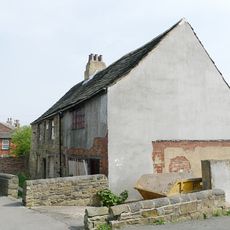
Horbury, large village in the City of Wakefield, West Yorkshire, England
Location: Wakefield
Shares border with: Wakefield
GPS coordinates: 53.65950,-1.55660
Latest update: March 3, 2025 02:55
Wakefield Castle
3.6 km
St Peter and St Leonard's Church, Horbury
205 m
Church of St John the Divine, Calder Grove
1.9 km
Thornes Park
3.4 km
Church of the Holy Trinity
3.4 km
Ossett Town Hall
2.7 km
Horbury Town Hall
307 m
Church of St Mary Virgin
906 m
Christ Church
1.6 km
Church of St Andrew
1.6 km
Westgate Wesleyan Methodist Church
3.8 km
Church of St James
3.5 km
Ossett Library
2.6 km
Savoy Cinema
2.8 km
St John
1.3 km
Ossett War Memorial
2.8 km
Horbury Library
271 m
Horbury Viaduct
1.6 km
Crigglestone Viaduct
1.6 km
Works To South Of Number 33
166 m
Former Lock Up Approximately 5 Metres South East Of Number 33
171 m
Milepost Adjacent To White Swan Public House
2.8 km
Milestone Approximately 10 Metres North Of Junction With Branch Road
2.4 km
Milestone, Dewsbury Road, opp. Broadway
2.4 km
Horbury Basin
1.5 km
Milepost Approximately 1000 Metres North East Of West Bretton Traffic Island
3.4 km
River Calder Bridge
1.4 km
Horbury Hall
196 mReviews
Visited this place? Tap the stars to rate it and share your experience / photos with the community! Try now! You can cancel it anytime.
Discover hidden gems everywhere you go!
From secret cafés to breathtaking viewpoints, skip the crowded tourist spots and find places that match your style. Our app makes it easy with voice search, smart filtering, route optimization, and insider tips from travelers worldwide. Download now for the complete mobile experience.
A unique approach to discovering new places❞
— Le Figaro
All the places worth exploring❞
— France Info
A tailor-made excursion in just a few clicks❞
— 20 Minutes