Mere Sands Wood, Nature reserve and SSSI in West Lancashire, England
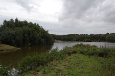
Mere Sands Wood is a nature reserve spanning several dozen hectares with lakes, woodlands, meadows, and heathland scattered throughout. The site features six observation areas and viewing platforms positioned to give visitors clear sightlines into different habitats.
The land was part of Martin Mere lake until the late 1800s before being converted to other uses, and later operated as a sand extraction site for glass manufacturing. The site was eventually restored and turned into the nature reserve it is today.
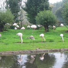
The Lancashire Wildlife Trust manages this place, and it serves as a gathering point where people come to watch birds in their natural habitats across different seasons. The reserve shows how local communities connect with nature through regular visits and educational activities.
Most paths throughout the site are wheelchair-accessible, making it easy for visitors of all abilities to explore the different areas. A visitor center provides refreshments and there are several wildlife viewing hides positioned across the grounds.
A small population of red squirrels makes its home in the pine plantation, offering visitors an uncommon sight in this region. The water bodies here support around fifteen species of dragonflies, which dart across the lakes and ponds during warmer months.
The community of curious travelers
AroundUs brings together thousands of curated places, local tips, and hidden gems, enriched daily by 60,000 contributors worldwide.