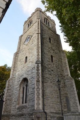
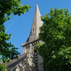
St Augustine's Tower, Medieval church tower in Hackney, England
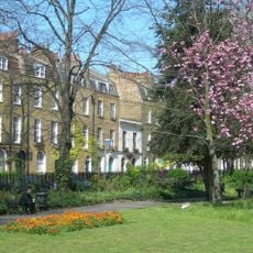
St Augustine's Tower is a four-stage stone tower rising above St John's Church Gardens, dating from around 1550. The structure features diagonal buttressing and a restored parapet at its summit.
The tower was built around 1550 as part of St Augustine's Church and is a rare survival from Tudor times in Hackney. When the original church was demolished in 1798, the structure remained standing and was later preserved as an independent landmark.
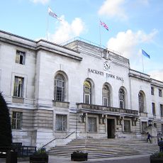
The tower appears on Hackney's coat of arms and was featured on military insignia during World War I. This recognition shows how important it became to local identity across different generations.
The tower is accessible to visitors on scheduled occasions, offering a chance to see the interior structure and historic construction up close. It is best to check ahead for current access times, as these can vary depending on the season and special events.
Inside the tower sits a working 16th-century clock mechanism recognized by the Royal Observatory Greenwich as one of England's oldest functioning timepieces. This timekeeping device is remarkable for having remained in daily operation for over four centuries.
Location: London Borough of Hackney
Inception: 16 century
GPS coordinates: 51.54780,-0.05474
Latest update: December 11, 2025 11:09
Hackney Empire
261 m
Sutton House
309 m
Church of St John-at-Hackney
185 m
Hackney Town Hall
332 m
Custard Apple , Breadfruit and Soursop
24 m
Hackney Museum
377 m
Clapton Square
380 m
Church of St Luke
391 m
The Plough Inn
487 m
Beaufort Family Tomb, St John At Hackney Churchyard Gardens
198 m
Hackney War Memorial
229 m
Hunter Family Tomb, St John At Hackney Churchyard Gardens
214 m
Loddiges Family Tomb, St John At Hackney Churchyard Gardens
199 m
Railings Around Clapton Square Garden
415 m
224 And 226, Dalston Lane E8
497 m
Circle House
213 m
222, Mare Street E8
446 m
33, Hackney Grove E8
383 m
26 And 28, Lower Clapton Road E5
388 m
226, Mare Street E8
418 m
25 And 27, Hackney Grove E8
400 m
210 And 212, Mare Street E8
479 m
4, Sylvester Path E8
212 m
224, Mare Street E8
423 m
Wall And Public Conveniences
271 m
Hackney Town Hall Civic Garden Walls And Lamp Piers, To Western Elevation
324 m
Forecourt Wall To Number 25
398 m
228-232, Mare Street E8
407 mVisited this place? Tap the stars to rate it and share your experience / photos with the community! Try now! You can cancel it anytime.
Discover hidden gems everywhere you go!
From secret cafés to breathtaking viewpoints, skip the crowded tourist spots and find places that match your style. Our app makes it easy with voice search, smart filtering, route optimization, and insider tips from travelers worldwide. Download now for the complete mobile experience.
A unique approach to discovering new places❞
— Le Figaro
All the places worth exploring❞
— France Info
A tailor-made excursion in just a few clicks❞
— 20 Minutes