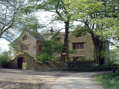
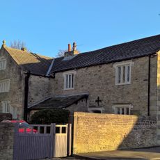
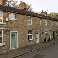
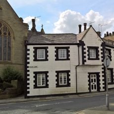
Shuttleworth Hall, Grade I listed English manor house in Hapton, England.
Shuttleworth Hall is a sandstone manor house in Hapton with an H-shaped layout, two stories, and large external chimney stacks. The building features original details like mullioned windows and decorated beams and is divided into two separate residential units.
The manor was built in the early to mid-17th century and bears an inscription dated 1639 above its outer doorway. This date confirms the building dates to the Stuart period, a time of significant change in England.
The manor reflects the craftsmanship and tastes of wealthy English landowners from the Stuart era, evident in the detailed stonework and window design. The way rooms are arranged shows how people of this period lived and organized their homes.
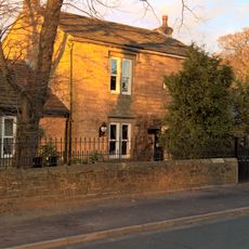
The building sits in a rural setting and is recognizable as a distinct structure, with clear external features like mullioned windows and prominent chimney stacks. The presence of a Grade II listed arched gateway and garden wall nearby provides visual context for understanding the site.
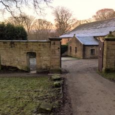
A Grade II listed arched gateway and garden wall connected to the house create an enclosed space on the south side. This accompanying architecture offers a rare view of the original courtyard layout and how such spaces functioned.
Location: Hapton
GPS coordinates: 53.78610,-2.32960
Latest update: December 12, 2025 17:46
St James' Church, Altham
1.5 km
Town Hall
1.9 km
Cellar Restaurant
2 km
Church of St Leonard
2 km
Church of St Augustine (Of Hippo)
2.6 km
Nazareth Unitarian Church
1.7 km
Canal Bridge Number 121
1 km
Canal Bridge (Knotts Bridge)
2 km
Canal Bridge (Altham Bridge)
891 m
St Peter's Church, Simonstone
2.4 km
Stockbridge Lodge
2.1 km
Green Farm Cottage Green Farm House
1.6 km
Altham War Memorial, Lancashire
1.4 km
Moor Side House
2.5 km
Stockbridge House
2 km
Hapton Castle
896 m
Boundary Stone At Sd 8046 3337
2.3 km
Boundary Stone At Sd 8054 3323
2.4 km
Lamp Post Opposite Number 217
2.7 km
Gate Piers And Boundary Wall To Courtyard Of Former Home Farm To Gawthorpe Hall
2.8 km
2-22, Lowerhouse Fold
2.7 km
Village Stocks In Corner Of Road 100 Metres East Of Hill House
1.9 km
Padiham War Memorial
1.7 km
Milestone On South Side Of Road Circa 220 Metres West Of Corner Of Simonstone Lane
2.5 km
1 and 3 Moor Lane
2 km
487, Padiham Road
2.7 km
Milestone, Burnley Road, Allotment Hall Farm
2.5 km
Guidestone, Huncoat, Higher Coat Road
1.9 kmVisited this place? Tap the stars to rate it and share your experience / photos with the community! Try now! You can cancel it anytime.
Discover hidden gems everywhere you go!
From secret cafés to breathtaking viewpoints, skip the crowded tourist spots and find places that match your style. Our app makes it easy with voice search, smart filtering, route optimization, and insider tips from travelers worldwide. Download now for the complete mobile experience.
A unique approach to discovering new places❞
— Le Figaro
All the places worth exploring❞
— France Info
A tailor-made excursion in just a few clicks❞
— 20 Minutes