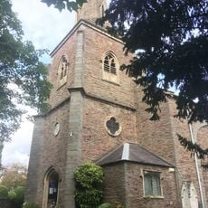
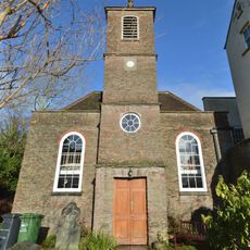
St John the Baptist, Frenchay, Medieval church in Broad Street, Bristol, England
St John the Baptist is a church building on Broad Street in Bristol integrated into the city's medieval walls, with a tower and steeple positioned directly above the last remaining medieval gateway. The structure connects the religious space to the fabric of the old fortifications that once defended the city.
Construction began around 1380 and was finished shortly before 1400, marking the end of the medieval period in Bristol. The church holds the tomb of Walter Frampton, a three-time mayor, reflecting the importance of the space for the city's ruling families.
The interior displays seven painted panels by a Dutch artist showing religious figures like Saint Peter, Saint Matthew, and Saint John the Baptist. These artworks shape how the space feels and tell stories that visitors can still see on the walls.
The upper church is accessed from Broad Street, while the crypt requires entering from Quay Street or Nelson Street at a lower level. Visitors should be prepared for the building's connection to Bristol's historic slopes and changing ground levels.
A medieval water fountain is built into the north wall and once supplied water to the neighboring Carmelite Friary for over 700 years. This practical feature connected the church to the daily life of the friars and remains visible today as a reminder of their presence.
The community of curious travelers
AroundUs brings together thousands of curated places, local tips, and hidden gems, enriched daily by 60,000 contributors worldwide.