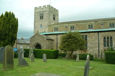
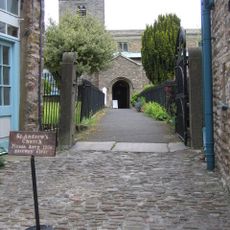
St Andrew's Church, Dent, Medieval Anglican church in Dent, England.
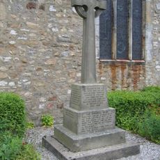
St Andrew's Church in Dent is an Anglican church built in Norman and English Gothic styles with rubble stone walls and cylindrical columns supporting six-bay arcades. The floor displays a distinctive black-and-white checkerboard pattern made from polished Dent Marble.
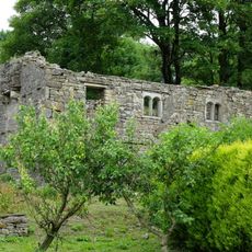
The building was founded in 1150 and underwent major reconstructions in 1417, 1590, and 1787. A comprehensive restoration by Paley, Austin and Paley followed in 1889 and brought together its various earlier structures.
The interior preserves an octagonal oak pulpit from 1614 and traditional box pews from the 17th century that visitors still see in their original positions. These furnishings show how worshippers experienced services here across the centuries.
The building remains an active parish church within the Western Dales Mission Community and holds regular services. Visitors should be prepared for uneven ground around the exterior and traditional stone steps at the entrance.
The church floor is made from polished Dent Marble, a local stone crafted into a black-and-white checkerboard pattern found nowhere else in England. This material was quarried nearby and reflects a deep connection between the building and its surrounding landscape.
Location: Dent
Inception: 12 century
Architects: Sharpe, Paley and Austin
Architectural style: English Gothic architecture, Norman architecture
Website: http://achurchnearyou.com/dent-st-andrew
GPS coordinates: 54.27810,-2.45420
Latest update: December 14, 2025 14:20
St John the Evangelist's Church, Cowgill
5.1 km
Crag Hill
3.9 km
Church of St John the Baptist
4.8 km
Wesleyan Chapel
188 m
Sun Inn
54 m
Post Office And Adjoining Barn
86 m
Ewegales Bridge
5 km
Old Post Office
113 m
Gibbs Hall
3.1 km
Stone Close Cafe And Adjoining Barn To West
76 m
Gateway to south side of churchyard of Church of St Andrew
34 m
Dent War Memorial
5 m
Milestone (Sedbergh 4) Approximately 20 Metres West Of Bellow Hill Turn
3.8 km
Milestone (Sedbergh 8) Approximately 200 Metres East Of Broadfield Lane On South Side Of Road
3.6 km
High Hall Farmhouse Including Cartshed
598 m
East Rackenthwaite And Adjoining Barn
4.3 km
Milestone (Sedbergh 3) On North Side Of Road Approximately 20 Metres West Of Craggs Hill
3.8 km
Milestone (Sedbergh 4) On North Side Of Lane At Sd 688 885
2.3 km
The George And Dragon
56 m
Milestone (Sedbergh 7) Approximately 170 Metres West Of Sundial Cottage
2.1 km
Ellers
3 km
Milestone approximately 100 metres east of Low Branthwaites on Hawes Road
4.7 km
Boundary Stone
4.3 km
Milestone (Sedbergh 9) On South Side Of Road Approximately 50 Metres South West Of Cowgill Bridge
5.1 km
Milestone (Sedbergh 3) Approximately 10 Metres East Of Nether House (Not Included)
3.9 km
Milestone (Sedbergh 6) Approximately 75 Metres West Of Kirk Bridge
4.7 km
Milestone (Sedbergh 6) Approximately 5 Metres West Of Hallbank Lane
648 m
Milestone (Sedbergh 5) Approximately 10 Metres West Of Hippins On North Side Of Road
845 mVisited this place? Tap the stars to rate it and share your experience / photos with the community! Try now! You can cancel it anytime.
Discover hidden gems everywhere you go!
From secret cafés to breathtaking viewpoints, skip the crowded tourist spots and find places that match your style. Our app makes it easy with voice search, smart filtering, route optimization, and insider tips from travelers worldwide. Download now for the complete mobile experience.
A unique approach to discovering new places❞
— Le Figaro
All the places worth exploring❞
— France Info
A tailor-made excursion in just a few clicks❞
— 20 Minutes