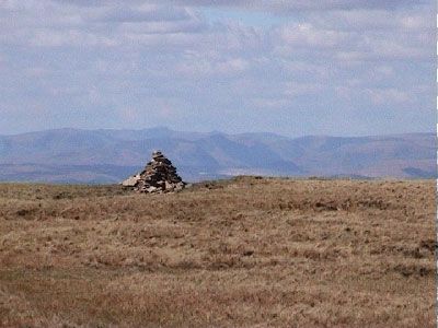
Crag Hill, Mountain summit in Lake District National Park, England
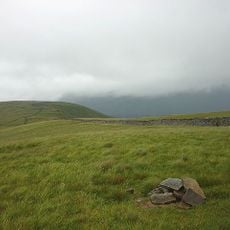
Crag Hill is a summit in the Lake District rising to 839 meters, with expansive views across the North-Western Fells from its rocky peak. The mountain features grassy slopes and exposed rock faces that give it a characteristic fell appearance.
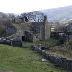
The mountain area contains evidence of historical mining activities, with abandoned mine tracks still visible today. These remnants of past resource extraction reflect the industrial heritage of this part of the Lake District.
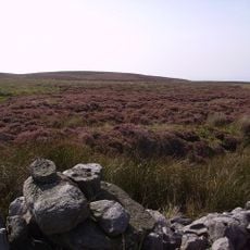
Shepherds graze their flocks on the lower slopes, a farming practice that has shaped the landscape here for generations. The grasslands you see reflect this long tradition of pastoral land use.
The summit can be reached through multiple routes, with easier approaches starting from Newlands Valley near Keswick. Sturdy footwear and weather-appropriate clothing are important, as mountain conditions change quickly throughout the day.
The mountain offers numerous climbing routes with varying levels of difficulty, making it a popular destination for climbers seeking different technical challenges. This variety of options is what draws experienced and inexperienced climbers to test themselves here.
GPS coordinates: 54.24465,-2.47395
Latest update: December 14, 2025 20:28
Whernside
5 km
Lost John's Cave
5.1 km
Three Counties System
4.7 km
Green Hill
2 km
Gragareth
4 km
Death's Head Hole
4.8 km
Yordas Cave
4.5 km
Leck Beck Head Catchment Area
4.3 km
St Andrew's Church, Dent
3.9 km
Boxhead Pot
5.4 km
Wesleyan Chapel
3.9 km
Sun Inn
3.9 km
Post Office And Adjoining Barn
3.9 km
Blindbeck Bridge
3.7 km
Old Post Office
3.9 km
The George And Dragon
3.9 km
Gibbs Hall
5.3 km
Milestone (Sedbergh 4) On North Side Of Lane At Sd 688 885
5.2 km
Gateway to south side of churchyard of Church of St Andrew
3.9 km
Dent War Memorial
3.9 km
High Hall Farmhouse Including Cartshed
4.4 km
Stone Close Cafe And Adjoining Barn To West
3.9 km
Milestone (Sedbergh 7) Approximately 170 Metres West Of Sundial Cottage
4.7 km
Milestone (Sedbergh 5) Approximately 10 Metres West Of Hippins On North Side Of Road
4.1 km
Apron Full of Stones cairn
4.8 km
2 Limekilns South Of Little Aygill At Sd 662 818
3.3 km
Milestone (Sedbergh 6) Approximately 5 Metres West Of Hallbank Lane
4.4 km
Boundary Stone
2.8 kmVisited this place? Tap the stars to rate it and share your experience / photos with the community! Try now! You can cancel it anytime.
Discover hidden gems everywhere you go!
From secret cafés to breathtaking viewpoints, skip the crowded tourist spots and find places that match your style. Our app makes it easy with voice search, smart filtering, route optimization, and insider tips from travelers worldwide. Download now for the complete mobile experience.
A unique approach to discovering new places❞
— Le Figaro
All the places worth exploring❞
— France Info
A tailor-made excursion in just a few clicks❞
— 20 Minutes