Chest opened
+${chestReward.xp} XP
Explorer
NOUVEAU ×${chestReward.collectible.quantity}
tapez pour fermer
Chest locked

Open chests in the app

Around Us is built for your phone — chests unlock when you walk, explore and capture nearby places.

Enable Location

We need your location to show you interesting places around you

Discover nearby places

Find interesting locations and hidden gems around you

Precise directions

Get accurate directions and distances to places

Your location is never shared with other users. It's only used when you tap the location button.

Bloodgate Hill Iron Age Fort

Log in to your account

Start exploring — it's free

Trusted by 73,076 travelers worldwide

Continue with Google
Continue with Apple
or

We will send you a code to connect

By continuing, you accept our Terms and Conditions and our Privacy Policy

Check your inbox

We've sent a pincode in your inbox. Please enter the code below.

Bloodgate Hill Iron Age Fort
Discussion Reviews 1 Photos
1.6k Popularity

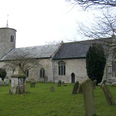
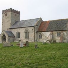
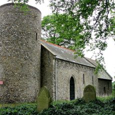
Bloodgate Hill Iron Age Fort, hillfort in Norfolk

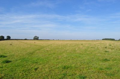
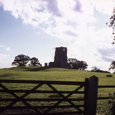
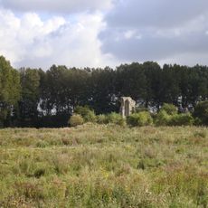
Bloodgate Hill Iron Age Fort is an ancient fortified site in South Creake built using earthworks and a defensive ditch. The structure encloses an open area that once served as a gathering place or grazing ground for the community.

The fort was built during the Iron Age over two thousand years ago to protect and monitor the surrounding landscape. Archaeological finds show that the site was reused during Roman times and the Middle Ages.

The name reflects local folklore that has passed down through generations in the area. Today, people view the site as a connection to the Iron Age communities who once lived here, treating it as an important part of their regional heritage.

The site is open during daylight hours and best explored on foot wearing comfortable shoes across open meadow. Visitors should bring water and be prepared for changing weather, as there are no facilities on site.

The earthwork banks become most visible when the sun is low, revealing the fort's circular outline through long shadows and highlights. Aerial photographs show the complete ring shape that is difficult to perceive while standing on the ground.

The community of curious travelers

AroundUs brings together thousands of curated places, local tips, and hidden gems, enriched daily by 60,000 contributors worldwide.

Start exploring
Location
GPS coordinates
52.88340,0.74504
Latest update
February 9, 2026 08:19
Reviews
Share your experience

No review yet

Discussions
Start a discussion...

No discussion yet

« Bloodgate Hill Iron Age Fort - hillfort in Norfolk » is provided by Around Us (aroundus.com). Images and texts are derived from Wikimedia project under a Creative Commons license. You are allowed to copy, distribute, and modify copies of this page, under the conditions set by the license, as long as this note is clearly visible.

Discover hidden gems everywhere you go!

From secret cafés to breathtaking viewpoints, skip the crowded tourist spots and find places that match your style. Our app makes it easy with voice search, smart filtering, route optimization, and insider tips from travelers worldwide. Download now for the complete mobile experience.

Around Us App Screenshot

A unique approach to discovering new places

Le Figaro

All the places worth exploring

France Info

A tailor-made excursion in just a few clicks

20 Minutes

Around Us
Travel Guide & Maps
Download

Send to your phone

QR Code
1

Open the camera app on your mobile.

2

Point at the QR code with your camera. A notification will appear.

3

Tap the notification to open the link.