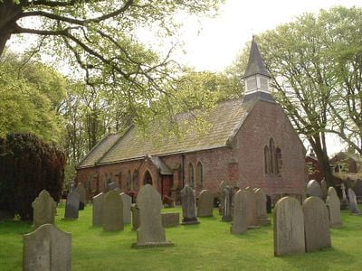
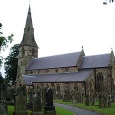
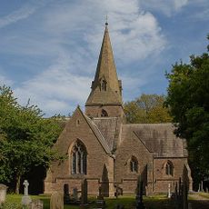
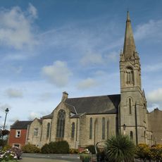
St Michael's Church, Weeton, Anglican church in Weeton, England
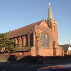
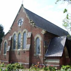
St. Michael's Church in Weeton is an Anglican place of worship built from red brick with stone details and a slate roof topped by a small spire on its western end. The building sits on its own grounds and is surrounded by a churchyard with graves.
The church was built in 1843 after the 13th Earl of Derby donated the land for the project. Nine years later in 1852, architect Edwin Hugh Shellard added an expansion to the structure.
The wooden furnishings inside date from the 1800s and include a pulpit, a minister's desk, and pews with doors that show how churches were outfitted in that era. These fittings give visitors a sense of how worship spaces were arranged and used during the Victorian period.
Visitors can freely explore the churchyard and its gravestones at any time. The church interior is accessible during service times and can be viewed on other occasions by prior arrangement.
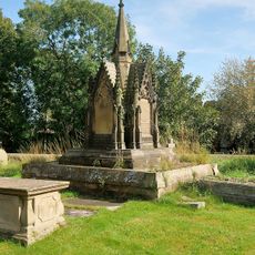
The churchyard holds memorial graves for two British Army soldiers who died in World War I and an airman from World War II. Walking through the cemetery, visitors can discover these individual stories of sacrifice.
Location: Weeton-with-Preese
Inception: 1843
Architects: Edwin Hugh Shellard
GPS coordinates: 53.79960,-2.93580
Latest update: December 14, 2025 17:42
Blackpool Zoo
5.4 km
Little Marton Mill
3.6 km
St Michael's Church, Kirkham
4.6 km
St John the Evangelist's Church, Kirkham
3.9 km
Christ Church
3.5 km
St Anne's Church
4.3 km
Ivy House
4.4 km
St Nicholas' Church, Wrea Green
2.8 km
Heron's Reach Golf Course
4.8 km
Malt Kiln Farmhouse
4.4 km
Roman Catholic Church of St Anne
1.5 km
Kirkham United Reformed Church
4.4 km
Tomb of William Birley and others in churchyard circa 50 metres south east of the porch of the Church of St Michael
4.6 km
Medlar-with-Wesham War Memorial
3.5 km
Churchyard Wall And Gateway South Of The Church Of St John The Evangelist
3.9 km
Staining Windmill
4.5 km
Hillside And Attached Wings
4.8 km
Fox's Farmhouse
4.6 km
Hall Cross Farmhouse
5.6 km
Lychgate to Church of St Anne
4.3 km
Fox Lane Ends Cross
2.3 km
Milestone, Preston New Road, by No. 209
4.3 km
Milestone, Peel Hill Bridge, by Maple Farm Nursery
2.7 km
Milestone, Little Plumpton
1.7 km
Milestone, Wrea Green
1.7 km
Milestone, Preston Road, Dowbridge; opp. Glebe Lane, by No. 73
5.6 km
Milestone, Ribby
3 km
Milestone, Bankfield Farm
5.7 kmVisited this place? Tap the stars to rate it and share your experience / photos with the community! Try now! You can cancel it anytime.
Discover hidden gems everywhere you go!
From secret cafés to breathtaking viewpoints, skip the crowded tourist spots and find places that match your style. Our app makes it easy with voice search, smart filtering, route optimization, and insider tips from travelers worldwide. Download now for the complete mobile experience.
A unique approach to discovering new places❞
— Le Figaro
All the places worth exploring❞
— France Info
A tailor-made excursion in just a few clicks❞
— 20 Minutes