Bowder Stone, Glacial rock formation in Borrowdale, England
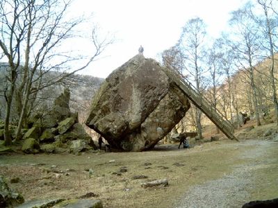
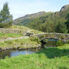
The Bowder Stone is a massive rock formation made of hardened lava material positioned in Borrowdale, serving as a striking landmark in the valley. The stone sits in a confined space and is made accessible by walking paths that allow visitors to reach both its base and summit.
The rock broke away from Bowder Crag between 10,000 and 13,500 years ago and settled into its current position. Joseph Pocklington purchased the site in 1798 and developed it as a visitor destination with constructed paths and stairs.
The stone's name draws from Norse mythology, with one side resembling the face of god Baldr and a marking where a mistletoe weapon struck him. Visitors sense this connection to ancient mythology while exploring the rock.
A walking path of about 15 minutes from the parking area leads to the stone, with a metal staircase allowing access to the top. The terrain is uneven and the climb requires some effort, so wear comfortable shoes and come prepared for a bit of exertion.
A natural hollow beneath the rock once allowed visitors to crawl underneath and exchange handshakes as a farewell gesture. This access is now closed for safety reasons.
The community of curious travelers
AroundUs brings together thousands of curated places, local tips, and hidden gems, enriched daily by 60,000 contributors worldwide.