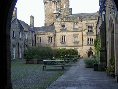
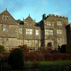
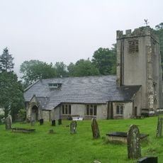
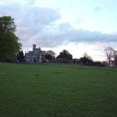
Capernwray Hall, Gothic Revival country house in Over Kellet, England.
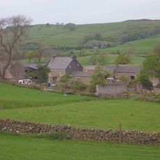
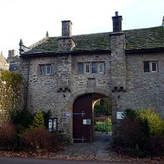
Capernwray Hall is a Gothic Revival country residence built with sandstone walls and slate roofs, featuring multiple wings arranged around a central structure with a prominent north-facing entrance. The property spreads across approximately 70 hectares and includes four entrance lodges along with agricultural buildings scattered across the grounds.
Edmund Sharpe redesigned and expanded the original Keer Bank house in 1844 for George Marton, creating a larger Gothic Revival residence in its place. This transformation established the country house that stands at this location today.
The grounds were designed by Thomas Mawson in 1901 and feature geometric garden beds arranged around a circular fountain. These layouts reflect the landscaping traditions of that era and shape how the property appears today.
Access to the estate is provided through four separate entrance lodges, giving visitors multiple points to enter and explore the extensive grounds. It helps to plan which areas to visit in advance, as the property is large and takes time to traverse.
During World War II, the hall sheltered evacuated students while its grounds stored military fuel supplies. This dual use reveals how private estates were repurposed to serve the nation during wartime.
Location: Over Kellet
Inception: 1844
Architects: Edmund Sharpe
Architectural style: Gothic Revival
GPS coordinates: 54.14360,-2.69630
Latest update: December 8, 2025 19:44
Borwick Hall
2.2 km
Capernwray Chapel
433 m
St John the Evangelist's Church, Gressingham
3.5 km
St Cuthbert's Church, Over Kellet
3.5 km
St Mary's Church, Borwick
2 km
Lancaster Canal Hodgson's Bridge (Number 134)
1.9 km
Bay Horse Hotel
3.7 km
Capernwray Packhorse Bridge, 130 Metres Downstream From Keer Bridge (Aqueduct) By Mill House
1.8 km
Lancaster Canal Borwick Hall Bridge (Number 135)
2.3 km
Lancaster Canal Kellet Lane Bridge (Number 130)
2.9 km
Capernwray Viaduct
1.8 km
Lancaster Canal Tewitfield Old Turnpike Bridge (Number 138)
2.8 km
Dale House
3.2 km
Lancaster Canal Tewitfield Locks
3.1 km
Cawood House
4.1 km
Milestone Approximately 250 Metres South South West Of Heronsyke
3.8 km
Storrs Hall
3.1 km
Lancaster Canal Canal Bridge (Number 131) North West Of Capernwray Old Hall
1.7 km
Lancaster Canal Sanders Bridge (Number 136)
2.4 km
Lancaster Canal Taylor's Bridge (Number 137)
2.4 km
Milestone On West Side, South Of Junction With Borwick Lane At Ngr Sd 513 728
3.3 km
Gunnerthwaite Farmhouse
1.6 km
Borwick Hall Gatehouse
2.2 km
Milestone On South Bank Of Lancaster Canal, 130 Metres East Of Tewitfield Old Turnpike Bridge At Ngr Sd 522 733
2.7 km
Red Load Farmhouse
1.9 km
Lancaster Canal Saltmire Bridge (Number 141)
3.9 km
Milestone, Low Greenlands; opp. caravan park
2.9 km
Village Cross, On Village Green
3.4 kmVisited this place? Tap the stars to rate it and share your experience / photos with the community! Try now! You can cancel it anytime.
Discover hidden gems everywhere you go!
From secret cafés to breathtaking viewpoints, skip the crowded tourist spots and find places that match your style. Our app makes it easy with voice search, smart filtering, route optimization, and insider tips from travelers worldwide. Download now for the complete mobile experience.
A unique approach to discovering new places❞
— Le Figaro
All the places worth exploring❞
— France Info
A tailor-made excursion in just a few clicks❞
— 20 Minutes