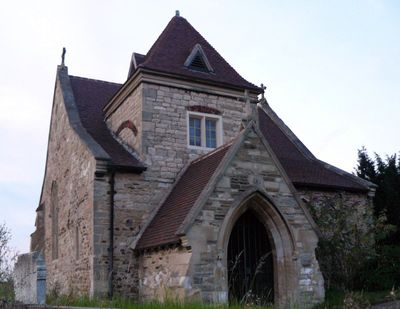
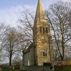
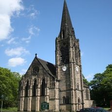
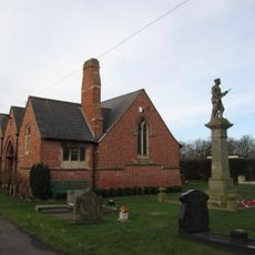
St Oswald's Church, Kirk Sandall, Norman church in Kirk Sandall, England.
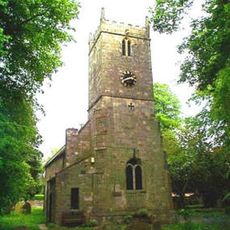
St Oswald's Church in Kirk Sandall is a limestone building with a two-bay nave, north and south aisles, and a Gothic chancel. A Perpendicular chapel and truncated west tower complete its structure.
The church first appears in the Domesday survey and underwent major construction in the 12th century. Further changes were made during the 14th and 16th centuries.
The Rokeby Chapel holds memorials to William Rokeby, who served as rector before becoming Archbishop of Dublin. These monuments show how this small church was connected to important religious figures of the time.
Visitors enter through a vestry door with steep steps, so careful footing is needed. The building lacks heating, running water, and modern facilities.
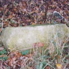
A cylindrical Norman font rests on a stepped base, showing fine medieval craftsmanship. Medieval cross fragments made of Magnesian Limestone remain scattered in the churchyard.
Location: Barnby Dun with Kirk Sandall
Inception: 12 century
Architectural style: Norman architecture
GPS coordinates: 53.56630,-1.08150
Latest update: December 14, 2025 14:21
Mansion House, Doncaster
5.9 km
St George's Minster
5.8 km
Doncaster Museum
5.9 km
Doncaster Market
5.8 km
Nether Hall
5.5 km
Doncaster Corn Exchange
5.8 km
Sandall Park
2.4 km
Church of St Lawrence
5.6 km
Christ Church
5.7 km
Church of All Saints
5.2 km
Church of All Saints
3.2 km
Church of St Peter
5 km
Church of St Mary
3.5 km
Church of St Peter and St Paul
1.7 km
Church of St Mary
3.7 km
War Memorial Immediately to East of Chapel at Stainforth Cemetery
4.6 km
Stainforth Bridge
5.1 km
Bennetthorpe War Memorial
5.8 km
Milepost Approximately 30 Metres To North Of Entrance To Hatfield Manor House
5.4 km
Milepost Opposite Northern Junction With Rosendale Road
4.6 km
Coachhouse Immediately To South West Of Hatfield House Farmhouse
5.3 km
Milepost Approximately 130 Metres North Of Junction With Adwick Lane
5 km
Milepost Approximately 40 Metres To West Of Entrance To Wyndthorpe Hall
3.1 km
National Westminster Bank
5.9 km
Milepost Approximately 180 Metres South Of Junction With Holme Lane
5.2 km
Thorpe Marsh Nature Reserve
2.7 km
Milepost 30 Metres North Of Stonehaven
2 km
Milepost Approximately 30 Metres To North East Of Mile End Avenue
4.4 kmVisited this place? Tap the stars to rate it and share your experience / photos with the community! Try now! You can cancel it anytime.
Discover hidden gems everywhere you go!
From secret cafés to breathtaking viewpoints, skip the crowded tourist spots and find places that match your style. Our app makes it easy with voice search, smart filtering, route optimization, and insider tips from travelers worldwide. Download now for the complete mobile experience.
A unique approach to discovering new places❞
— Le Figaro
All the places worth exploring❞
— France Info
A tailor-made excursion in just a few clicks❞
— 20 Minutes