Church of St Lawrence, Medieval church in Hatfield, United Kingdom
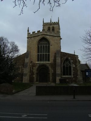
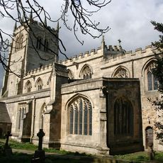
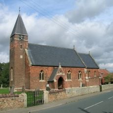
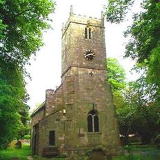
The Church of St Lawrence is a medieval church in Hatfield built with Norman pebble construction and a central tower dominating its structure. The building features three lancet windows at its west end and was expanded around 1400 with transepts and a lengthened east section.
The church was established in 1150 and incorporated stone salvaged from Roche Abbey into its construction. The central tower, transepts, and eastern extension were completed around 1400, forming the core of what visitors see today.
The church serves as a gathering place for the local community through regular worship and social activities. It remains an active center where people connect through shared religious practices and fellowship throughout the year.
The building provides level access throughout its main areas and has bicycle storage available for visitors. Street parking can be found within walking distance of the entrance, making arrival straightforward.
The building contains a massive oak chest bound with iron straps, crafted from a single piece of wood with remarkable skill. This Norman-era piece originally had ten locks securing its contents, reflecting the craftsmanship of medieval builders.
Location: Hatfield
Inception: 12 century
GPS coordinates: 53.57870,-1.00011
Latest update: December 14, 2025 18:45
Yorkshire Wildlife Park
8.7 km
The Trolleybus Museum at Sandtoft
8.7 km
Cantley Hall
8.4 km
St Oswald's Church, Kirk Sandall
5.6 km
Sandall Park
6.9 km
The Trolleybus Museum
8.6 km
Thorne Memorial Park Miniature Railway
4.1 km
Church of All Saints
8.4 km
Church of All Saints
8.8 km
Church of St Cuthbert
3.6 km
Church of St Mary
6.2 km
Church of St Nicholas
4.5 km
Church of St Peter and St Paul
4.9 km
Church of the Holy Trinity
8.1 km
Church of St Mary
4.8 km
War Memorial Immediately to East of Chapel at Stainforth Cemetery
2.8 km
Stainforth Bridge
3.4 km
Milepost Approximately 30 Metres To North Of Entrance To Hatfield Manor House
233 m
Coachhouse Immediately To South West Of Hatfield House Farmhouse
530 m
Milepost Approximately 40 Metres To West Of Entrance To Wyndthorpe Hall
3.2 km
Wayside cross on Trundle Lane
4 km
Thorpe Marsh Nature Reserve
7.7 km
Wayside cross on Pinfold Lane
3.6 km
Milepost Approximately 30 Metres To North East Of Mile End Avenue
1.6 km
Milepost 30 Metres North Of Stonehaven
4.7 km
Milepost To East Of Gatewood End Farm At Se 67830485
5 km
Milestone, N of Hatfield Woodhouse
2 km
Milestone, Thorne Road, W of TI jct with Armthorpe Lane, Hatfield Lane
4.7 kmVisited this place? Tap the stars to rate it and share your experience / photos with the community! Try now! You can cancel it anytime.
Discover hidden gems everywhere you go!
From secret cafés to breathtaking viewpoints, skip the crowded tourist spots and find places that match your style. Our app makes it easy with voice search, smart filtering, route optimization, and insider tips from travelers worldwide. Download now for the complete mobile experience.
A unique approach to discovering new places❞
— Le Figaro
All the places worth exploring❞
— France Info
A tailor-made excursion in just a few clicks❞
— 20 Minutes